File:Map of Colorado.svg

Original file (SVG file, nominally 3,117 × 2,255 pixels, file size: 894 KB)
Captions
Captions
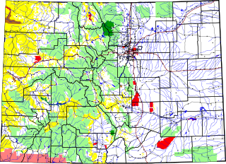
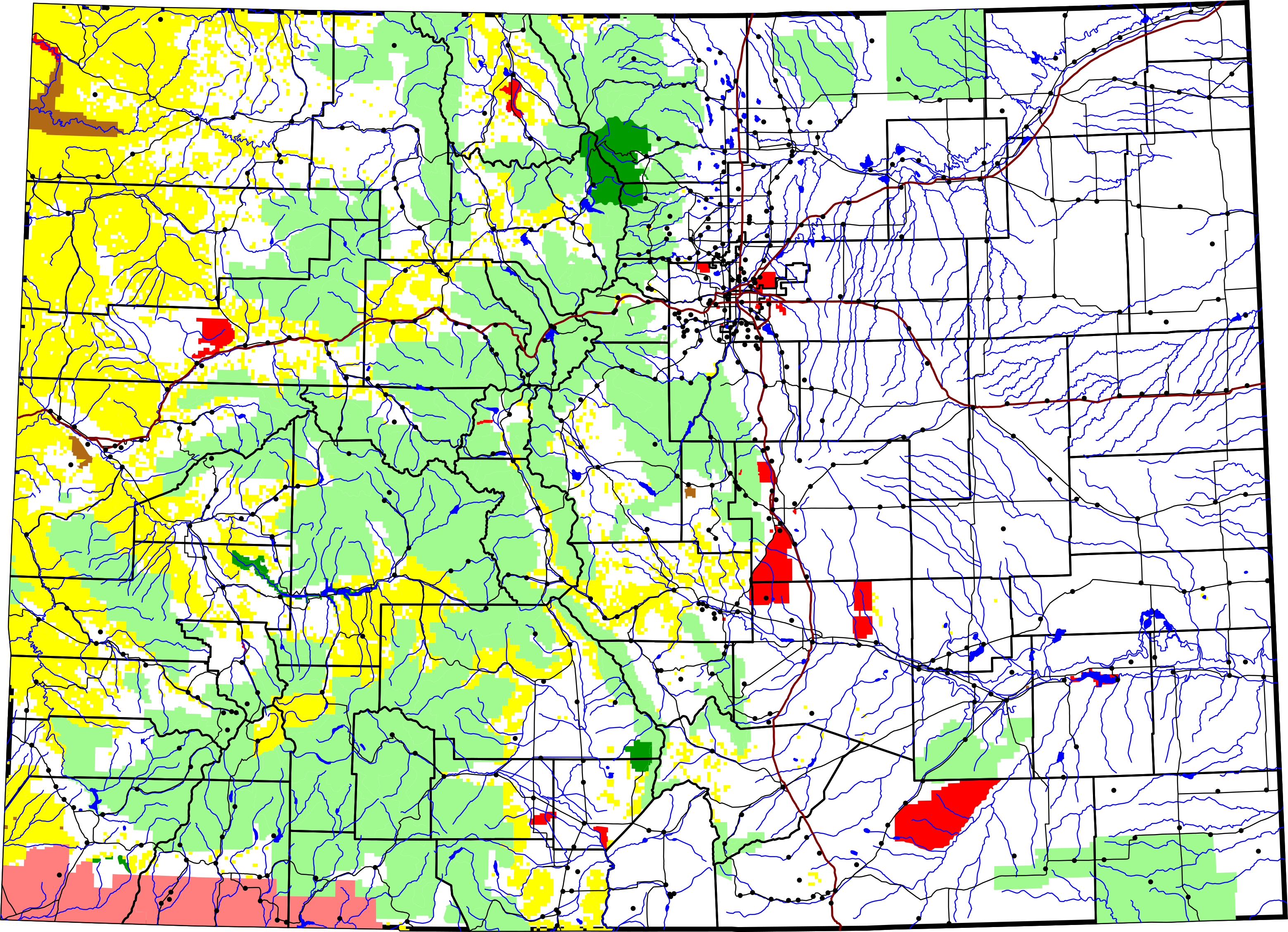
A map of Colorado. Dark green is National Park; brown is National Monument; yellow is Bureau of Land Management land; light green is National Forest; red is other federal land. The thick black lines are county boundaries. The thick reddish lines are Interstate Highways; thin black lines are other roads. Dots are towns. The SVG file contains the names of all the features.
David Benbennick made this map with data from nationalatlas.gov. I used shpdump to extract the Shapefile.
This map uses azimuthal equidistant projection, centered on (-105.7167, 39.1333) (degrees longitude, latitude). The area outside Colorado is transparent, so it should look nice on non-white backgrounds.
The data from nationalatlas is apparently accurate to 0.000278 degrees, or about 100 feet. The coordinates in this map are in decameters.
| I, the copyright holder of this work, release this work into the public domain. This applies worldwide. In some countries this may not be legally possible; if so: I grant anyone the right to use this work for any purpose, without any conditions, unless such conditions are required by law. |
File history
Click on a date/time to view the file as it appeared at that time.
| Date/Time | Thumbnail | Dimensions | User | Comment | |
|---|---|---|---|---|---|
| current | 23:18, 5 April 2007 | | 3,117 × 2,255 (894 KB) | Augiasstallputzer~commonswiki (talk | contribs) | Setting a srceencompatible size. To print, please download the image and edit the size values in real measures (metric or inch). |
You cannot overwrite this file.
File usage on Commons
There are no pages that use this file.
File usage on other wikis
The following other wikis use this file:
- Usage on en.wikipedia.org
- Usage on es.wikipedia.org
- Usage on ro.wikipedia.org
- Colorado
- Colorado (dezambiguizare)
- Categorie:Statul Colorado, SUA
- Format:Colorado stat SUA
- Denver
- Colorado Springs
- Categorie:Liste Colorado
- Listă de oameni din statul Colorado
- Listă de comitate din statul Colorado
- Categorie:Guvernul statului Colorado
- Comitatul San Juan, Colorado
- Categorie:Vulcani din Colorado
- Categorie:Comitatul Montezuma, Colorado
- Comitatul Adams, Colorado
- Pagosa Springs, Colorado
- Categorie:Zone metropolitane din Colorado
- Categorie:Zone micropolitane din Colorado
- Boulder, Colorado
- Categorie:Localități din Colorado
- Categorie:Comitatul Boulder, Colorado
- Categorie:Regiuni ale statului Colorado
- Categorie:Dezastre naturale din statul Colorado
- Gunnison, Colorado
- Categorie:Comitatul El Paso, Colorado
- Categorie:Atracții turistice din Colorado
- Categorie:Membri ai legislaturii statului Colorado
- Categorie:Localități din Colorado după comitat
- Categorie:Geografia statului Colorado după comitat
- Categorie:Localități din comitatul Gunnison, Colorado
- Comitatul Rio Blanco, Colorado
- Categorie:Absolvenți din Colorado după instituția de învățământ superior
- Categorie:Geografia statului Colorado
- Categorie:Oameni din statul Colorado după institutul de învățământ superior
- Categorie:Târguri din statul Colorado
- Categorie:Municipalități din statul Colorado
- Format:Sediile comitatelor din Colorado
- Categorie:Localități din comitatul Archuleta, Colorado
- Categorie:Geografia comitatului Adams, Colorado
- Categorie:Geografia comitatului Arapahoe, Colorado
- Categorie:Geografia comitatului Archuleta, Colorado
- Categorie:Geografia comitatului Boulder, Colorado
- Categorie:Geografia comitatului Douglas, Colorado
- Categorie:Geografia comitatului El Paso, Colorado
- Categorie:Geografia comitatului Gunnison, Colorado
- Categorie:Insule ale statului Colorado
- Categorie:Locuri desemnate pentru recensământ din statul Colorado
View more global usage of this file.