File:Map of Eastern Mediterranean. HM 34. PORTOLAN ATLAS, anonymous. France (?), ca. 1600.jpg
Jump to navigation
Jump to search

Size of this preview: 725 × 600 pixels. Other resolutions: 290 × 240 pixels | 580 × 480 pixels | 928 × 768 pixels | 1,237 × 1,024 pixels | 2,475 × 2,048 pixels | 5,358 × 4,434 pixels.
Original file (5,358 × 4,434 pixels, file size: 7.34 MB, MIME type: image/jpeg)
Captions
Captions
Add a one-line explanation of what this file represents
Summary[edit]
,_ca._1600.jpg&action=edit§ion=1)
| Description |
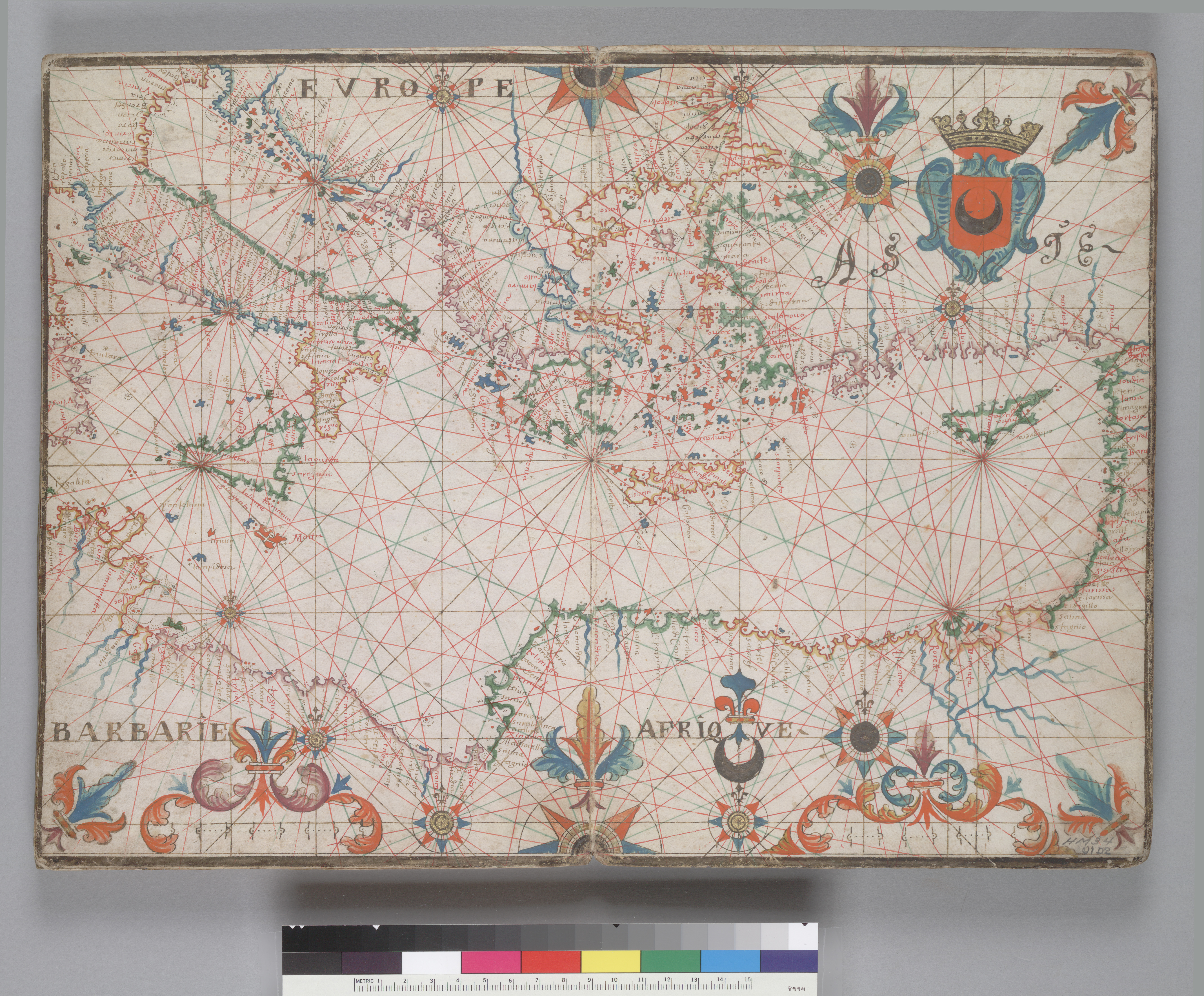
English: Map of Eastern Mediterranean. HM 34. PORTOLAN ATLAS, anonymous. France (?), ca. 1600 Call Number: HM 34 |
| Date | circa 1600 |
| Source | berkeley.edu |
| Author | Anonymous |
| Other versions | The Library University of California, Berkeley |
Source:[edit]
,_ca._1600.jpg&action=edit§ion=2)
Licensing[edit]
,_ca._1600.jpg&action=edit§ion=3)
|
This is a faithful photographic reproduction of a two-dimensional, public domain work of art. The work of art itself is in the public domain for the following reason:
The official position taken by the Wikimedia Foundation is that "faithful reproductions of two-dimensional public domain works of art are public domain".
This photographic reproduction is therefore also considered to be in the public domain in the United States. In other jurisdictions, re-use of this content may be restricted; see Reuse of PD-Art photographs for details. | ||||
File history
Click on a date/time to view the file as it appeared at that time.
| Date/Time | Thumbnail | Dimensions | User | Comment | |
|---|---|---|---|---|---|
| current | 02:46, 21 September 2010 | | 5,358 × 4,434 (7.34 MB) | Geagea (talk | contribs) | == {{int:filedesc}} == {{Information |Description={{en|1=Map of the Mediterranean Sea}} |Source=[http://digitalassets.lib.berkeley.edu/ds/ucb/images/heh/300/000400.jpg The Library University of California, Berkeley] |Author={{Creator:Guillaume le Vasseur |
You cannot overwrite this file.
File usage on Commons
The following 2 pages use this file:
- User:Geagea/Maps
- File:Beauplan. Map of Mediterranean Sea.jpg (file redirect)
,_ca._1600.jpg&oldid=818294579)