File:Map of Florida highlighting St. Johns County.svg
Jump to navigation
Jump to search

Size of this PNG preview of this SVG file: 602 × 600 pixels. Other resolutions: 241 × 240 pixels | 482 × 480 pixels | 771 × 768 pixels | 1,028 × 1,024 pixels | 2,055 × 2,048 pixels | 1,130 × 1,126 pixels.
Original file (SVG file, nominally 1,130 × 1,126 pixels, file size: 179 KB)
Captions
Captions
Add a one-line explanation of what this file represents
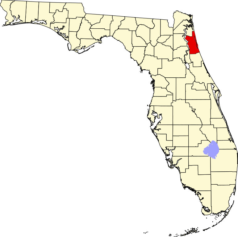
This is a locator map showing Saint Johns County in Florida.
David Benbennick made this map. For more information, see Commons:United States county locator maps.
| I, the copyright holder of this work, release this work into the public domain. This applies worldwide. In some countries this may not be legally possible; if so: I grant anyone the right to use this work for any purpose, without any conditions, unless such conditions are required by law. |
File history
Click on a date/time to view the file as it appeared at that time.
| Date/Time | Thumbnail | Dimensions | User | Comment | |
|---|---|---|---|---|---|
| current | 07:29, 5 July 2024 | | 1,130 × 1,126 (179 KB) | Nux (talk | contribs) | fix rendering (remove clipping), uniform colors |
| 05:43, 14 February 2006 |  | 7,342 × 7,321 (310 KB) | David Benbennick (talk | contribs) | New version with Lake Okeechobee | |
| 10:51, 12 February 2006 |  | 7,342 × 7,321 (307 KB) | David Benbennick (talk | contribs) | {{subst:User:Dbenbenn/clm|county=Saint Johns County|state=Florida}} |
You cannot overwrite this file.
File usage on Commons
The following 11 pages use this file:
- File:Map of Florida highlighting Saint Johns County.svg (file redirect)
- File:Map of Florida highlighting St Johns County.svg (file redirect)
- Category:Births in St. Johns County, Florida
- Category:Deaths in St. Johns County, Florida
- Category:Maps of St. Johns County, Florida
- Category:Matanzas State Forest
- Category:National Register of Historic Places in St. Johns County, Florida
- Category:People of St. Johns County, Florida
- Category:Populated places in St. Johns County, Florida
- Category:St. Johns County, Florida
- Category:Views of St. Johns County, Florida
File usage on other wikis
The following other wikis use this file:
- Usage on ar.wikipedia.org
- Usage on arz.wikipedia.org
- Usage on bg.wikipedia.org
- Usage on bpy.wikipedia.org
- Usage on cdo.wikipedia.org
- Usage on ceb.wikipedia.org
- Usage on ce.wikipedia.org
- Usage on cy.wikipedia.org
- Usage on de.wikipedia.org
- St. Johns County
- St. Augustine (Florida)
- Marineland (Florida)
- Vorlage:Navigationsleiste Orte im St. Johns County
- Hastings (Florida)
- St. Augustine Beach
- Butler Beach
- Crescent Beach (Florida)
- Flagler Estates
- Fruit Cove
- Nocatee
- Palm Valley (Florida)
- Sawgrass
- St. Augustine Shores
- St. Augustine South
- Vilano Beach
- World Golf Village
- Usage on en.wikipedia.org
- List of counties in Florida
- St. Johns County, Florida
- Marineland, Florida
- Butler Beach, Florida
- Crescent Beach, St. Johns County, Florida
- Fruit Cove, Florida
- Hastings, Florida
- Palm Valley, Florida
- Sawgrass, Florida
- St. Augustine, Florida
- St. Augustine Shores, Florida
- Vilano Beach, Florida
- St. Augustine Beach, Florida
- St. Augustine South, Florida
- Ponte Vedra Beach, Florida
- Template:St. Johns County, Florida
- Switzerland, Florida
- Julington Creek Plantation, Florida
- Elkton, Florida
- Armstrong, Florida
- Spuds, Florida
- Vermont Heights, Florida
- St. Johns, Florida
View more global usage of this file.