File:Map of Gibraltar Bay 1782.jpg
Jump to navigation
Jump to search

Size of this preview: 797 × 600 pixels. Other resolutions: 319 × 240 pixels | 638 × 480 pixels | 1,021 × 768 pixels | 1,280 × 963 pixels | 1,768 × 1,330 pixels.
Original file (1,768 × 1,330 pixels, file size: 1.63 MB, MIME type: image/jpeg)
Captions
Captions
Map of Gibraltar Bay 1782
Summary[edit]
| Description |
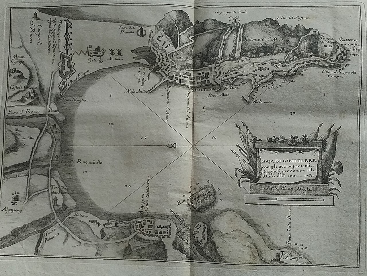
English: Map of Gibraltar Bay 1782, in Italian, paper: 26x39 cm, image: 16.5x23 cm
In the map legend is written: Baja di Gibilterra / con gli accampamenti / Spagnoli per Servire alla / Storia dell'anno 1781 (Bay of Gibraltar, with the Spanish encampments to serve the history of the year 1781) Estract of Storia politica dell'anno 1781. Scritta da un pensatore italiano arricchita delle carte geografiche della Baja di Gibilterra, e delle Colonie Unite d'America by Giovanni Ristori, published in Modena in early 1782 |
| Date | |
| Source | Own work |
| Author | A ntv |
Licensing[edit]
I, the copyright holder of this work, hereby publish it under the following license:
This file is licensed under the Creative Commons Attribution-Share Alike 4.0 International license.
- You are free:
- to share – to copy, distribute and transmit the work
- to remix – to adapt the work
- Under the following conditions:
- attribution – You must give appropriate credit, provide a link to the license, and indicate if changes were made. You may do so in any reasonable manner, but not in any way that suggests the licensor endorses you or your use.
- share alike – If you remix, transform, or build upon the material, you must distribute your contributions under the same or compatible license as the original.
File history
Click on a date/time to view the file as it appeared at that time.
| Date/Time | Thumbnail | Dimensions | User | Comment | |
|---|---|---|---|---|---|
| current | 18:17, 23 May 2019 | | 1,768 × 1,330 (1.63 MB) | A ntv (talk | contribs) | User created page with UploadWizard |
You cannot overwrite this file.
File usage on Commons
There are no pages that use this file.