File:Map of New Netherland (Novi Belgii Novaeque Angliae) by Justus Danckerts c1673.jpg
Jump to navigation
Jump to search

Size of this preview: 714 × 600 pixels. Other resolutions: 286 × 240 pixels | 572 × 480 pixels | 915 × 768 pixels | 1,219 × 1,024 pixels | 2,439 × 2,048 pixels | 8,908 × 7,481 pixels.
Original file (8,908 × 7,481 pixels, file size: 9.59 MB, MIME type: image/jpeg)
Captions
Captions
Add a one-line explanation of what this file represents
Summary[edit]
_by_Justus_Danckerts_c1673.jpg&action=edit§ion=1)
| Description |
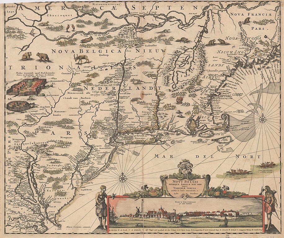
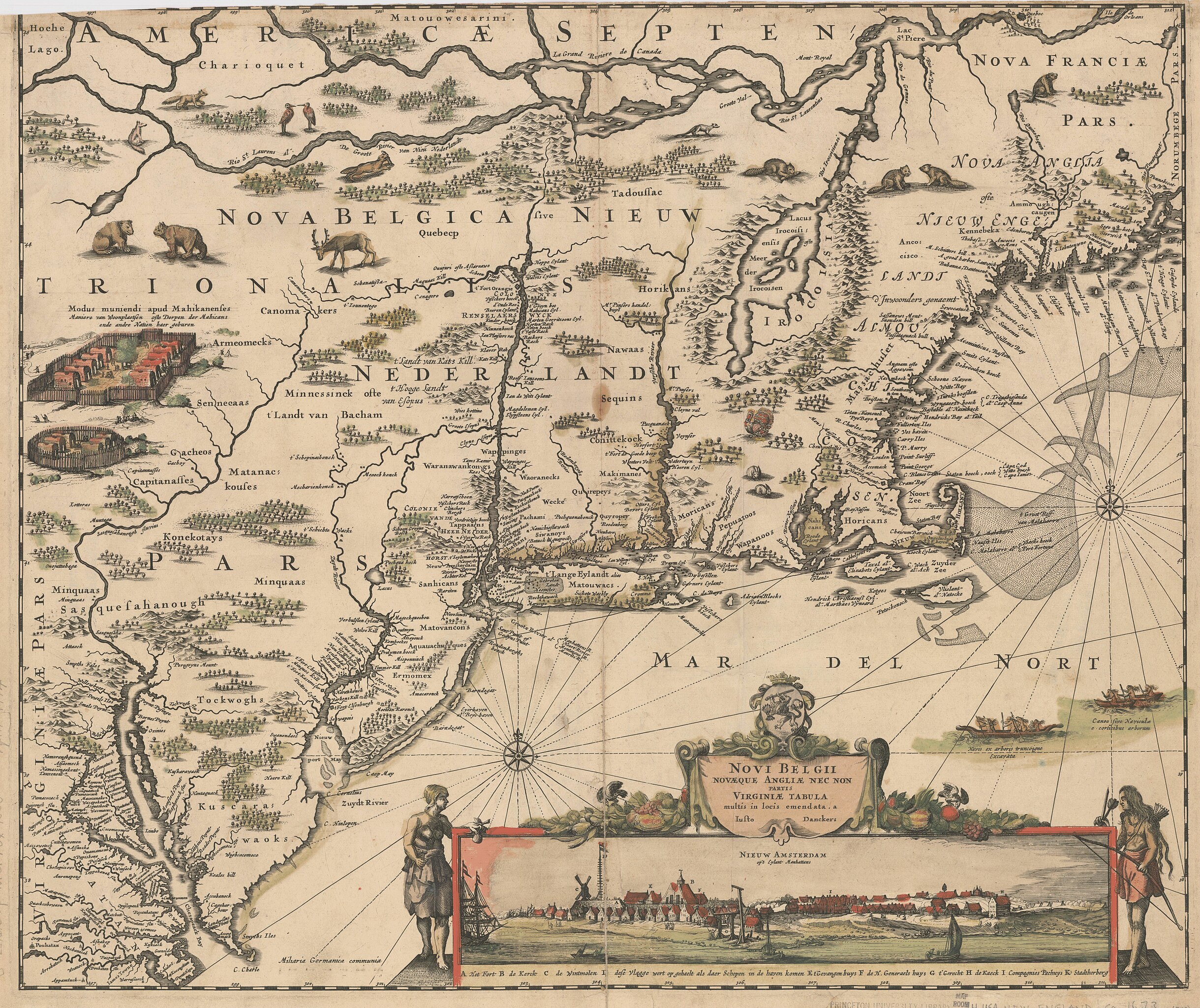
English: Title: Novi Belgii, Novæque Angliæ nec non partis Virginiæ tabula. Map of New Netherland (Nova Belgica - Nieuw Nederlandt). Made by Justus Danckerts in c1673. The first issue of the "Jansson-Visscher series," lacking Philadelphia. Cf. Campbell, T. New light on the Jansson-Visscher maps of New England (In: Map collectors' circle, no. 24), Relief shown pictorially. Place names in Latin and Dutch. Names of Indian tribes. Inset view: Nieuw Amsterdam op't Eylant Manhattans. Publication date from Burden. |
| Date | circa 1673 |
| Source | Stanford Libraries - https://kurma-monitor-prod.stanford.edu/catalog/princeton-df65vb21k |
| Author | Danckerts, Justus, 1635-1701 |
Licensing[edit]
_by_Justus_Danckerts_c1673.jpg&action=edit§ion=2)
|
This work is in the public domain in its country of origin and other countries and areas where the copyright term is the author's life plus 100 years or fewer. | |
| This file has been identified as being free of known restrictions under copyright law, including all related and neighboring rights. | |
File history
Click on a date/time to view the file as it appeared at that time.
| Date/Time | Thumbnail | Dimensions | User | Comment | |
|---|---|---|---|---|---|
| current | 09:07, 1 March 2024 | | 8,908 × 7,481 (9.59 MB) | Artanisen (talk | contribs) | Uploaded a work by Danckerts, Justus, 1635-1701 from Stanford Libraries - https://kurma-monitor-prod.stanford.edu/catalog/princeton-df65vb21k with UploadWizard |
You cannot overwrite this file.
File usage on Commons
The following 3 pages use this file:
.jpg)
_by_Justus_Danckerts_c1673.jpg&oldid=857249424)