File:Map of New York highlighting Nassau County.svg
Jump to navigation
Jump to search

Size of this PNG preview of this SVG file: 787 × 600 pixels. Other resolutions: 315 × 240 pixels | 630 × 480 pixels | 1,008 × 768 pixels | 1,280 × 976 pixels | 2,560 × 1,951 pixels | 6,599 × 5,030 pixels.
Original file (SVG file, nominally 6,599 × 5,030 pixels, file size: 112 KB)
Captions
Captions
Add a one-line explanation of what this file represents
Summary[edit]
| Description |
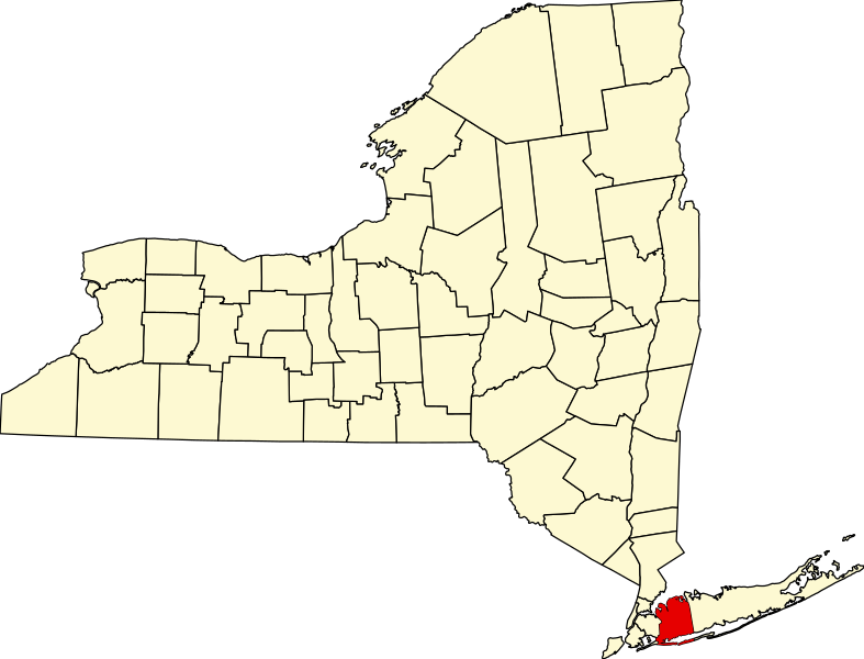
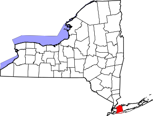
English: This is a locator map showing Nassau County in New York. For more information, see Commons:United States county locator maps. |
| Date | |
| Source |
Own work: English: The maps use data from nationalatlas.gov, specifically countyp020.tar.gz on the Raw Data Download page. The maps also use state outline data from statesp020.tar.gz. The Florida maps use hydrogm020.tar.gz to display Lake Okeechobee. |
| Author | David Benbennick |
Licensing[edit]
| I, the copyright holder of this work, release this work into the public domain. This applies worldwide. In some countries this may not be legally possible; if so: I grant anyone the right to use this work for any purpose, without any conditions, unless such conditions are required by law. |
File history
Click on a date/time to view the file as it appeared at that time.
| Date/Time | Thumbnail | Dimensions | User | Comment | |
|---|---|---|---|---|---|
| current | 15:33, 12 February 2006 | | 6,599 × 5,030 (112 KB) | David Benbennick (talk | contribs) | {{subst:User:Dbenbenn/clm|county=Nassau County|state=New York|type=county}} |
You cannot overwrite this file.
File usage on Commons
The following 12 pages use this file:
- Category:Births in Nassau County, New York
- Category:Cemeteries in Nassau County, New York
- Category:Deaths in Nassau County, New York
- Category:Geography of Nassau County, New York
- Category:Maps of Nassau County, New York
- Category:Nassau County, New York
- Category:New York State Register of Historic Places in Nassau County
- Category:People of Nassau County, New York
- Category:Populated places in Nassau County, New York
- Category:Towns in Nassau County, New York
- Category:Views of Nassau County, New York
- Category:Villages in Nassau County, New York
File usage on other wikis
The following other wikis use this file:
- Usage on ar.wikipedia.org
- مقاطعة ناسو (نيويورك)
- مينيولا
- بالدوين (نيويورك)
- إيست ميدو
- إلمونت
- فرانكلين سكوير (نيويورك)
- فريبورت (نيويورك)
- غاردين سيتي (نيويورك)
- غلين كوف (نيويورك)
- ليفيتاون (نيويورك)
- لونغ بيتش (نيويورك)
- ماسابيكوا
- ميريك (نيويورك)
- أوشنسايد
- بلينفيو (نيويورك)
- روكفيل سنتر (نيويورك)
- يونيوندايل (نيويورك)
- هيمبستيد (نيويورك)
- هيكسفيلي (نيويورك)
- فالي ستريم (نيويورك)
- أريحا (نيويورك)
- ليك ساكسس (نيويورك)
- فارمينغديل (نيويورك)
- روسلين (نيويورك)
- وستباري (نيويورك)
- أتلانتيك بيتش (نيويورك)
- بايفيل (نيويورك)
- سيدارهورست (نيويورك)
- فلورال بارك (نيويورك)
- كينغز بوينت (نيويورك)
- لاتينغتاون (نيويورك)
- لينبروك (نيويورك)
- نيو هايد بارك (نيويورك)
- أولد وستباري (نيويورك)
- أويستر باي كوف (نيويورك)
- بلاندوم (نيويورك)
- روسلين هاربور (نيويورك)
- سادل روك (نيويورك)
- توماستون (نيويورك)
- باكستر إستيتس (نيويورك)
- بيلروس (نيويورك)
- بروكفيل (نيويورك)
- سنتر أيلاند (نيويورك)
- كوف نيك (نيويورك)
- إيست هيلس (نيويورك)
- إيست روكسواي (نيويورك)
- إيست ويليستون (نيويورك)
- فلاور هيل (نيويورك)
- غريت نيك أستيتس (نيويورك)
- غريت نيك بلازا (نيويورك)
View more global usage of this file.