File:Map of Okinawa Islands 02.svg
Jump to navigation
Jump to search

Size of this PNG preview of this SVG file: 800 × 600 pixels. Other resolutions: 320 × 240 pixels | 640 × 480 pixels | 1,024 × 768 pixels | 1,280 × 960 pixels | 2,560 × 1,920 pixels | 1,000 × 750 pixels.
Original file (SVG file, nominally 1,000 × 750 pixels, file size: 479 KB)
Captions
Captions
Add a one-line explanation of what this file represents
Summary[edit]
| Description |
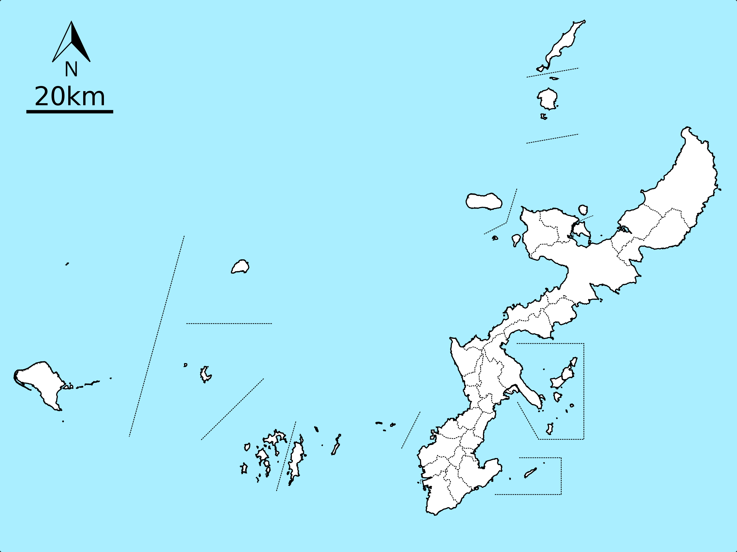
English: Map of Okinawa Islands (except Io-Torishima Island). Dotted lines are boundaries of the municipalities in these islands, located in Okinawa Prefecture, Japan.
日本語: 沖縄諸島の地図、ただし硫黄鳥島は欄外。点線は当諸島における市町村の境界を示す。 |
| Date | |
| Source |
Using the orientation symbol File:North Pointer.svg(PD) English: Created based on the map of Geospatial Information Authority of Japan (Link)
日本語: 国土地理院の地理院地図を基に作成 |
| Author | Own work |
| Other versions |
|


This W3C-unspecified vector image was created with Inkscape .
Licensing[edit]
I, the copyright holder of this work, hereby publish it under the following licenses:

|
Permission is granted to copy, distribute and/or modify this document under the terms of the GNU Free Documentation License, Version 1.2 or any later version published by the Free Software Foundation; with no Invariant Sections, no Front-Cover Texts, and no Back-Cover Texts. A copy of the license is included in the section entitled GNU Free Documentation License. |
This file is licensed under the Creative Commons Attribution-Share Alike 4.0 International license.
- You are free:
- to share – to copy, distribute and transmit the work
- to remix – to adapt the work
- Under the following conditions:
- attribution – You must give appropriate credit, provide a link to the license, and indicate if changes were made. You may do so in any reasonable manner, but not in any way that suggests the licensor endorses you or your use.
- share alike – If you remix, transform, or build upon the material, you must distribute your contributions under the same or compatible license as the original.
You may select the license of your choice.
File history
Click on a date/time to view the file as it appeared at that time.
| Date/Time | Thumbnail | Dimensions | User | Comment | |
|---|---|---|---|---|---|
| current | 02:27, 5 July 2017 | | 1,000 × 750 (479 KB) | Kugel~commonswiki (talk | contribs) | Added administrative line, removed frame, modified font to sans-serif. |
| 15:01, 5 May 2017 |  | 1,000 × 750 (482 KB) | Kugel~commonswiki (talk | contribs) | == {{int:filedesc}} == {{Information |Description={{en|Map of Okinawa Islands. Added boundaries of the municipalities of Okinawa Prefecture.}} {{ja|沖縄諸島の地図}} |Source=Using the orientation symbol File:North Pointer.svg(PD) {{en|Create... |
You cannot overwrite this file.
File usage on Commons
The following 8 pages use this file:
File usage on other wikis
The following other wikis use this file:
- Usage on fr.wikipedia.org
- Usage on ja.wikipedia.org
- Usage on www.wikidata.org
- Usage on zh.wikipedia.org