File:Map of Septimania in 537 AD-ar.svg
Jump to navigation
Jump to search

Size of this PNG preview of this SVG file: 488 × 349 pixels. Other resolutions: 320 × 229 pixels | 640 × 458 pixels | 1,024 × 732 pixels | 1,280 × 915 pixels | 2,560 × 1,831 pixels.
Original file (SVG file, nominally 488 × 349 pixels, file size: 22 KB)
Captions
Captions
Add a one-line explanation of what this file represents
Summary[edit]
| Description |
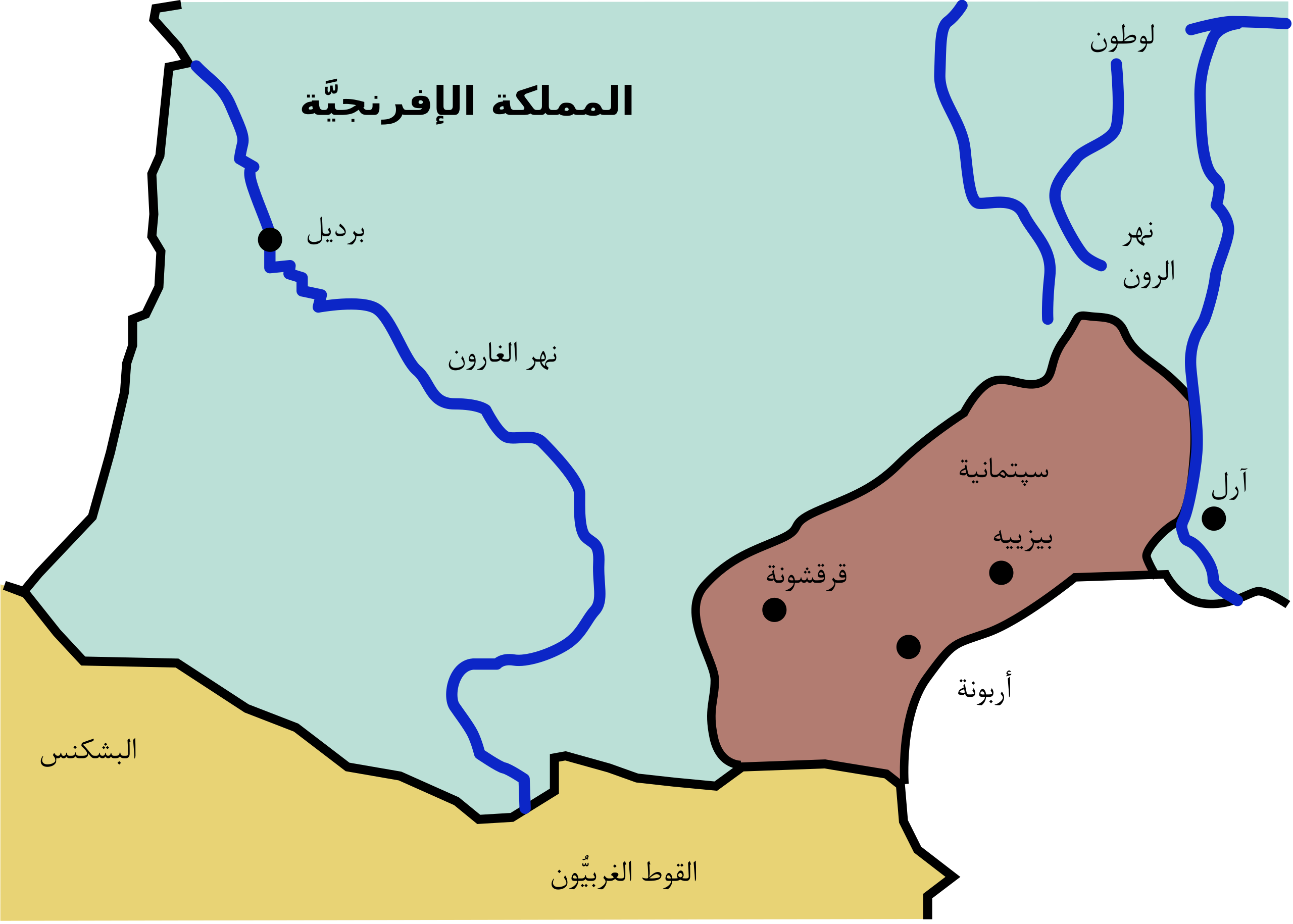
العربية: إقليم سپتمانية في جنوب الغال زمن الفتح الإسلامي. |
| Date | |
| Source |
This file was derived from: Map of Septimania in 537 AD.svg |
| Author | |
| Other versions |
[]
JPG:
|


| This is a retouched picture, which means that it has been digitally altered from its original version. Modifications: Translated to Arabic - عُرِبَت. The original can be viewed here: Map of Septimania in 537 AD.svg:
|
Licensing[edit]
I, the copyright holder of this work, hereby publish it under the following license:
| |
This work has been released into the public domain by its author, Example, at the [[::|English Wikipedia]] project. This applies worldwide. In case this is not legally possible: |
File history
Click on a date/time to view the file as it appeared at that time.
| Date/Time | Thumbnail | Dimensions | User | Comment | |
|---|---|---|---|---|---|
| current | 20:50, 23 April 2017 | | 488 × 349 (22 KB) | باسم (talk | contribs) | User created page with UploadWizard |
You cannot overwrite this file.
File usage on Commons
The following 9 pages use this file:
- File:537Septimania3.JPG
- File:537 Septimania mk.svg
- File:Map of Septimania in 537 AD-ar.svg
- File:Map of Septimania in 537 AD-hu.svg
- File:Map of Septimania in 537 AD.svg
- File:Map of Septimania in 537 AD la.svg
- File:Map of Septimania in 537 AD ru.svg
- File:Map of Septimania in 537 AD uk.svg
- Template:Other versions/Map of Septimania in 537 AD
File usage on other wikis
The following other wikis use this file:
- Usage on ar.wikipedia.org
- Usage on pnb.wikipedia.org
- Usage on ur.wikipedia.org