File:Map of Uyunid Emirate (3).png
Jump to navigation
Jump to search

Size of this preview: 666 × 599 pixels. Other resolutions: 267 × 240 pixels | 533 × 480 pixels | 853 × 768 pixels | 1,138 × 1,024 pixels | 2,276 × 2,048 pixels | 10,000 × 9,000 pixels.
Original file (10,000 × 9,000 pixels, file size: 2.56 MB, MIME type: image/png)
Captions
Captions
Add a one-line explanation of what this file represents
Summary
[edit].png&action=edit§ion=1)
| Description |
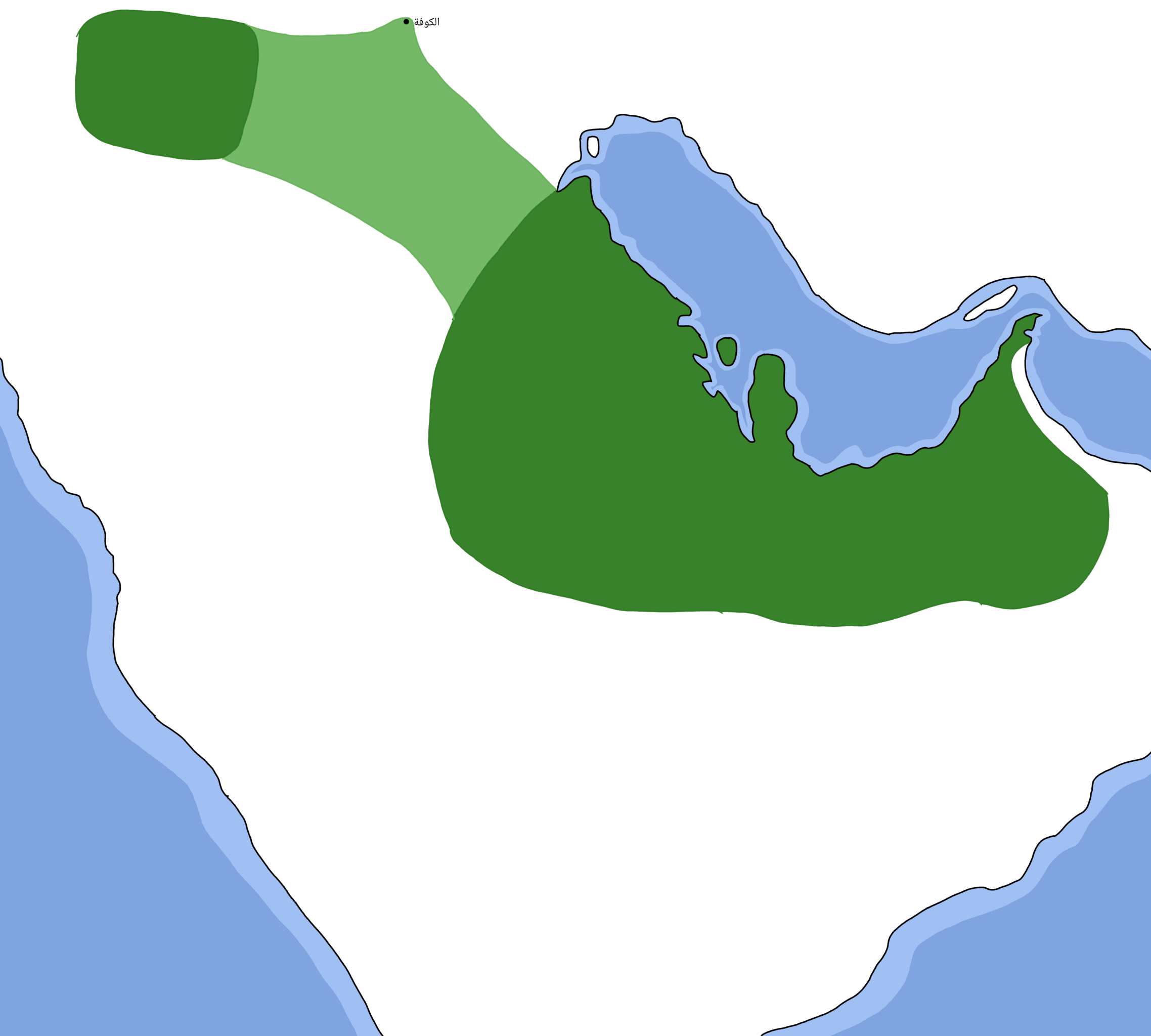
العربية: خريطةٌ جُغرافيّةٌ توضحُ نفوذ العيونيين في عهد محمد بن أحمد العيوني |
| Date | |
| Source |
|
| Author | عبدالعزيز علي |
| Other versions |
.png)  |
Licensing
[edit].png&action=edit§ion=2)
| This work has been released into the public domain by its author, عبدالعزيز علي at Arabic Wikipedia. This applies worldwide. In some countries this may not be legally possible; if so: عبدالعزيز علي grants anyone the right to use this work for any purpose, without any conditions, unless such conditions are required by law. |
File history
Click on a date/time to view the file as it appeared at that time.
| Date/Time | Thumbnail | Dimensions | User | Comment | |
|---|---|---|---|---|---|
| current | 08:14, 18 July 2023 | | 10,000 × 9,000 (2.56 MB) | عبد العزيز علي (talk | contribs) | Uploaded own work with UploadWizard |
You cannot overwrite this file.
File usage on Commons
The following 3 pages use this file:
File usage on other wikis
The following other wikis use this file:
- Usage on ar.wikipedia.org
.png&oldid=790774033)