File:Map of Wind Cave National Park.png
Jump to navigation
Jump to search
Size of this preview: 661 × 600 pixels. Other resolutions: 265 × 240 pixels | 529 × 480 pixels | 846 × 768 pixels | 1,128 × 1,024 pixels | 2,486 × 2,256 pixels.
Original file (2,486 × 2,256 pixels, file size: 854 KB, MIME type: image/png)
Captions
Captions
Add a one-line explanation of what this file represents
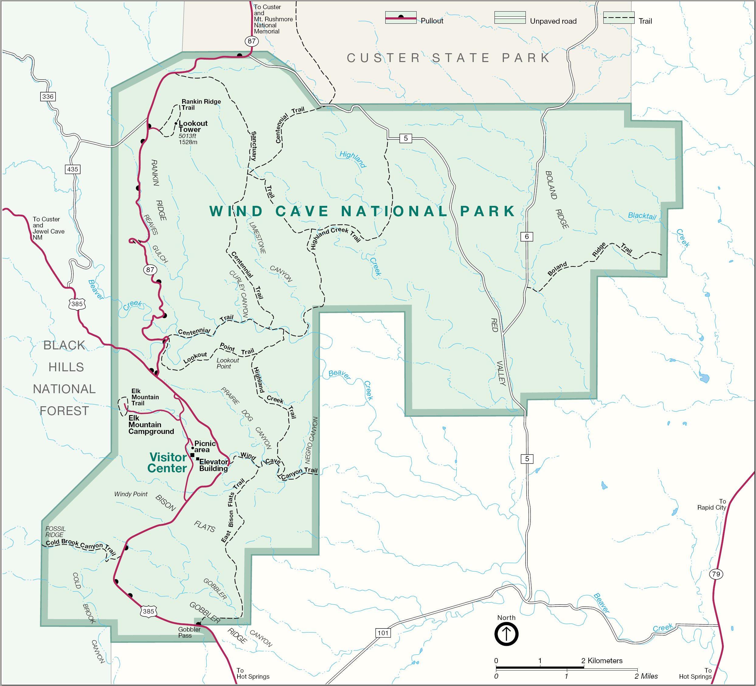
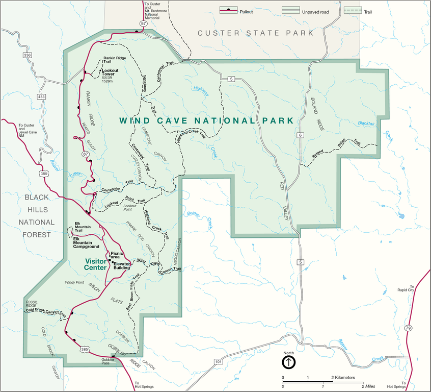
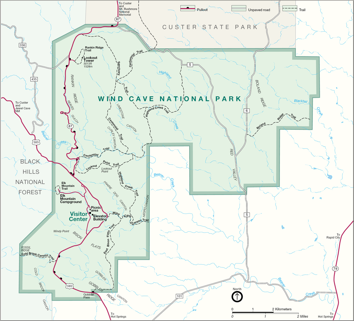
| Description | Map of Wind Cave National Park — in South Dakota. |
| Source | http://www.nps.gov |
| Author |
| This image or media file contains material based on a work of a National Park Service employee, created as part of that person's official duties. As a work of the U.S. federal government, such work is in the public domain in the United States. See the NPS website and NPS copyright policy for more information. |
File history
Click on a date/time to view the file as it appeared at that time.
| Date/Time | Thumbnail | Dimensions | User | Comment | |
|---|---|---|---|---|---|
| current | 14:41, 19 August 2006 | | 2,486 × 2,256 (854 KB) | Huebi~commonswiki (talk | contribs) | {{Information |Description=Map of Wind Cave National Park |Source=http://www.nps.gov |Date= |Author= |Permission= |other_versions= }} {{PD-USGov-NPS}} category:Wind Cave National Park |
You cannot overwrite this file.
File usage on Commons
There are no pages that use this file.
File usage on other wikis
The following other wikis use this file:
- Usage on da.wikipedia.org
- Usage on de.wikipedia.org
- Usage on es.wikipedia.org
- Usage on nl.wikipedia.org
- Usage on no.wikipedia.org
- Usage on pl.wikipedia.org
- Usage on ru.wikipedia.org
- Usage on tr.wikipedia.org