File:Map of the Empire of Germany, north side (Delarochette, 1794).jpg

Original file (14,614 × 6,381 pixels, file size: 20.37 MB, MIME type: image/jpeg)
Captions
Captions
Summary[edit]
| Warning | The original file is very high-resolution. It might not load properly or could cause your browser to freeze when opened at full size. |
|---|
| DescriptionMap of the Empire of Germany, north side (Delarochette, 1794).jpg |
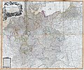
English: (North side) Map of the Empire of Germany, including all the states comprehended under that name: with the Kingdom of Prussia, &c. By L. Delarochette. London, Published by Laurie & Whittle, No. 53, Fleet Street, 12th May, 1794. T. Kitchin sculpt.
Digital composite of 2 hand colored engraved maps (printed on 4 sheets). Relief shown pictorially. Contents: The circles of Westphalia and Lower Saxony, with the western parts of the Circle of Upper Saxony, and the northern parts of the Circle of Upper Rhine, part of Sweden, and Denmark; the United Provinces, and part of the Netherlands -- Eastern parts of Brandenburg and Saxony, with Pomerania, Prussia, Lusatia, and the northern parts of Silesia; part of Sweden, Samogitia, Lithuania, and Poland -- The circles of Lower Rhine, Franconia, Swabia and Bavaria, with the southern parts of the circles of Upper Rhine and Saxony, the western parts of Bohemia and of the circle of Austria, Switzerland and part of Italy, France and the Netherlands -- Eastern parts of Bohemia and of the Circle of Austria, with Moravia, and the southern parts of Silesia; part of Poland, Hungary, Sclavonia, Croatia, and Istria.
Note:
Digital composite of 2 hand colored engraved maps (printed on 4 sheets). Relief shown pictorially. Contents: The circles of Westphalia and Lower Saxony, with the western parts of the Circle of Upper Saxony, and the northern parts of the Circle of Upper Rhine, part of Sweden, and Denmark; the United Provinces, and part of the Netherlands -- Eastern parts of Brandenburg and Saxony, with Pomerania, Prussia, Lusatia, and the northern parts of Silesia; part of Sweden, Samogitia, Lithuania, and Poland -- The circles of Lower Rhine, Franconia, Swabia and Bavaria, with the southern parts of the circles of Upper Rhine and Saxony, the western parts of Bohemia and of the circle of Austria, Switzerland and part of Italy, France and the Netherlands -- Eastern parts of Bohemia and of the Circle of Austria, with Moravia, and the southern parts of Silesia; part of Poland, Hungary, Sclavonia, Croatia, and Istria. |
|||||
| Date | 1794 | |||||
| Source | David Rumsey Map Collection. | |||||
| Author | Delarochette, Louis Stanislas d'Arcy (1731-1802) | |||||
| Permission (Reusing this file) |
|
|||||
| Other versions |
|
|||||
File history
Click on a date/time to view the file as it appeared at that time.
| Date/Time | Thumbnail | Dimensions | User | Comment | |
|---|---|---|---|---|---|
| current | 19:31, 12 June 2019 |  | 14,614 × 6,381 (20.37 MB) | FDRMRZUSA (talk | contribs) | User created page with UploadWizard |
You cannot overwrite this file.
File usage on Commons
The following 5 pages use this file:
- User:J budissin/Uploads/BiH/2019 June 11-20
- User:Zinneke/Nei Biller iwwer Lëtzebuerg/2019 June 11-20
- File:1794 Delarochette Wall Map of the Empire of Germany - Geographicus - Germany-delarochette-1794.jpg
- File:Map of the Empire of Germany, north side (Delarochette, 1794).jpg
- File:Map of the Empire of Germany, south side (Delarochette, 1794).jpg


