File:Map of the Kingdom of Northumbria around 700 AD-es.svg
Jump to navigation
Jump to search

Size of this PNG preview of this SVG file: 586 × 594 pixels. Other resolutions: 237 × 240 pixels | 474 × 480 pixels | 758 × 768 pixels | 1,010 × 1,024 pixels | 2,020 × 2,048 pixels.
Original file (SVG file, nominally 586 × 594 pixels, file size: 338 KB)
Captions
Captions
Add a one-line explanation of what this file represents
Summary
[edit]
| Description |
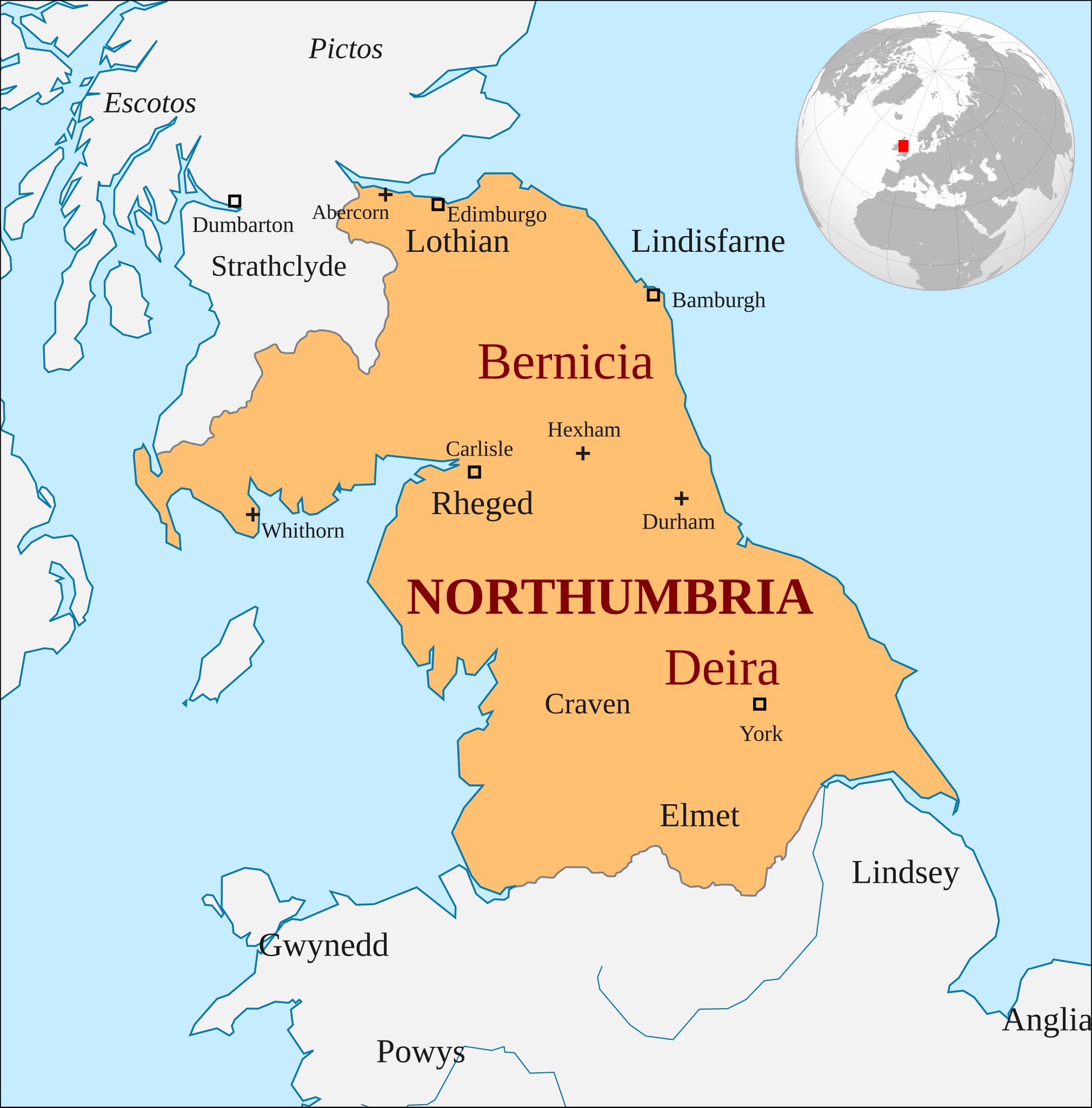
Español: El reino anglosajón de Northumbria hacia el año 700 |
| Date | |
| Source |
This file was derived from: Map of the Kingdom of Northumbria around 700 AD.svg |
| Author |
Map of the Kingdom of Northumbria around 700 AD.svg: Deu, Hogweard
|
Licensing
[edit]
This file is licensed under the Creative Commons Attribution-Share Alike 4.0 International license.
- You are free:
- to share – to copy, distribute and transmit the work
- to remix – to adapt the work
- Under the following conditions:
- attribution – You must give appropriate credit, provide a link to the license, and indicate if changes were made. You may do so in any reasonable manner, but not in any way that suggests the licensor endorses you or your use.
- share alike – If you remix, transform, or build upon the material, you must distribute your contributions under the same or compatible license as the original.
File history
Click on a date/time to view the file as it appeared at that time.
| Date/Time | Thumbnail | Dimensions | User | Comment | |
|---|---|---|---|---|---|
| current | 11:08, 15 October 2021 | | 586 × 594 (338 KB) | Rowanwindwhistler (talk | contribs) | Location inset added (Europe (orthographic projection).svg) |
| 11:03, 15 October 2021 |  | 586 × 594 (222 KB) | Rowanwindwhistler (talk | contribs) | Uploaded a work by Hogweard from https://commons.wikimedia.org/wiki/File:Map_of_the_Kingdom_of_Northumbria_around_700_AD.svg with UploadWizard |
You cannot overwrite this file.
File usage on Commons
The following page uses this file:
File usage on other wikis
The following other wikis use this file:
- Usage on es.wikipedia.org
- Usage on sr.wikipedia.org
- Usage on uk.wikipedia.org
- Елхред
- Елла II
- Осберт (король Нортумбрії)
- Еґберт I (король Берніції)
- Етельред II (король Нортумбрії)
- Кеолвульф
- Етельфріт (король Нортумбрії)
- Едвін (король Нортумбрії)
- Освальд (король Нортумбрії)
- Егфріт
- Освіу
- Елдфріт
- Едвульф
- Осред I
- Коенред
- Осрік (король Нортумбрії)
- Едберт
- Освульф
- Етелвалд Молл
- Етельред I (король Нортумбрії)
- Ельфвалд І
- Осред II
- Осбальд
- Ердвульф
- Ельфвалд II
- Енред
- Ріксіг
- Еґберт II
- Шаблон:Королі Нортумбрії