File:Map of the Territorial Waters in the Caribbean.png
Jump to navigation
Jump to search

Size of this preview: 800 × 522 pixels. Other resolutions: 320 × 209 pixels | 640 × 418 pixels | 1,024 × 668 pixels | 1,280 × 835 pixels | 1,713 × 1,118 pixels.
Original file (1,713 × 1,118 pixels, file size: 340 KB, MIME type: image/png)
Captions
Captions
Add a one-line explanation of what this file represents

|
This map image could be re-created using vector graphics as an SVG file. This has several advantages; see Commons:Media for cleanup for more information. If an SVG form of this image is available, please upload it and afterwards replace this template with
{{vector version available|new image name}}.
It is recommended to name the SVG file “Map of the Territorial Waters in the Caribbean.svg”—then the template Vector version available (or Vva) does not need the new image name parameter. |
Summary[edit]
| Description |
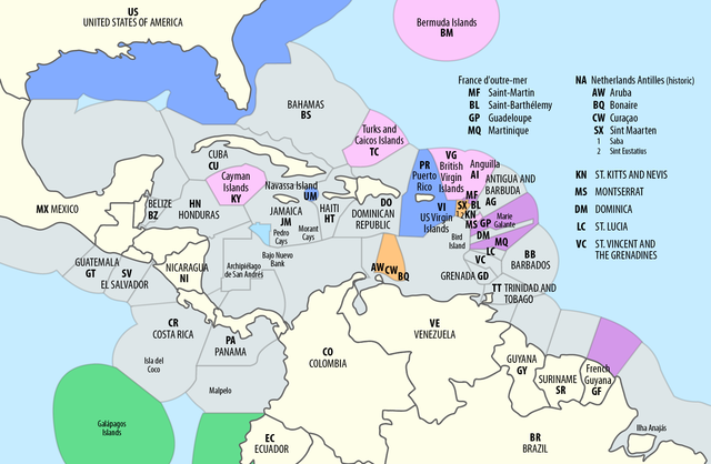
Deutsch: Ausschließliche Wirtschaftszonen (EEZ) in der Karibik
English: Territorial waters (EEZ) in the Caribbean |
| Date | see file history |
| Source | Own work using: this map by B1mbo |
| Author | Maximilian Dörrbecker (Chumwa) |
| Permission (Reusing this file) |
I, the copyright holder of this work, hereby publish it under the following license: This file is licensed under the Creative Commons Attribution-Share Alike 2.5 Generic license.
Sie dürfen das Bild zu den folgenden Bedingungen nutzen:
|
| Other versions |
|


File history
Click on a date/time to view the file as it appeared at that time.
| Date/Time | Thumbnail | Dimensions | User | Comment | |
|---|---|---|---|---|---|
| current | 08:10, 1 September 2018 | | 1,713 × 1,118 (340 KB) | Chumwa (talk | contribs) | == {{int:filedesc}} == {{Information |Description= {{de|1=Ausschließliche Wirtschaftszonen (EEZ) in der Karibik}} {{en|1=Territorial waters (EEZ) in the Caribbean}} |Source = {{own using}} this map by {{U|B1mbo}} |Date = see file history |Author = Maximilian Dörrbecker (Chumwa) |Permission={{self|cc-by-sa-2.5}} Sie dürfen das Bild zu den folgenden Bedingungen nutzen: * Sie müssen den Namen des Autors nennen. *... |
You cannot overwrite this file.
File usage on Commons
The following 5 pages use this file:
- File:Accord de délimitation des frontières entre la France et la Nouvelle-Zélande.png
- File:Map of the Exclusive Economic Zones of the Pacific Ocean.png
- File:Map of the Territorial Waters in the Caribbean.png
- File:Map of the Territorial Waters of the Atlantic and Indian Ocean.png
- File:Tonga and its borders (cropped).png
.png)
File usage on other wikis
The following other wikis use this file:
- Usage on af.wikipedia.org
- Usage on ast.wikipedia.org
- Usage on en.wikipedia.org
- Usage on es.wikipedia.org
- Usage on ja.wikipedia.org