File:Map showing Sikh Empire's territory at the time of Ranjit Singh’s passing away.jpg

Original file (4,784 × 4,020 pixels, file size: 1.76 MB, MIME type: image/jpeg)
Captions
Captions
Summary[edit]
| Description |
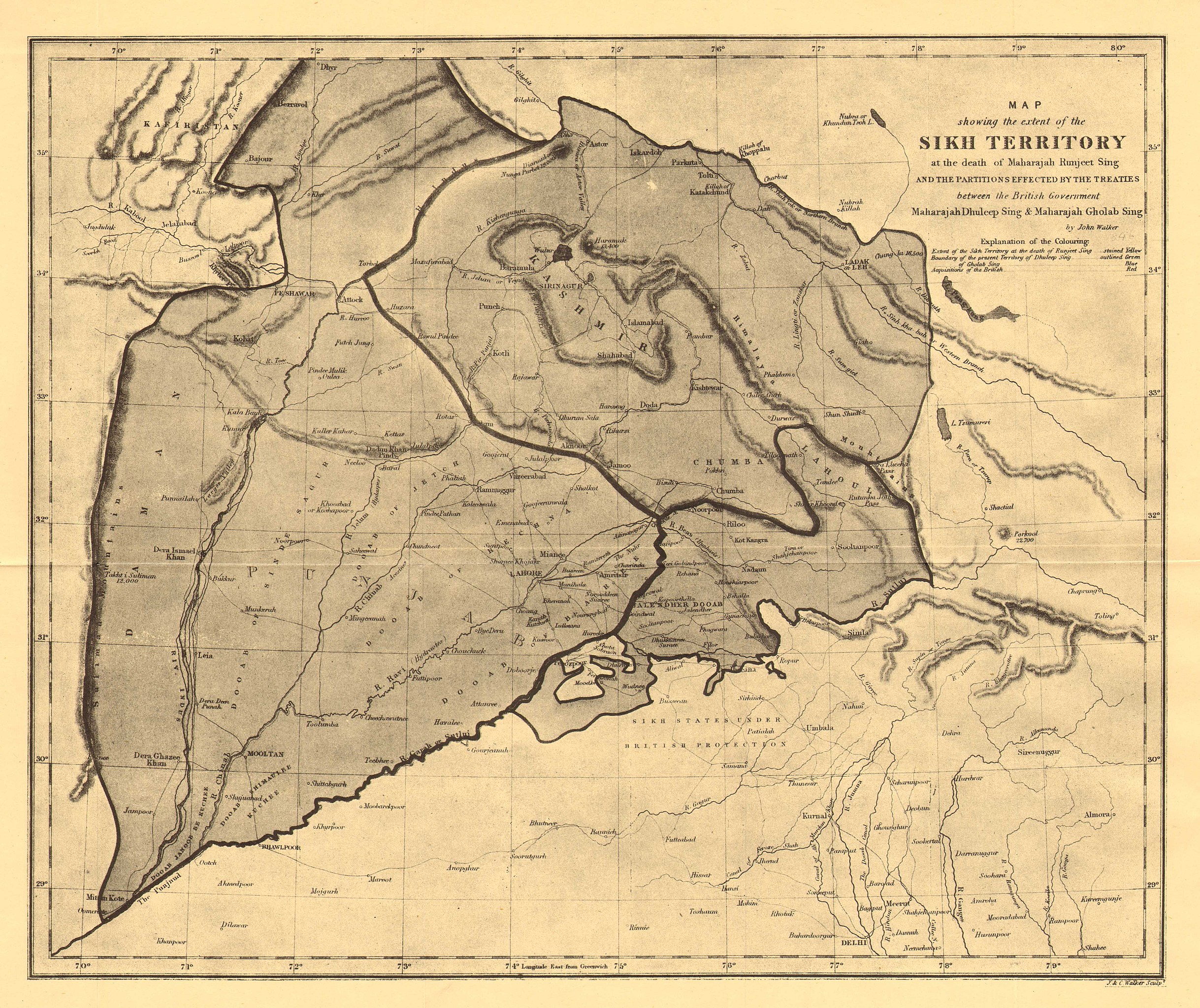
English: Map showing Sikh Empire's territory at the time of Ranjit Singh’s passing away, by John Walker. This scan is not in colour so you cannot see the shading and outlines of the original map. Another scan (in a much lower resolution) in colour can be viewed at the following URL: https://www.instagram.com/p/CMepNk4sr47/ or https://twitter.com/learnpunjabi/status/1371816041416904707 |
| Date | circa 1846 |
| Source | https://travelthehimalayas.com/himalayan-maps |
| Author | John Walker |
Licensing[edit]
This image is in the public domain because it is a mere mechanical scan or photocopy of a public domain original, or – from the available evidence – is so similar to such a scan or photocopy that no copyright protection can be expected to arise. The original itself is in the public domain for the following reason:
This tag is designed for use where there may be a need to assert that any enhancements (eg brightness, contrast, colour-matching, sharpening) are in themselves insufficiently creative to generate a new copyright. It can be used where it is unknown whether any enhancements have been made, as well as when the enhancements are clear but insufficient. For known raw unenhanced scans you can use an appropriate {{PD-old}} tag instead. For usage, see Commons:When to use the PD-scan tag.  | ||||
File history
Click on a date/time to view the file as it appeared at that time.
| Date/Time | Thumbnail | Dimensions | User | Comment | |
|---|---|---|---|---|---|
| current | 04:44, 22 December 2022 | | 4,784 × 4,020 (1.76 MB) | MaplesyrupSushi (talk | contribs) | Uploaded a work by John Walker from https://travelthehimalayas.com/himalayan-maps with UploadWizard |
You cannot overwrite this file.
File usage on Commons
There are no pages that use this file.
File usage on other wikis
The following other wikis use this file:
- Usage on en.wikipedia.org
- Usage on pa.wikipedia.org
- Usage on tl.wikipedia.org
- Usage on tr.wikipedia.org