File:Marylebone station, geograph 6380655 by Robin Webster.jpg
From Wikimedia Commons, the free media repository
Jump to navigation
Jump to search
Size of this preview: 800 × 600 pixels. Other resolutions: 320 × 240 pixels | 640 × 480 pixels | 1,024 × 768 pixels.
Original file (1,024 × 768 pixels, file size: 261 KB, MIME type: image/jpeg)
File information
Structured data
Captions
Summary[edit]
DescriptionMarylebone station, geograph 6380655 by Robin Webster.jpg |
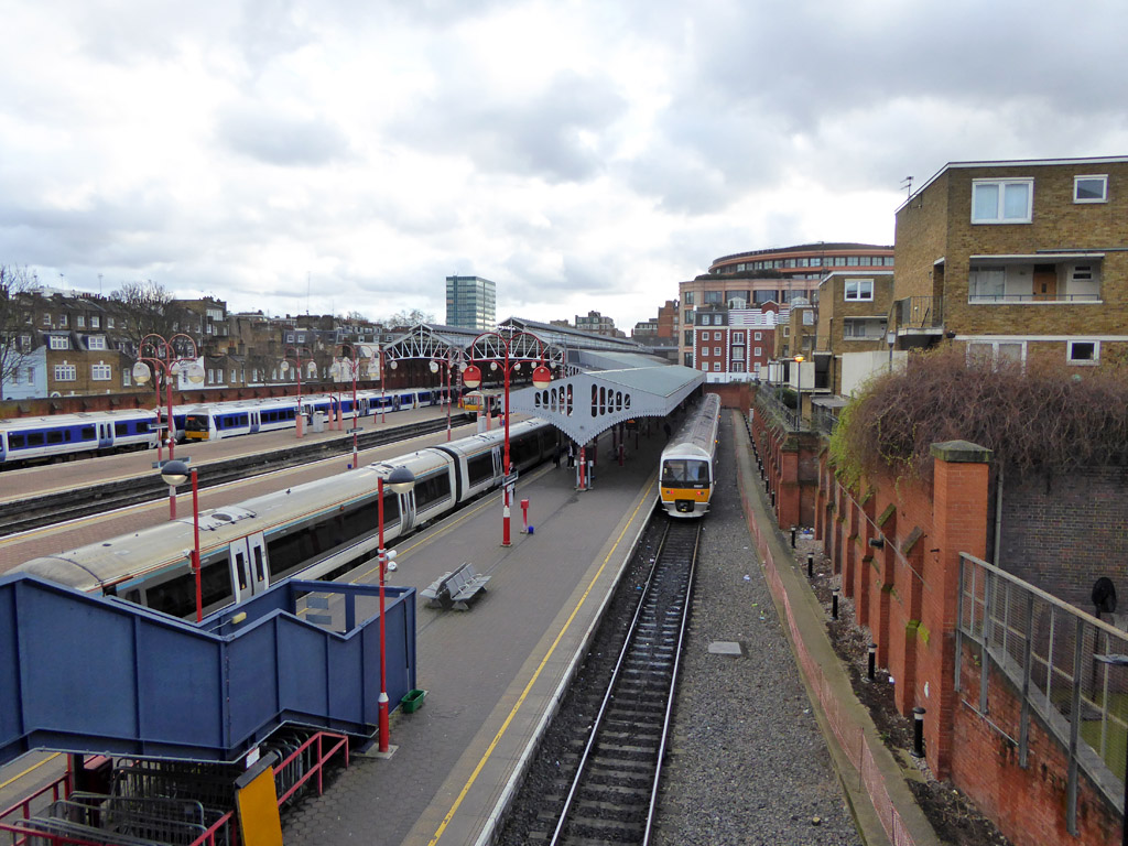
English: Marylebone station
Looking from the Rossmore Road bridge. |
||
Date | |||
Source | geograph.org.uk | ||
Author | Robin Webster | ||
Permission (Reusing this file) |
This file is licensed under the Creative Commons Attribution-Share Alike 2.0 Generic license. Attribution: Robin Webster
|
||
Attribution (required by the license) InfoField | Robin Webster / Marylebone station / | ||
InfoField | Robin Webster / Marylebone station |
Camera location | 51° 31′ 30.21″ N, 0° 09′ 51.3″ W | View this and other nearby images on: OpenStreetMap | 51.525057; -0.164260 |
---|
Object location | 51° 31′ 28.1″ N, 0° 09′ 50″ W | View this and other nearby images on: OpenStreetMap | 51.524470; -0.163900 |
---|
File history
Click on a date/time to view the file as it appeared at that time.
Date/Time | Thumbnail | Dimensions | User | Comment | |
---|---|---|---|---|---|
current | 01:39, 15 November 2021 | 1,024 × 768 (261 KB) | G-13114 (talk | contribs) | {{Information |description={{en|1=Marylebone station Looking from the Rossmore Road bridge.}} |date=2020-01-28 |source= [https://www.geograph.org.uk geograph.org.uk] |author= Robin Webster |permission= {{Geograph|6380655|Robin Webster}} |other_versions= |other fields= {{Credit line |Author = Robin Webster |Other = ''Marylebone station'' |License = CC-BY-SA-2.0 }}}} Category:Marylebone station Category:January 2020 in London Category:2020 in rail transport in London [[Ca... |
You cannot overwrite this file.
File usage on Commons
The following page uses this file:
Metadata
This file contains additional information such as Exif metadata which may have been added by the digital camera, scanner, or software program used to create or digitize it. If the file has been modified from its original state, some details such as the timestamp may not fully reflect those of the original file. The timestamp is only as accurate as the clock in the camera, and it may be completely wrong.
Camera manufacturer | Panasonic |
---|---|
Camera model | DMC-TZ61 |
Exposure time | 1/320 sec (0.003125) |
F-number | f/3.3 |
ISO speed rating | 160 |
Date and time of data generation | 14:54, 28 January 2020 |
Lens focal length | 4.3 mm |
Latitude | 51° 31′ 30.19″ N |
Longitude | 0° 9′ 51.32″ W |
Altitude | 28 meters above sea level |
Orientation | Normal |
Horizontal resolution | 180 dpi |
Vertical resolution | 180 dpi |
Software used | Adobe Photoshop Elements 6.0 Windows |
File change date and time | 00:59, 1 February 2020 |
Y and C positioning | Co-sited |
Exposure Program | Landscape mode (for landscape photos with the background in focus) |
Exif version | 2.3 |
Date and time of digitizing | 14:54, 28 January 2020 |
Meaning of each component |
|
Image compression mode | 4 |
APEX exposure bias | 0 |
Maximum land aperture | 3.4453125 APEX (f/3.3) |
Metering mode | Pattern |
Light source | Unknown |
Flash | Flash did not fire, compulsory flash suppression |
Supported Flashpix version | 1 |
Color space | sRGB |
Sensing method | One-chip color area sensor |
File source | Digital still camera |
Scene type | A directly photographed image |
Custom image processing | Normal process |
Exposure mode | Auto exposure |
White balance | Auto white balance |
Digital zoom ratio | 0 |
Focal length in 35 mm film | 25 mm |
Scene capture type | Standard |
Scene control | Low gain up |
Contrast | Normal |
Saturation | Normal |
Sharpness | Normal |
Geodetic survey data used | WGS-84 |
GPS tag version | 0.0.2.2 |
Supported Flashpix version | 1 |
Image width | 1,024 px |
Image height | 768 px |
Date metadata was last modified | 00:59, 1 February 2020 |
IIM version | 41,001 |
Structured data
Items portrayed in this file
depicts
28 January 2020
0.003125 second
3.3
4.3 millimetre
160
51°31'30.205"N, 0°9'51.336"W
51°31'28.09"N, 0°9'50.04"W
image/jpeg
cf9b0f5a7e033a8fd35d6b0248934a4977225251
267,110 byte
768 pixel
1,024 pixel
Hidden categories:
- CC-BY-SA-2.0
- Images from Geograph Britain and Ireland
- Images from Geograph Britain and Ireland missing SDC creator
- Images from Geograph Britain and Ireland missing SDC source of file
- Information field template with formatting
- Files with coordinates missing SDC location of creation (51° N, 1° W)
- London photographs taken on 2020-01-28
- Pages with maps