File:Matakana 2020-04-25 Sentinel 2 SR.jpg

Original file (1,920 × 1,310 pixels, file size: 1.1 MB, MIME type: image/jpeg)
Captions
Captions
Summary[edit]
| Description |
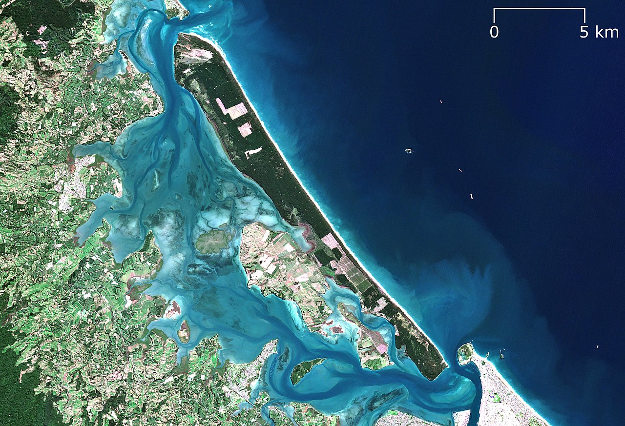
English: Sentinel 2 surface reflectance image of Matakana Island, Bay of Plenty/Te Moana-a-Toi, New Zealand/Aotearoa on 2020-04-25 as an example of a barrier island. |
|||||||||
| PNG Development | ||||||||||
| Date | ||||||||||
| Source | Contains modified Copernicus Sentinel data 2020. European Space Agency. | |||||||||
| Creator |
European Space Agency, RXerself |
|||||||||
| Geotemporal data | ||||||||||
| Spatial reference system | New Zealand Transverse Mercator 2000 (NZTM2000) | |||||||||
| Heading |
 |
|||||||||
| Bounding box |
|
|||||||||

Licensing[edit]
- You are free:
- to share – to copy, distribute and transmit the work
- to remix – to adapt the work
- Under the following conditions:
- attribution – You must give appropriate credit, provide a link to the license, and indicate if changes were made. You may do so in any reasonable manner, but not in any way that suggests the licensor endorses you or your use.
- share alike – If you remix, transform, or build upon the material, you must distribute your contributions under the same or compatible license as the original.

|
This image contains data from a satellite in the Copernicus Programme, such as Sentinel-1, Sentinel-2 or Sentinel-3. Attribution is required when using this image.
Attribution: Contains modified Copernicus Sentinel data 2020
The use of Copernicus Sentinel Data is regulated under EU law (Commission Delegated Regulation (EU) No 1159/2013 and Regulation (EU) No 377/2014). Relevant excerpts:
Free access shall be given to GMES dedicated data [...] made available through GMES dissemination platforms [...].
Access to GMES dedicated data [...] shall be given for the purpose of the following use in so far as it is lawful:
GMES dedicated data [...] may be used worldwide without limitations in time.
GMES dedicated data and GMES service information are provided to users without any express or implied warranty, including as regards quality and suitability for any purpose. |
File history
Click on a date/time to view the file as it appeared at that time.
| Date/Time | Thumbnail | Dimensions | User | Comment | |
|---|---|---|---|---|---|
| current | 03:38, 4 September 2022 | | 1,920 × 1,310 (1.1 MB) | RXerself (talk | contribs) | == {{int:filedesc}} == {{Map |description ={{en|1=Sentinel 2 surface reflectance image of Matakana Island, Bay of Plenty/Te Moana-a-Toi, New Zealand/Aotearoa on 2020-04-25 as an example of a {{w|barrier island}}.}} |date =2020-04-25 |source=Contains modified Copernicus Sentinel data 2020. European Space Agency. |author=European Space Agency, {{u|RXerself}} |projection = New Zealand Transverse Mercator 2000 (NZTM2000) |heading = N |latitude =-37.67371/-37.66348/-37.451... |
You cannot overwrite this file.
File usage on Commons
There are no pages that use this file.
File usage on other wikis
The following other wikis use this file:
- Usage on hr.wikipedia.org
- Usage on id.wikipedia.org