File:Mockup ground plan and view of Fort on Botany - Bay Island, North Edisto River. from cgs05197, 1862 - Cgs05202.jpg
Jump to navigation
Jump to search
Size of this preview: 774 × 599 pixels. Other resolutions: 310 × 240 pixels | 620 × 480 pixels | 992 × 768 pixels | 1,280 × 991 pixels | 1,995 × 1,545 pixels.
Original file (1,995 × 1,545 pixels, file size: 1.87 MB, MIME type: image/jpeg)
Captions
Captions
Add a one-line explanation of what this file represents
Summary[edit]
| Description |
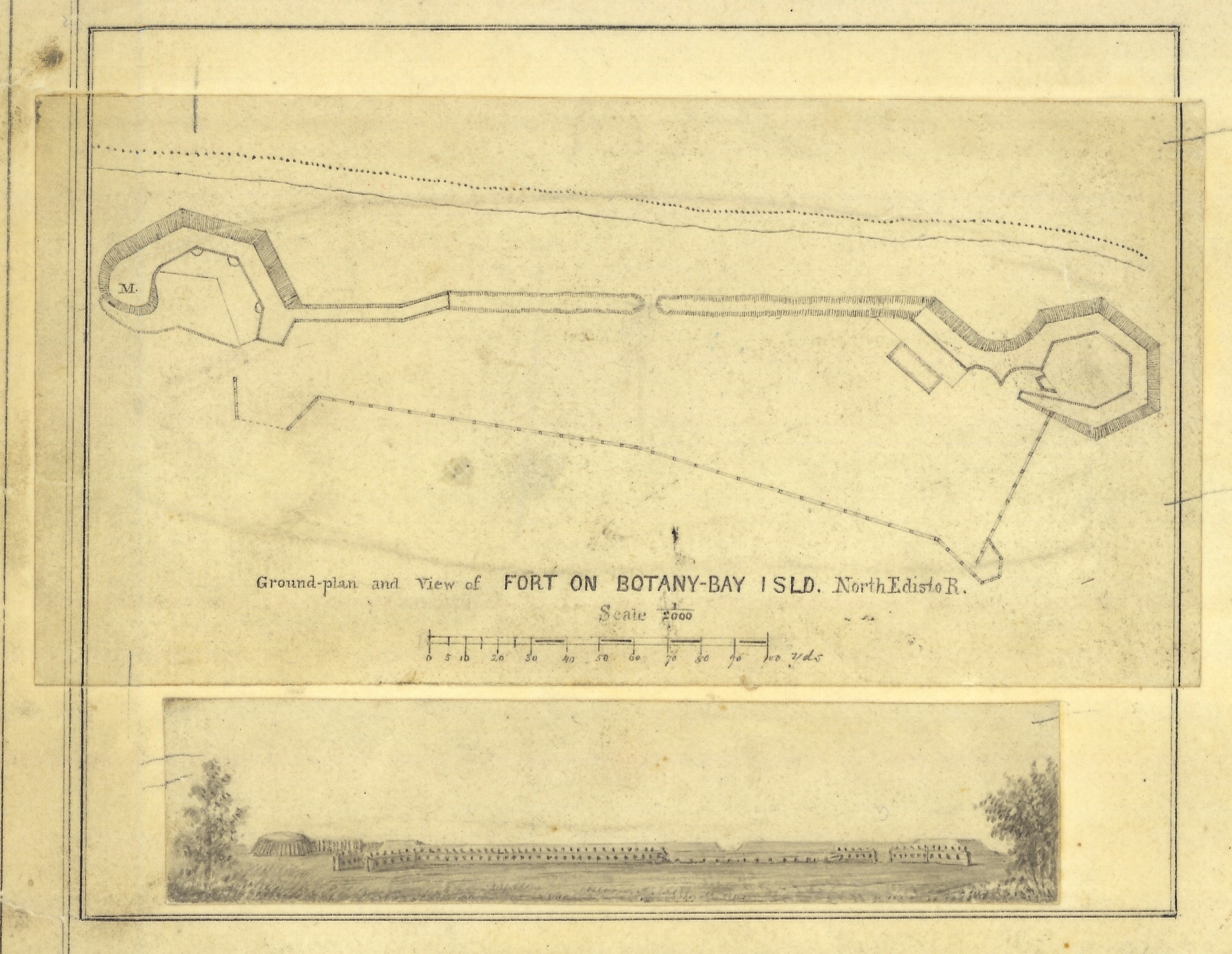
English: Mockup ground plan and view of Fort on Botany - Bay Island, North Edison River. from cgs05197.
   Image ID: cgs05202, NOAA's Historic Coast & Geodetic Survey (C&GS) Collection
   Location: South Carolina coast
   Photo Date: 1862
Credit: NARA C&GS Colllection |
| Date | |
| Source | https://www.flickr.com/photos/51647007@N08/9716170849/ |
| Author | NOAA Photo Library |
Licensing[edit]
This file is licensed under the Creative Commons Attribution 2.0 Generic license.
- You are free:
- to share – to copy, distribute and transmit the work
- to remix – to adapt the work
- Under the following conditions:
- attribution – You must give appropriate credit, provide a link to the license, and indicate if changes were made. You may do so in any reasonable manner, but not in any way that suggests the licensor endorses you or your use.
| This image was originally posted to Flickr by NOAA Photo Library at https://flickr.com/photos/51647007@N08/9716170849. It was reviewed on 29 August 2021 by FlickreviewR 2 and was confirmed to be licensed under the terms of the cc-by-2.0. |
File history
Click on a date/time to view the file as it appeared at that time.
| Date/Time | Thumbnail | Dimensions | User | Comment | |
|---|---|---|---|---|---|
| current | 22:01, 29 August 2021 | | 1,995 × 1,545 (1.87 MB) | Ooligan (talk | contribs) | Uploaded a work by NOAA Photo Library from https://www.flickr.com/photos/51647007@N08/9716170849/ with UploadWizard |
You cannot overwrite this file.
File usage on Commons
There are no pages that use this file.