File:Mount Parker Old Route Surveillance Radar in Hong Kong.jpg
Jump to navigation
Jump to search
Size of this preview: 800 × 600 pixels. Other resolutions: 320 × 240 pixels | 640 × 480 pixels | 1,024 × 768 pixels | 1,280 × 960 pixels | 2,560 × 1,920 pixels | 4,608 × 3,456 pixels.
Original file (4,608 × 3,456 pixels, file size: 4.48 MB, MIME type: image/jpeg)
Captions
Captions
Add a one-line explanation of what this file represents
Summary[edit]
| Description |
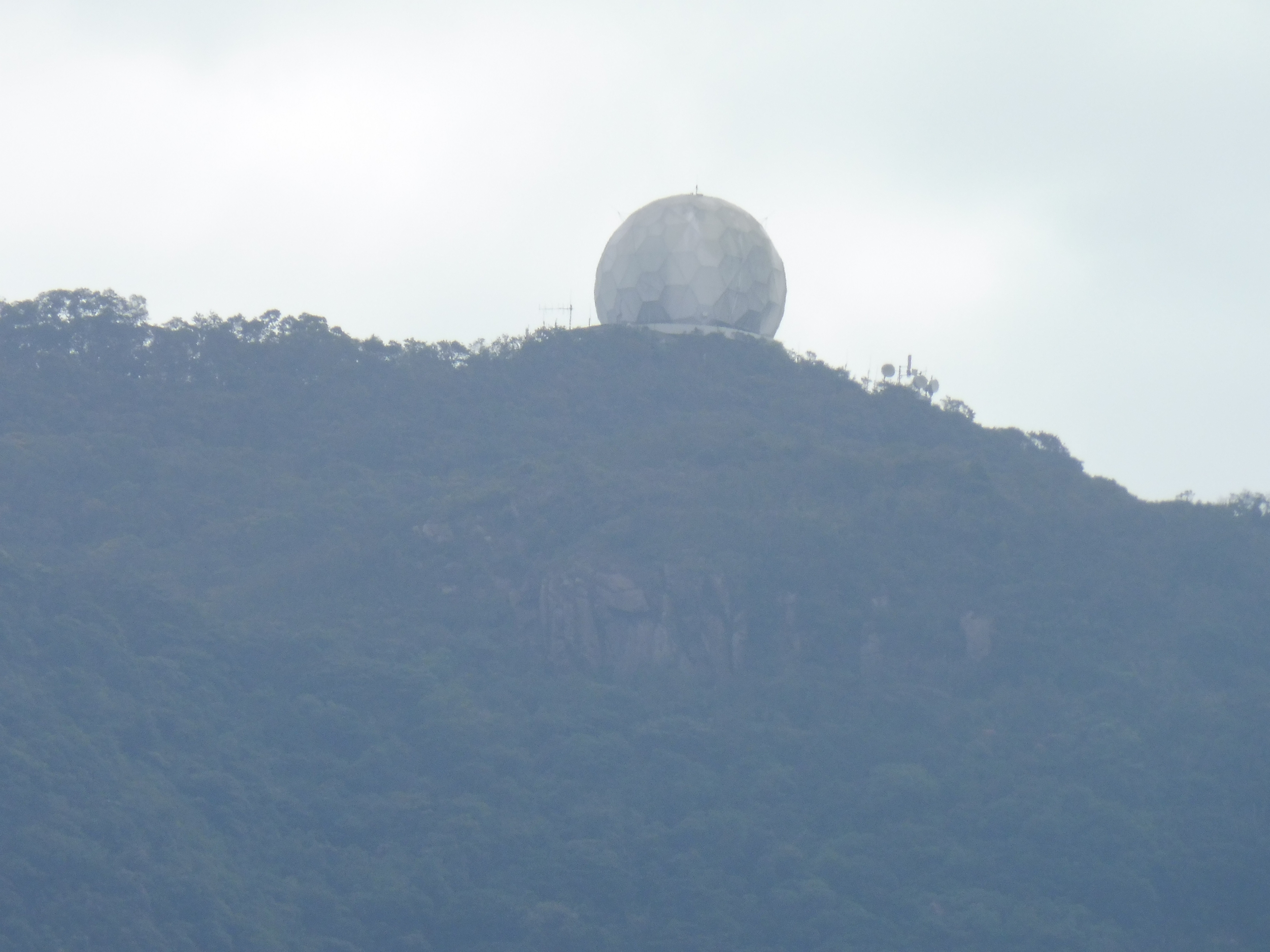
English: Installed at Mount Parker in 1978, for the former Hong Kong International Airport at Kai Tak, this radar was operated for more than 25 years. It served as a primary surveillance radar (PSR) with coverage of 200 nautical miles for en-route air traffic surveillance. It was replaced in 2004 because of its age and difficulty in acquiring spares. (see https://www.info.gov.hk/gia/general/200403/30/0330090.htm and https://www.news.gov.hk/isd/ebulletin/en/category/infrastructureandlogistics/021115/features/html/021115e06005.htm#) |
| Date | |
| Source | Own work |
| Author | Pierre cb |
Licensing[edit]
I, the copyright holder of this work, hereby publish it under the following license:
This file is licensed under the Creative Commons Attribution-Share Alike 4.0 International license.
- You are free:
- to share – to copy, distribute and transmit the work
- to remix – to adapt the work
- Under the following conditions:
- attribution – You must give appropriate credit, provide a link to the license, and indicate if changes were made. You may do so in any reasonable manner, but not in any way that suggests the licensor endorses you or your use.
- share alike – If you remix, transform, or build upon the material, you must distribute your contributions under the same or compatible license as the original.
File history
Click on a date/time to view the file as it appeared at that time.
| Date/Time | Thumbnail | Dimensions | User | Comment | |
|---|---|---|---|---|---|
| current | 16:50, 1 February 2019 | | 4,608 × 3,456 (4.48 MB) | Pierre cb (talk | contribs) | User created page with UploadWizard |
You cannot overwrite this file.
File usage on Commons
The following page uses this file: