File:Nant-Pont sur la Dourbie VA-20120624.jpg
Jump to navigation
Jump to search

Size of this preview: 600 × 600 pixels. Other resolutions: 240 × 240 pixels | 480 × 480 pixels | 768 × 768 pixels | 1,024 × 1,024 pixels | 2,048 × 2,048 pixels | 4,000 × 4,000 pixels.
Original file (4,000 × 4,000 pixels, file size: 3.93 MB, MIME type: image/jpeg)
Captions
Captions
Add a one-line explanation of what this file represents
| Description |
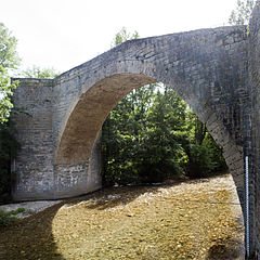
The medieval bridge. | ||
| Protection |
|
||
| Date | Taken on 24 June 2012. | ||
| Source | Own work. | ||
| Author | Daniel VILLAFRUELA. | ||
| Permission (Reusing this file) |
Daniel VILLAFRUELA, the copyright holder of this work, hereby publishes it under the following license: This file is licensed under the Creative Commons Attribution-Share Alike 4.0 International license. Attribution: Daniel VILLAFRUELA
|
||
| Other versions |
|


| Object location | | View this and other nearby images on: OpenStreetMap |
|---|
| Camera location | | View this and other nearby images on: OpenStreetMap |
|---|
File history
Click on a date/time to view the file as it appeared at that time.
| Date/Time | Thumbnail | Dimensions | User | Comment | |
|---|---|---|---|---|---|
| current | 11:05, 4 July 2012 | | 4,000 × 4,000 (3.93 MB) | Daniel VILLAFRUELA (talk | contribs) | {{Information |Description ={{fr|1=Pont sur la Dourbie, 15° S. }} |Source ={{own}} |Author =Daniel Villafruela |Date =2012-06-24 |Permission = |other_versions = }} {{Mérimée|type=inscrit|PA00094... |
You cannot overwrite this file.
File usage on Commons
The following 2 pages use this file:
File usage on other wikis
The following other wikis use this file:
- Usage on en.wikipedia.org
- Usage on fr.wikipedia.org
- Usage on www.wikidata.org