File:Naturraumkarte Thueringisch-Fraenkisch-Vogtlaendisches Schiefergebirge.png
Jump to navigation
Jump to search
Size of this preview: 800 × 487 pixels. Other resolutions: 320 × 195 pixels | 640 × 390 pixels | 1,024 × 623 pixels | 1,541 × 938 pixels.
Original file (1,541 × 938 pixels, file size: 2.04 MB, MIME type: image/png)
Captions
Captions
Add a one-line explanation of what this file represents
Summary[edit]
| Description |
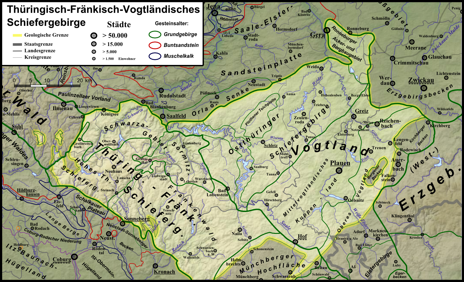
Deutsch: Naturraumkarte des Thüringisch-Fränkisch-Vogtländischen Schiefergebirges in seinen geologischen Grenzen; hervorgehoben sind auch die inselartig im Thüringer Wald liegenden Schleuse-Horst und Vesser-Komplex; umgekehrt sind die halbinselartigen Thüringer-Wald-Ausläufer Masserberger und Crocker Scholle sowie die Erzgebirgs-Exclave Bergener Becken abgedunkelt, ebenso der im Inneren liegende Teil des Stockheimer Beckens östlich Sonnebergs. |
| Date | |
| Source | Own work |
| Author |
|
| Other versions | Siehe Galerie |
Licensing[edit]
I, the copyright holder of this work, hereby publish it under the following license:
This file is licensed under the Creative Commons Attribution 3.0 Unported license.
- You are free:
- to share – to copy, distribute and transmit the work
- to remix – to adapt the work
- Under the following conditions:
- attribution – You must give appropriate credit, provide a link to the license, and indicate if changes were made. You may do so in any reasonable manner, but not in any way that suggests the licensor endorses you or your use.
File history
Click on a date/time to view the file as it appeared at that time.
| Date/Time | Thumbnail | Dimensions | User | Comment | |
|---|---|---|---|---|---|
| current | 17:44, 5 January 2013 | | 1,541 × 938 (2.04 MB) | Elop (talk | contribs) | + Stockheimer Becken |
| 16:42, 4 January 2013 |  | 1,541 × 938 (2.04 MB) | Elop (talk | contribs) | Update | |
| 16:10, 4 January 2013 |  | 1,541 × 938 (2.04 MB) | Elop (talk | contribs) | Update | |
| 14:36, 3 January 2013 |  | 1,539 × 938 (2.04 MB) | Elop (talk | contribs) | {{Information |Description={{de|1=Naturraumkarte des Thüringisch-Fränkisch-Vogtländischen Schiefergebirges in seinen geologischen Grenzen; hervorgehoben sind auch die inselartig im Thü... |
You cannot overwrite this file.
File usage on Commons
The following 2 pages use this file:
File usage on other wikis
The following other wikis use this file:
- Usage on de.wikipedia.org