File:Neue Welt Fischauer Vorberge Ruine Emmerberg Prosset 20231216.jpg
Jump to navigation
Jump to search

Size of this preview: 800 × 450 pixels. Other resolutions: 320 × 180 pixels | 640 × 360 pixels | 1,024 × 576 pixels | 1,280 × 720 pixels | 3,171 × 1,784 pixels.
Original file (3,171 × 1,784 pixels, file size: 2.29 MB, MIME type: image/jpeg)
Captions
Captions
Add a one-line explanation of what this file represents
Summary[edit]
| Description |
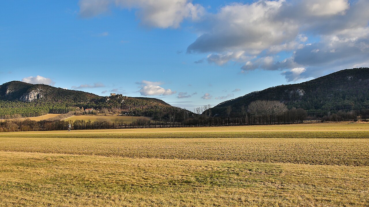
Deutsch: Wiesen in der Neue Welt, im Hintergrund die Fischauer Vorberge mit der Burgruine Emmerberg. Der Taleinschitt ist die Prosset. Gemeinde Winzendorf-Muthmannsdorf im Bezirk Wiener Neustadt-Land in Niederösterreich / Österreich / Europäische Union. English: Meadows in the Neue Welt, in the background the Fischau foothills with the Emmerberg castle ruins. The valley entrance is the Prosset. Municipality of Winzendorf-Muthmannsdorf, district Wiener Neustadt-Land District, Lower Austria / Austria / EU. |
| Date | 16 December 2023 (according to Exif data) |
| Source | Own work |
| Author | Joadl |
| Permission (Reusing this file) |
Deutsch: Ergänzung zur Lizenz CC BY-SA 4.0. Kostenlose / unentgeltliche / gratis Verwendung, privat oder gewerblich, zu den unten genannten Bedingungen:
English: Supplement to the license CC BY-SA 4.0. Usage is free of charge for private or commercial use under the conditions specified below:
|
| Camera location | | View this and other nearby images on: OpenStreetMap |
|---|
Licensing[edit]
I, the copyright holder of this work, hereby publish it under the following license:
This file is licensed under the Creative Commons Attribution-Share Alike 4.0 International license.
- You are free:
- to share – to copy, distribute and transmit the work
- to remix – to adapt the work
- Under the following conditions:
- attribution – You must give appropriate credit, provide a link to the license, and indicate if changes were made. You may do so in any reasonable manner, but not in any way that suggests the licensor endorses you or your use.
- share alike – If you remix, transform, or build upon the material, you must distribute your contributions under the same or compatible license as the original.
File history
Click on a date/time to view the file as it appeared at that time.
| Date/Time | Thumbnail | Dimensions | User | Comment | |
|---|---|---|---|---|---|
| current | 19:17, 16 December 2023 | | 3,171 × 1,784 (2.29 MB) | Joadl (talk | contribs) | == {{int:filedesc}} == {{Information |Description= {{Multilingual description |de= Marmor-Schnittfläche (Detailansicht) im Engelsberger Marmorsteinbruch in der Gemeinde Winzendorf-Muthmannsdorf im Bezirk Wiener Neustadt-Land in Niederösterreich / Österreich / Europäische Union. Gut erkennbar ist die Riffelung durch den Abbau mit... |
You cannot overwrite this file.
File usage on Commons
The following page uses this file:
File usage on other wikis
The following other wikis use this file:
- Usage on de.wikipedia.org