File:New Full-Hemisphere Views of Earth at Night.jpg
Jump to navigation
Jump to search

Size of this preview: 763 × 600 pixels. Other resolutions: 306 × 240 pixels | 611 × 480 pixels | 978 × 768 pixels | 1,280 × 1,006 pixels | 2,560 × 2,011 pixels | 4,200 × 3,300 pixels.
Original file (4,200 × 3,300 pixels, file size: 3.56 MB, MIME type: image/jpeg)
Captions
Captions
Add a one-line explanation of what this file represents
Summary[edit]
| Description |
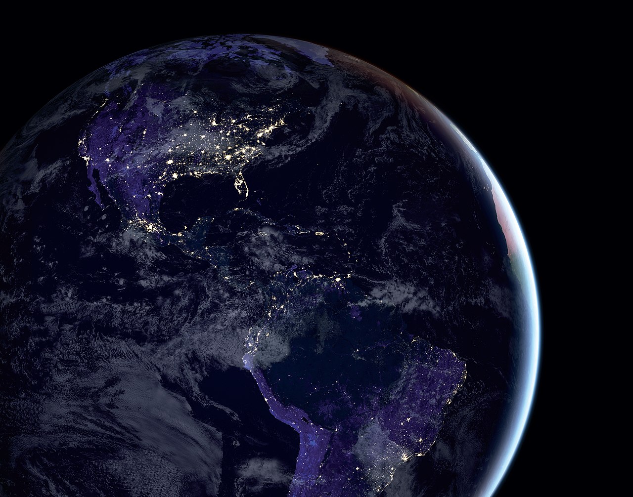
English: This composite image of the Americas at night shows large concentrations of human activity and urban infrastructure. It was produced by researchers at NASA’s Goddard Space Flight Center using night lights data from the Visible Infrared Imaging Radiometer Suite (VIIRS) on the Suomi National Polar-orbiting Partnership satellite, a NASA-National Oceanic and Atmospheric Administration (NOAA) mission. The researchers wrote a code to pick the clearest night views over many months, combining them to provide moonlight-free and -corrected images. The clouds and sunglint, added for aesthetic effect, are derived from Moderate Resolution Imaging Spectroradiometer (MODIS) land surface and cloud cover products. The researchers analyze night lights data and develop software algorithms that make night lights imagery clearer, more accurate and readily available. |
| Date | |
| Source | NASA Science 2018 Commemorative Calendar.pdf |
| Author | NASA’s Earth Observatory/Joshua Stevens, NASA GSFC/Miguel Román |
| Other versions |

Licensing[edit]
| This file is in the public domain in the United States because it was solely created by NASA. NASA copyright policy states that "NASA material is not protected by copyright unless noted". (See Template:PD-USGov, NASA copyright policy page or JPL Image Use Policy.) | ||
 |
Warnings:
|
File history
Click on a date/time to view the file as it appeared at that time.
| Date/Time | Thumbnail | Dimensions | User | Comment | |
|---|---|---|---|---|---|
| current | 18:59, 7 February 2022 | | 4,200 × 3,300 (3.56 MB) | Ras67 (talk | contribs) | == {{int:filedesc}} == {{Information |Description ={{en|1=This composite image of the Americas at night shows large concentrations of human activity and urban infrastructure. It was produced by researchers at NASA’s Goddard Space Flight Center using night lights data from the Visible Infrared Imaging Radiometer Suite (VIIRS) on the Suomi National Polar-orbiting Partnership satellite, a NASA-National Oceanic and Atmospheric Administration (NOAA) mission. The researchers wrote a code to pick... |
You cannot overwrite this file.
File usage on Commons
The following page uses this file: