File:Newsmap - Maps are not true for all purposes.jpg
Jump to navigation
Jump to search

Size of this preview: 800 × 596 pixels. Other resolutions: 320 × 238 pixels | 640 × 477 pixels | 1,024 × 763 pixels | 1,280 × 953 pixels | 2,560 × 1,906 pixels | 3,000 × 2,234 pixels.
Original file (3,000 × 2,234 pixels, file size: 498 KB, MIME type: image/jpeg)
Captions
Captions
Add a one-line explanation of what this file represents
Summary[edit]
| Description |
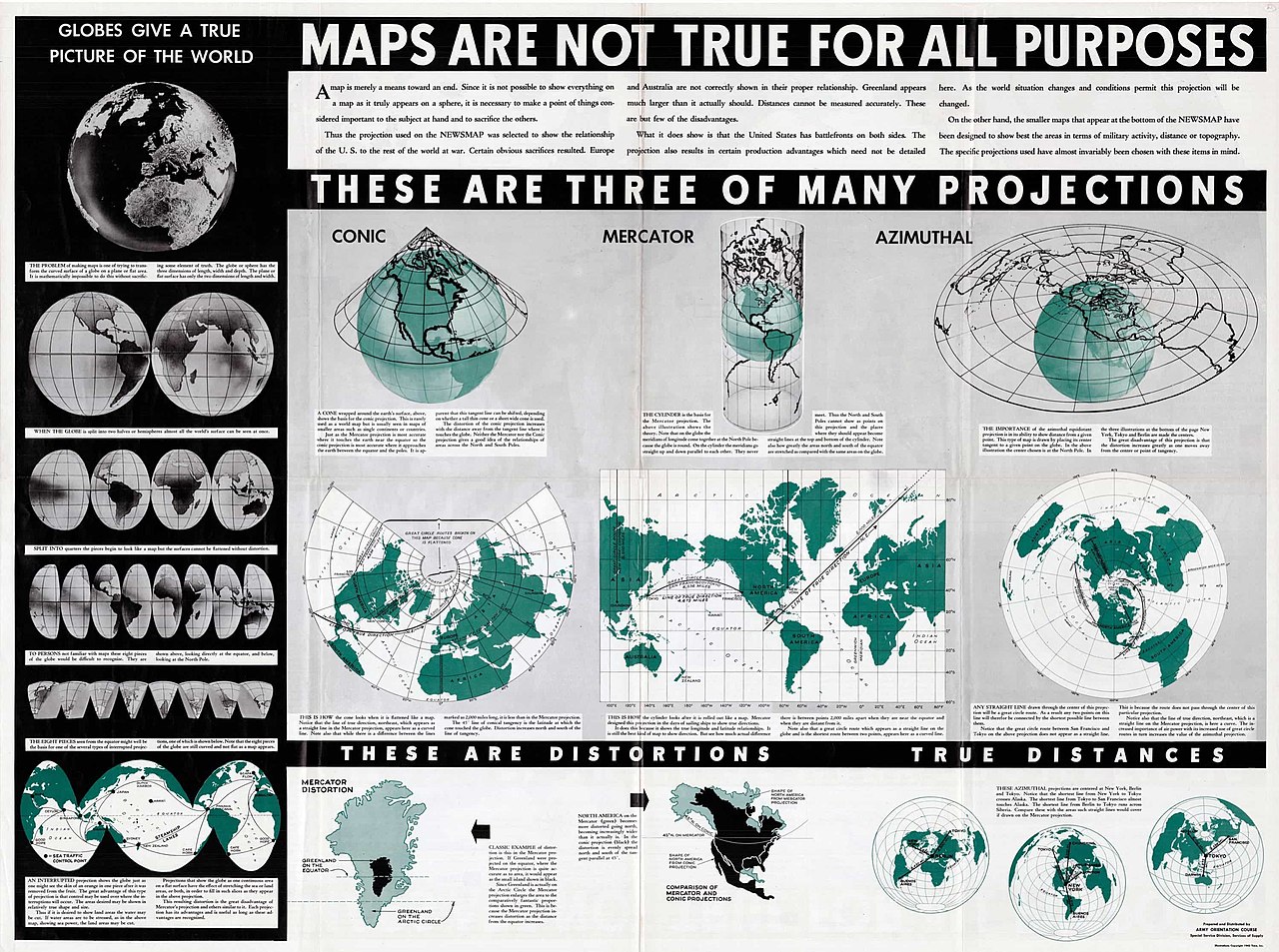
English: Information about the tradeoffs involved in choosing between map projections, making the basic point that “maps are not true for all purposes.” It includes numerous diagrams illustrating the advantages and disadvantages of conic, Mercator and azimuthal projections. |
| Date | |
| Source | https://bostonraremaps.com/wp-content/uploads/2017/01/BRM2634-Maps-Not-True-1942_lowres-3000x2234.jpg |
| Author | Army Information Branch |
Licensing[edit]
This image is a work of a U.S. military or Department of Defense employee, taken or made as part of that person's official duties. As a work of the U.S. federal government, the image is in the public domain in the United States.
|
 |
File history
Click on a date/time to view the file as it appeared at that time.
| Date/Time | Thumbnail | Dimensions | User | Comment | |
|---|---|---|---|---|---|
| current | 18:53, 1 February 2023 | | 3,000 × 2,234 (498 KB) | Universalis (talk | contribs) | Uploaded a work by Army Information Branch from https://bostonraremaps.com/wp-content/uploads/2017/01/BRM2634-Maps-Not-True-1942_lowres-3000x2234.jpg with UploadWizard |
You cannot overwrite this file.
File usage on Commons
The following page uses this file: