File:Northern terminus of I-65.jpg
Jump to navigation
Jump to search
Size of this preview: 800 × 451 pixels. Other resolutions: 320 × 180 pixels | 640 × 360 pixels | 1,024 × 577 pixels | 1,280 × 721 pixels | 2,573 × 1,449 pixels.
Original file (2,573 × 1,449 pixels, file size: 688 KB, MIME type: image/jpeg)
Captions
Captions
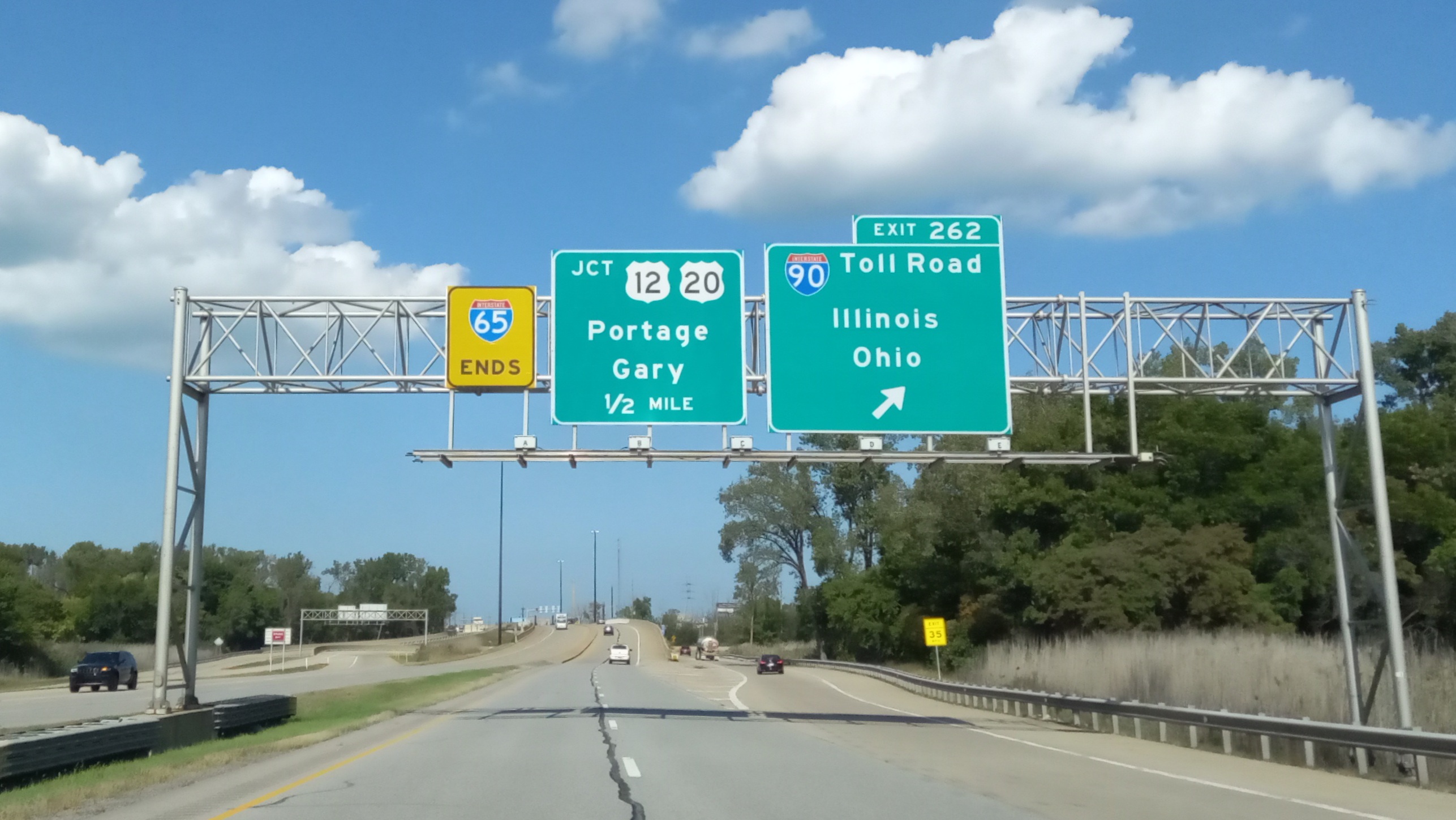
Interstate 65 ends at I-90 (Indiana Toll Road) / US 12 / US 20 in Gary, Indiana.
Summary[edit]
| Description |
English: After meeting with I-90 (Indiana Toll Road), Interstate 65 ends right in Gary, Indiana. The freeway then abruptly stops at an at-grade intersection with US 12 and US 20 half a mile from there. |
| Date | October 9, 2021 12:47 PM |
| Source | Own work |
| Author | AlphaBeta135 |
| Camera location | | View this and other nearby images on: OpenStreetMap |
|---|
Licensing[edit]
I, the copyright holder of this work, hereby publish it under the following license:
This file is licensed under the Creative Commons Attribution 3.0 Unported license.
- You are free:
- to share – to copy, distribute and transmit the work
- to remix – to adapt the work
- Under the following conditions:
- attribution – You must give appropriate credit, provide a link to the license, and indicate if changes were made. You may do so in any reasonable manner, but not in any way that suggests the licensor endorses you or your use.
File history
Click on a date/time to view the file as it appeared at that time.
| Date/Time | Thumbnail | Dimensions | User | Comment | |
|---|---|---|---|---|---|
| current | 01:30, 10 October 2021 | | 2,573 × 1,449 (688 KB) | AlphaBeta135 (talk | contribs) | Uploaded own work with UploadWizard |
You cannot overwrite this file.
File usage on Commons
The following page uses this file:
File usage on other wikis
The following other wikis use this file:
- Usage on en.wikipedia.org
- Usage on fr.wikipedia.org