File:NowaMapaS6.svg
Jump to navigation
Jump to search

Size of this PNG preview of this SVG file: 643 × 599 pixels. Other resolutions: 258 × 240 pixels | 515 × 480 pixels | 824 × 768 pixels | 1,099 × 1,024 pixels | 2,198 × 2,048 pixels | 776 × 723 pixels.
Original file (SVG file, nominally 776 × 723 pixels, file size: 183 KB)
Captions
Captions
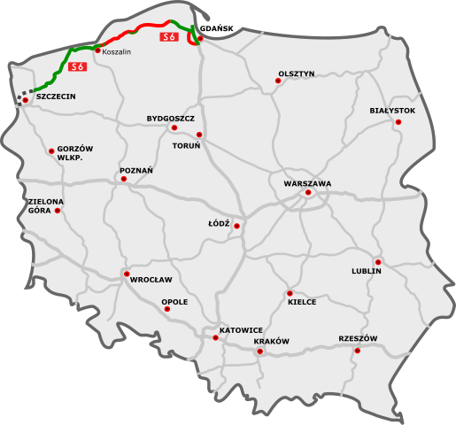
S6 Expressway on the map of Poland
| Description | |
| Date | |
| Source |
|
| Author |
|
| This is a retouched picture, which means that it has been digitally altered from its original version. Modifications: S6 Expressway. The original can be viewed here: DocelowyUkladDrog.svg:
|
I, the copyright holder of this work, hereby publish it under the following license:
This file is licensed under the Creative Commons Attribution 3.0 Unported license.
- You are free:
- to share – to copy, distribute and transmit the work
- to remix – to adapt the work
- Under the following conditions:
- attribution – You must give appropriate credit, provide a link to the license, and indicate if changes were made. You may do so in any reasonable manner, but not in any way that suggests the licensor endorses you or your use.
Original upload log[edit]
This image is a derivative work of the following images:
- File:DocelowyUkladDrog.svg licensed with Cc-by-3.0
- 2009-11-05T17:29:06Z Sliwers 785x724 (157031 Bytes) Minor tweaks to the S19
- 2009-10-26T18:20:44Z Sliwers 785x724 (156964 Bytes) Next attempt
- 2009-10-26T17:50:36Z Sliwers 784x723 (156985 Bytes) Updated according to the newest version of the plan
- 2009-09-22T16:31:17Z Sliwers 784x723 (153828 Bytes) Zgorzelec/Jędrzychowice
- 2009-08-31T18:21:25Z Sliwers 784x723 (153823 Bytes) Colors
- 2009-08-30T16:41:32Z Sliwers 784x723 (155471 Bytes) Darker color.
- 2009-08-30T16:40:18Z Sliwers 784x723 (155471 Bytes) Cropped.
- 2009-08-30T16:36:58Z Sliwers 1073x790 (154212 Bytes) {{Information |Description={{en|1=Map of the planned free- and expressway network in Poland.}} {{pl|1=Docelowy układ autostrad i dróg ekspresowych w Polsce.}} {{de|1=Das Autobahn- und Schnellstraßennetz Polens, geplanter E
Uploaded with derivativeFX
File history
Click on a date/time to view the file as it appeared at that time.
| Date/Time | Thumbnail | Dimensions | User | Comment | |
|---|---|---|---|---|---|
| current | 21:12, 23 April 2024 | | 776 × 723 (183 KB) | Kirt93 (talk | contribs) | Update |
| 21:38, 11 February 2022 |  | 776 × 723 (182 KB) | Polska7140 (talk | contribs) | aktualizacja | |
| 11:07, 23 December 2021 |  | 776 × 723 (183 KB) | Polska7140 (talk | contribs) | aktualizacja | |
| 20:34, 26 December 2019 |  | 776 × 723 (182 KB) | Poznaniak (talk | contribs) | aktualizacja | |
| 21:06, 28 August 2016 |  | 776 × 723 (174 KB) | Daniel749 (talk | contribs) | update (incl. background) | |
| 00:50, 24 December 2015 |  | 776 × 723 (172 KB) | Daniel749 (talk | contribs) | update (incl. background) | |
| 22:59, 27 October 2015 |  | 785 × 724 (97 KB) | Daniel749 (talk | contribs) | update | |
| 11:18, 23 December 2014 |  | 785 × 724 (92 KB) | Daniel749 (talk | contribs) | update | |
| 13:53, 22 December 2013 |  | 785 × 724 (92 KB) | Daniel749 (talk | contribs) | nowe tabliczki | |
| 18:08, 23 December 2011 |  | 785 × 724 (90 KB) | Daniel749 (talk | contribs) | new section opened |
You cannot overwrite this file.
File usage on Commons
The following 16 pages use this file:
- User:Chumwa/OgreBot/Potential transport maps/2016 August 21-31
- User:Chumwa/OgreBot/Potential transport maps/2019 December 21-31
- User:Chumwa/OgreBot/Transport Maps/2015 December 21-31
- User:Chumwa/OgreBot/Transport Maps/2015 October 21-31
- User:Chumwa/OgreBot/Transport Maps/2016 August 21-31
- User:Chumwa/OgreBot/Transport Maps/2019 December 21-31
- User:Chumwa/OgreBot/Transport Maps/2021 December 21-31
- User:Chumwa/OgreBot/Transport Maps/2022 February 10-18
- User:Chumwa/OgreBot/Transport Maps/2024 April 21-30
- User:Chumwa/OgreBot/Travel and communication maps/2016 August 21-31
- User:Chumwa/OgreBot/Travel and communication maps/2019 December 21-31
- User:Chumwa/OgreBot/Travel and communication maps/2021 December 21-31
- User:Chumwa/OgreBot/Travel and communication maps/2022 February 10-18
- User:Chumwa/OgreBot/Travel and communication maps/2024 April 21-30
- User:Sliwers
- Category:Expressway S6 (Poland)
File usage on other wikis
The following other wikis use this file:
- Usage on cs.wikipedia.org
- Usage on de.wikipedia.org
- Usage on en.wikipedia.org
- Usage on fr.wikipedia.org
- Usage on hu.wikipedia.org
- Usage on it.wikipedia.org
- Usage on ja.wikipedia.org
- Usage on lmo.wikipedia.org
- Usage on nl.wikipedia.org
- Usage on pl.wikipedia.org
- Usage on uk.wikipedia.org
- Usage on vi.wikipedia.org
- Usage on www.wikidata.org