File:ON 418 map.svg
Jump to navigation
Jump to search

Size of this PNG preview of this SVG file: 512 × 391 pixels. Other resolutions: 314 × 240 pixels | 629 × 480 pixels | 1,006 × 768 pixels | 1,280 × 978 pixels | 2,560 × 1,955 pixels.
Original file (SVG file, nominally 512 × 391 pixels, file size: 213 KB)
Captions
Captions
Add a one-line explanation of what this file represents
Summary[edit]
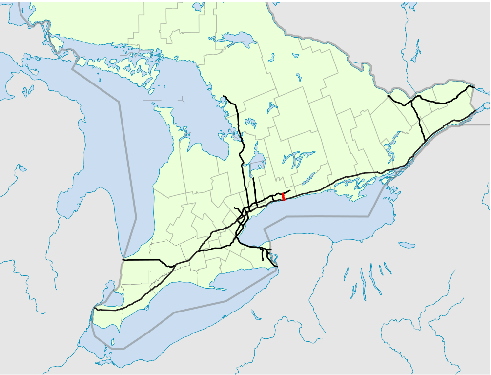
| Description | A map of Ontario's 400-series freeways, with King's Highway 418 in red. |
| Date | 18:56, 23 February 2021 (UTC) |
| Source |
|
| Author | Floydian (talk) |
Licensing[edit]
This file is licensed under the Creative Commons Attribution-Share Alike 4.0 International license.
- You are free:
- to share – to copy, distribute and transmit the work
- to remix – to adapt the work
- Under the following conditions:
- attribution – You must give appropriate credit, provide a link to the license, and indicate if changes were made. You may do so in any reasonable manner, but not in any way that suggests the licensor endorses you or your use.
- share alike – If you remix, transform, or build upon the material, you must distribute your contributions under the same or compatible license as the original.
File history
Click on a date/time to view the file as it appeared at that time.
| Date/Time | Thumbnail | Dimensions | User | Comment | |
|---|---|---|---|---|---|
| current | 18:56, 23 February 2021 | | 512 × 391 (213 KB) | Floydian (talk | contribs) | == {{int:filedesc}} == {{Information |Description=A map of Ontario's 400-series freeways, with King's Highway 418 in red. |Source= *Modified from File:Canada_Ontario_location_map.svg **United States National Imagery and Mapping Agency data **World Data Base II data **[http://www.statcan.gc.ca Statistics Canada/Statistique Canada] *Highways traced using Google Earth imagery |Date=~~~~~ |Author=Floydian (<span class="signature-talk">talk</span>) |Pe... |
You cannot overwrite this file.
File usage on Commons
There are no pages that use this file.
File usage on other wikis
The following other wikis use this file:
- Usage on fr.wikipedia.org