File:OSM Dallgow-Döberitz DöberitzerHeide.jpg
Jump to navigation
Jump to search

Size of this preview: 800 × 320 pixels. Other resolutions: 320 × 128 pixels | 640 × 256 pixels | 1,024 × 410 pixels | 1,280 × 512 pixels | 2,700 × 1,080 pixels.
Original file (2,700 × 1,080 pixels, file size: 1.14 MB, MIME type: image/jpeg)
Captions
Captions
Add a one-line explanation of what this file represents
Summary[edit]
| Description |
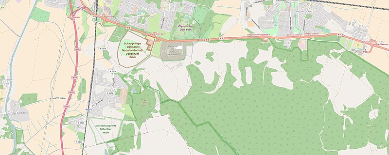
Deutsch: OpenStreetMap Kartenausschnitt Dallgow-Döberitz und Döberitzer Heide. Das Gelände Schaugehege - Sielmanns Naturlandschaft Döberitzer Heide wurde zwischen 1910 und 1960 als Flugplatz Döberitz genutzt.  |
| Date | |
| Source | http://www.openstreetmap.org/ |
| Author | OpenStreetMap und Mitwirkende |
| Permission (Reusing this file) |
© OpenStreetMap und Mitwirkende, CC BY-SA 3.0 |
Licensing[edit]
This file is licensed under the Creative Commons Attribution-Share Alike 3.0 Unported license.
- You are free:
- to share – to copy, distribute and transmit the work
- to remix – to adapt the work
- Under the following conditions:
- attribution – You must give appropriate credit, provide a link to the license, and indicate if changes were made. You may do so in any reasonable manner, but not in any way that suggests the licensor endorses you or your use.
- share alike – If you remix, transform, or build upon the material, you must distribute your contributions under the same or compatible license as the original.
File history
Click on a date/time to view the file as it appeared at that time.
| Date/Time | Thumbnail | Dimensions | User | Comment | |
|---|---|---|---|---|---|
| current | 10:32, 24 February 2017 | 2,700 × 1,080 (1.14 MB) | Michael32710 (talk | contribs) | == {{int:filedesc}} == {{Information |Description ={{de|1=OpenStreetMap Kartenausschnitt Dallgow-Döberitz und Döberitzer Heide. Das Gelände ''Schaugehege - Sielmanns Naturlandschaft Döberitzer Heide'' wurde zwischen 191... |
You cannot overwrite this file.
File usage on Commons
The following 2 pages use this file:
File usage on other wikis
The following other wikis use this file:
- Usage on de.wikipedia.org