File:Oberaarglacier Oberaarhorn.jpg
Jump to navigation
Jump to search
Size of this preview: 800 × 600 pixels. Other resolutions: 320 × 240 pixels | 640 × 480 pixels | 1,024 × 768 pixels | 1,280 × 960 pixels.
Original file (1,280 × 960 pixels, file size: 374 KB, MIME type: image/jpeg)
Captions
Captions
Add a one-line explanation of what this file represents
Summary[edit]
| Description |
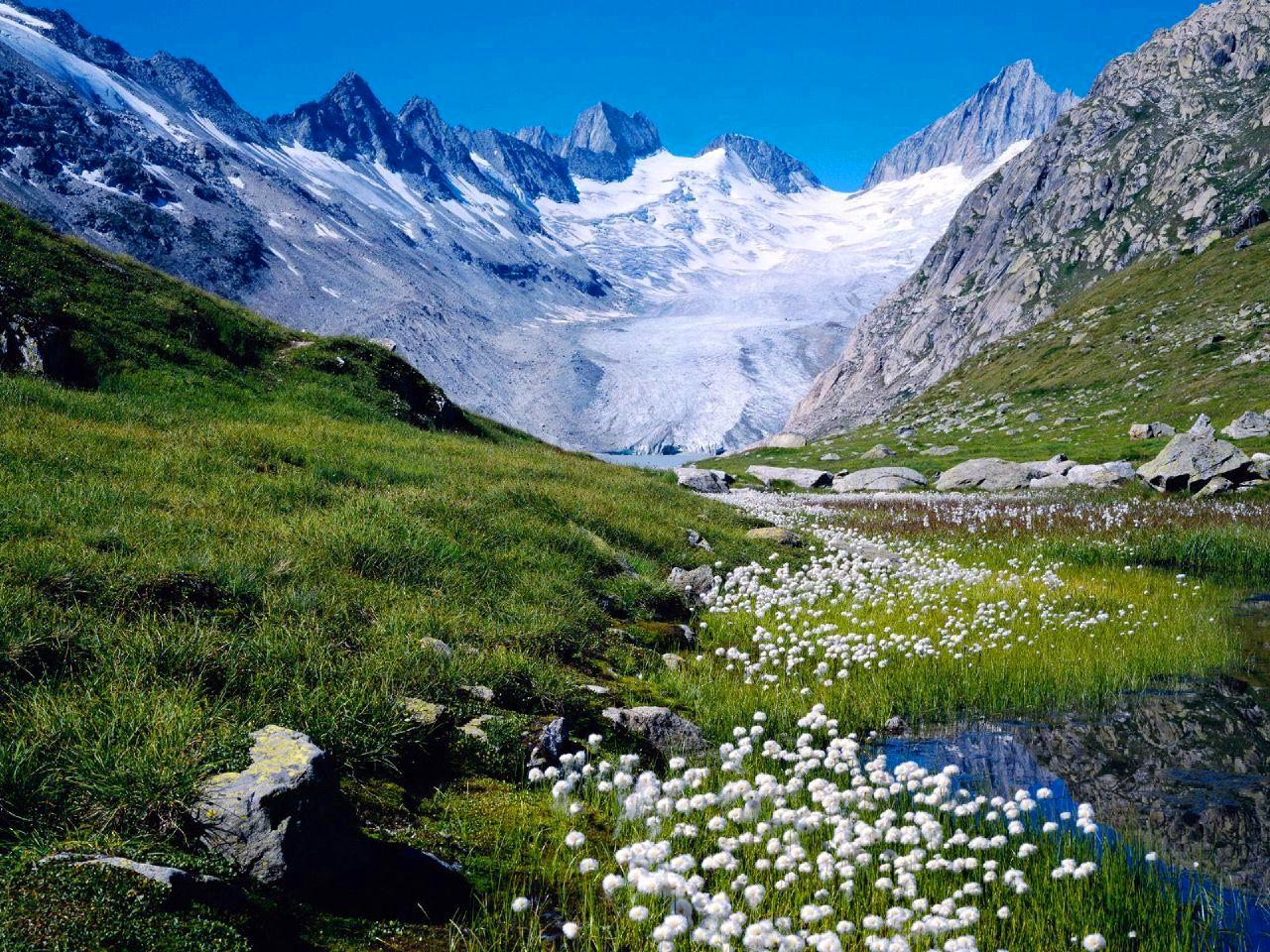
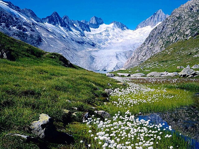
English: Oberaarhornglacier. Left Roossehörner and Roosseejoch 3132m, Oberaarrothorn 3477m, Nollen (Oberaarnollen) 3402m,Oberaarjoch and Oberaarhorn. (NOT Unteraarhornglacier)
Deutsch: Oberaarhorngletscher. Links Roossehörner and Roosseejoch 3132m, Oberaarrothorn 3477m, Nollen 3402m. Rechts Oberaarjoch und Oberaarhorn
|
| Date | |
| Source | Own work |
| Author | ZachT |
| Permission (Reusing this file) |
PD |
| Object location | | View this and other nearby images on: OpenStreetMap |
|---|
Licensing[edit]
| I, the copyright holder of this work, release this work into the public domain. This applies worldwide. In some countries this may not be legally possible; if so: I grant anyone the right to use this work for any purpose, without any conditions, unless such conditions are required by law. |
| Annotations | This image is annotated: View the annotations at Commons |
File history
Click on a date/time to view the file as it appeared at that time.
| Date/Time | Thumbnail | Dimensions | User | Comment | |
|---|---|---|---|---|---|
| current | 10:45, 16 May 2008 | | 1,280 × 960 (374 KB) | ZachT (talk | contribs) | {{Information |Description= Unteraar Glacier, Bernese Alps |Source=self-made |Date= 23.08.07 |Author= ZachT |Permission= |other_versions= }} Category:Alps |
You cannot overwrite this file.
File usage on Commons
The following 5 pages use this file:
File usage on other wikis
The following other wikis use this file:
- Usage on arz.wikipedia.org
- Usage on ceb.wikipedia.org
- Usage on de.wikipedia.org
- Usage on fr.wikipedia.org
- Usage on it.wikipedia.org
- Usage on lld.wikipedia.org
- Usage on pt.wikipedia.org
- Usage on sv.wikipedia.org
- Usage on uk.wikipedia.org
- Usage on www.wikidata.org