File:Ontario-map-greek.jpeg
Jump to navigation
Jump to search

Size of this preview: 612 × 600 pixels. Other resolutions: 245 × 240 pixels | 490 × 480 pixels | 784 × 768 pixels | 1,246 × 1,221 pixels.
Original file (1,246 × 1,221 pixels, file size: 180 KB, MIME type: image/jpeg)
Captions
Captions
Add a one-line explanation of what this file represents
| Description |
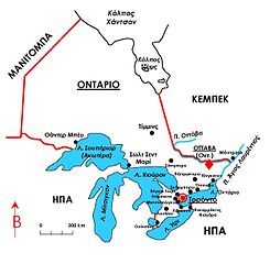
English: Map of Ontario, Canada, in Greek Ελληνικά: Συνοπτικός χάρτης της επαρχίας του Οντάριο (Καναδάς) |
| Date | |
| Source | Own work; transferred from el.wikipedia; transferred to Commons by User:MARKELLOS using CommonsHelper |
| Author | Flashdart2 |
| Permission (Reusing this file) |
CC-BY-SA-3.0; Released under the GNU Free Documentation License |
Licensing
[edit]
Flashdart2 at Greek Wikipedia, the copyright holder of this work, hereby publishes it under the following licenses:

|
Permission is granted to copy, distribute and/or modify this document under the terms of the GNU Free Documentation License, Version 1.2 or any later version published by the Free Software Foundation; with no Invariant Sections, no Front-Cover Texts, and no Back-Cover Texts. A copy of the license is included in the section entitled GNU Free Documentation License. |
This file is licensed under the Creative Commons Attribution-Share Alike 3.0 Unported license.
Attribution: Flashdart2 at Greek Wikipedia
- You are free:
- to share – to copy, distribute and transmit the work
- to remix – to adapt the work
- Under the following conditions:
- attribution – You must give appropriate credit, provide a link to the license, and indicate if changes were made. You may do so in any reasonable manner, but not in any way that suggests the licensor endorses you or your use.
- share alike – If you remix, transform, or build upon the material, you must distribute your contributions under the same or compatible license as the original.
You may select the license of your choice.
Original upload log
[edit]
The original description page was here. All following user names refer to el.wikipedia.
- 2007-03-10 02:59 Flashdart2 1246×1221× (184539 bytes) Συνοπτικός χάρτης του [[Οντάριο]] (επαρχία του [[Καναδάς|Καναδά]]). Δημιουργός: [[Χρήστης:Flashdart2|Flashdart2]].
- 2006-07-15 16:05 Flashdart2 1583×1483× (227741 bytes) Συνοπτικός χάρτης της επαρχίας του [[Οντάριο]] ([[Καναδάς]]).
File history
Click on a date/time to view the file as it appeared at that time.
| Date/Time | Thumbnail | Dimensions | User | Comment | |
|---|---|---|---|---|---|
| current | 21:16, 18 February 2010 | | 1,246 × 1,221 (180 KB) | File Upload Bot (Magnus Manske) (talk | contribs) | {{BotMoveToCommons|el.wikipedia|year={{subst:CURRENTYEAR}}|month={{subst:CURRENTMONTHNAME}}|day={{subst:CURRENTDAY}}}} {{Information |Description={{el|Συνοπτικός χάρτης της επαρχίας του Οντάριο (Καναδάς)<br/> = |
You cannot overwrite this file.
File usage on Commons
There are no pages that use this file.
File usage on other wikis
The following other wikis use this file:
- Usage on el.wikipedia.org