File:Outline Map of Kaduysky District (Vologda Oblast, 2015).svg
Jump to navigation
Jump to search

Size of this PNG preview of this SVG file: 114 × 114 pixels. Other resolutions: 240 × 240 pixels | 480 × 480 pixels | 768 × 768 pixels | 1,024 × 1,024 pixels | 2,048 × 2,048 pixels.
Original file (SVG file, nominally 114 × 114 pixels, file size: 24 KB)
Captions
Captions
Add a one-line explanation of what this file represents
Summary[edit]
| Description |
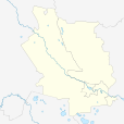
Русский: Позиционная карта Кадуйского района Вологодской области, 2015 год Равноугольная проекция, растяжение — 200 %. Координаты краёв:
|
| Date | |
| Source |
|
| Author | Виктор В |
| Other versions |
Derivative works of this file: Kaduyskiy district Names.svg
[]
|
.svg)
.svg)
.svg)
.svg&action=edit§ion=1)
Licensing[edit]
.svg&action=edit§ion=2)
| This work has been released into the public domain by its author, Виктор В. This applies worldwide. In some countries this may not be legally possible; if so: |
File history
Click on a date/time to view the file as it appeared at that time.
| Date/Time | Thumbnail | Dimensions | User | Comment | |
|---|---|---|---|---|---|
| current | 11:13, 30 April 2015 | | 114 × 114 (24 KB) | Daryona (talk | contribs) | {{Information |Description={{ru|1=Позиционная карта Кадуйского района Вологодской области, 2015 год<br>Равноугольная проекция, растяжение — 200 %. Координат... |
You cannot overwrite this file.
File usage on Commons
The following 4 pages use this file:
File usage on other wikis
The following other wikis use this file:
- Usage on ru.wikipedia.org
- Кадуй (рабочий посёлок)
- Дедовец (Кадуйский район)
- Хохлово (Кадуйский район)
- Пусторадицы
- Кадуй (деревня, Кадуйский район)
- Жорновец
- Черново (Вологодская область)
- Пугино (Вологодская область)
- Маза (Вологодская область)
- Шаблон:ПозКарта Россия Вологодская область Кадуйский район
- Вахонькино
- Аксентьевская (Кадуйский район)
- Алеканово (Вологодская область)
- Барановская (Кадуйский район)
- Бережок (Кадуйский район)
- Великий Двор (Кадуйский район)
- Горка (бывшее Барановское сельское поселение)
- Дильские
- Еремеево (Кадуйский район)
- Заручевье (Кадуйский район)
- Кананьевская
- Коротневая
- Крестовая (Вологодская область)
- Крюково (сельское поселение Семизерье)
- Ларионовская (Вологодская область)
- Осека (Вологодская область)
- Подосинник
- Порог (Кадуйский район)
- Преображенская (Вологодская область)
- Рыканец
- Савельевская (Вологодская область)
- Сельцо-Родное
- Семеновская (сельское поселение Семизерье)
- Сосновка (Кадуйский район)
- Старостино (Вологодская область)
- Тарасовская (сельское поселение Семизерье)
- Тимохино (Кадуйский район)
- Торки (Вологодская область)
- Турпал
- Успенское (Вологодская область)
- Хламово (Кадуйский район)
- Шигодские
- Якшинская (сельское поселение Семизерье)
- Бор (Кадуйский район)
- Верхний Двор
- Заэрап
- Заяцкое (Вологодская область)
- Капчино
- Кузьминка (Кадуйский район)
- Куракино (Кадуйский район)
View more global usage of this file.
.svg)
.svg&oldid=752044728)