File:Oxia Palus erosion.JPG
Jump to navigation
Jump to search
No higher resolution available.
Oxia_Palus_erosion.JPG (640 × 472 pixels, file size: 43 KB, MIME type: image/jpeg)
Captions
Captions
Add a one-line explanation of what this file represents
Summary[edit]
| Description |
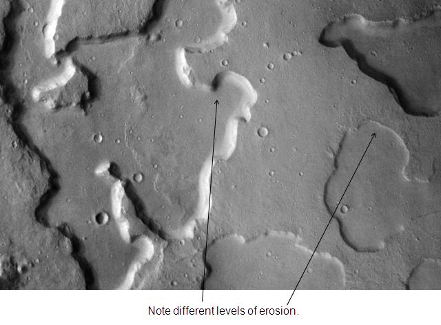
English: Oxia Palus erosion. Location is 2.4 degrees north latitude and 16.4 degrees west longitude. |
| Date | |
| Source | http://themis.la.asu.edu/zoom-20031202a.html |
| Author | Jim Secosky modified NASA image. |
Licensing[edit]
| This file is in the public domain in the United States because it was solely created by NASA. NASA copyright policy states that "NASA material is not protected by copyright unless noted". (See Template:PD-USGov, NASA copyright policy page or JPL Image Use Policy.) | ||
 |
Warnings:
|
Original upload log[edit]
Transferred from en.wikipedia to Commons by Magnus Manske using CommonsHelper.
The original description page was here. All following user names refer to en.wikipedia.
- 2009-01-16 19:54 Jimmarsmars 640×472× (43677 bytes) {{Information |Description=Oxia Palus erosion. Location is 2.4 degrees north latitude and 16.4 degrees west longitude. |Source=http://themis.la.asu.edu/zoom-20031202a.html |Date=January 16, 2009 |Author=Jim Secosky modified NASA image. |Permission= |othe
File history
Click on a date/time to view the file as it appeared at that time.
| Date/Time | Thumbnail | Dimensions | User | Comment | |
|---|---|---|---|---|---|
| current | 08:59, 20 February 2011 | | 640 × 472 (43 KB) | File Upload Bot (Magnus Manske) (talk | contribs) | {{BotMoveToCommons|en.wikipedia|year={{subst:CURRENTYEAR}}|month={{subst:CURRENTMONTHNAME}}|day={{subst:CURRENTDAY}}}} {{Information |Description={{en|Oxia Palus erosion. Location is 2.4 degrees north latitude and 16.4 degrees west longitude.}} |Source= |
You cannot overwrite this file.
File usage on Commons
There are no pages that use this file.
File usage on other wikis
The following other wikis use this file:
- Usage on en.wikipedia.org
- Usage on zh.wikipedia.org