File:PAT - Greater Antilles.gif
Jump to navigation
Jump to search
Size of this preview: 800 × 509 pixels. Other resolutions: 320 × 204 pixels | 640 × 407 pixels | 1,024 × 652 pixels | 1,280 × 815 pixels | 2,200 × 1,400 pixels.
Original file (2,200 × 1,400 pixels, file size: 210 KB, MIME type: image/gif)
Captions
Captions
Add a one-line explanation of what this file represents
Summary[edit]
| Description |
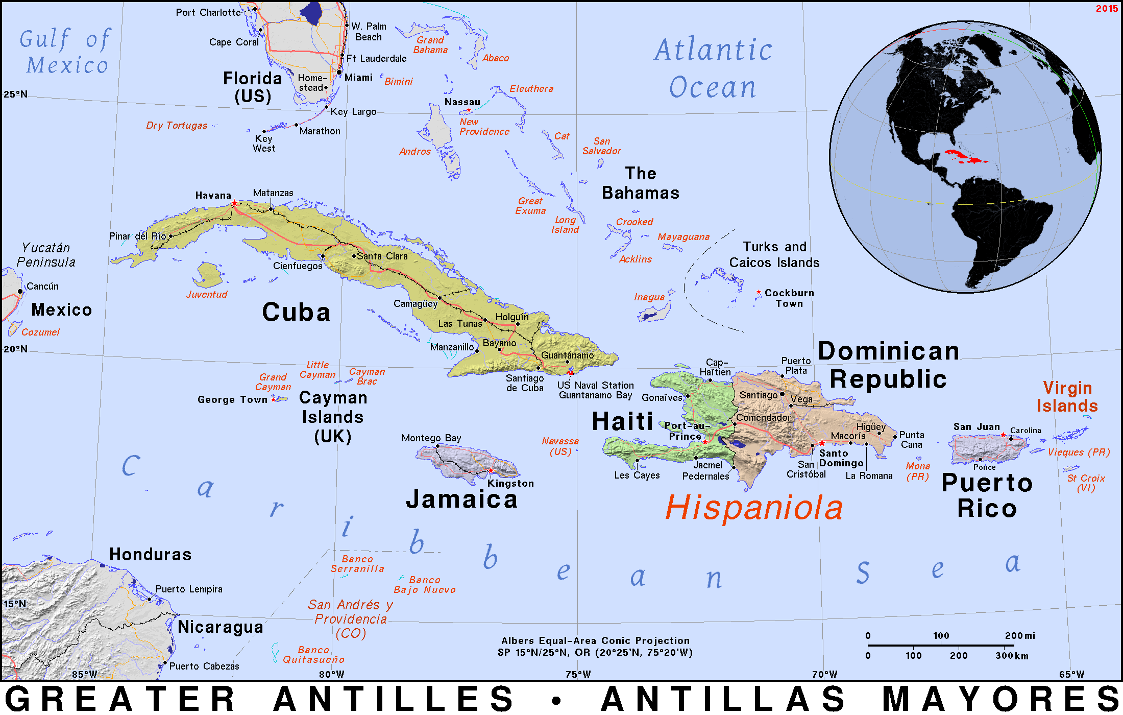
English: Map of Greater Antilles |
| Date | |
| Source | https://ian.macky.net/pat/map/gant/gantblu.gif |
| Author | Ian Macky, PAT Atlas |
Licensing[edit]
| This work has been released into the public domain by its author, Ian Macky. This applies worldwide. In some countries this may not be legally possible; if so: Ian Macky grants anyone the right to use this work for any purpose, without any conditions, unless such conditions are required by law.
|
File history
Click on a date/time to view the file as it appeared at that time.
| Date/Time | Thumbnail | Dimensions | User | Comment | |
|---|---|---|---|---|---|
| current | 18:28, 27 October 2022 | | 2,200 × 1,400 (210 KB) | Babelia (talk | contribs) | full size |
| 19:04, 1 August 2022 |  | 1,100 × 700 (148 KB) | Babelia (talk | contribs) | Uploaded a work by Ian Macky, PAT Atlas from PAT Atlas with UploadWizard |
You cannot overwrite this file.
File usage on Commons
There are no pages that use this file.