File:PB&W map.svg
Jump to navigation
Jump to search

Size of this PNG preview of this SVG file: 800 × 475 pixels. Other resolutions: 320 × 190 pixels | 640 × 380 pixels | 1,024 × 608 pixels | 1,280 × 760 pixels | 2,560 × 1,520 pixels | 1,152 × 684 pixels.
Original file (SVG file, nominally 1,152 × 684 pixels, file size: 1.71 MB)
Captions
Captions
Add a one-line explanation of what this file represents
Summary[edit]
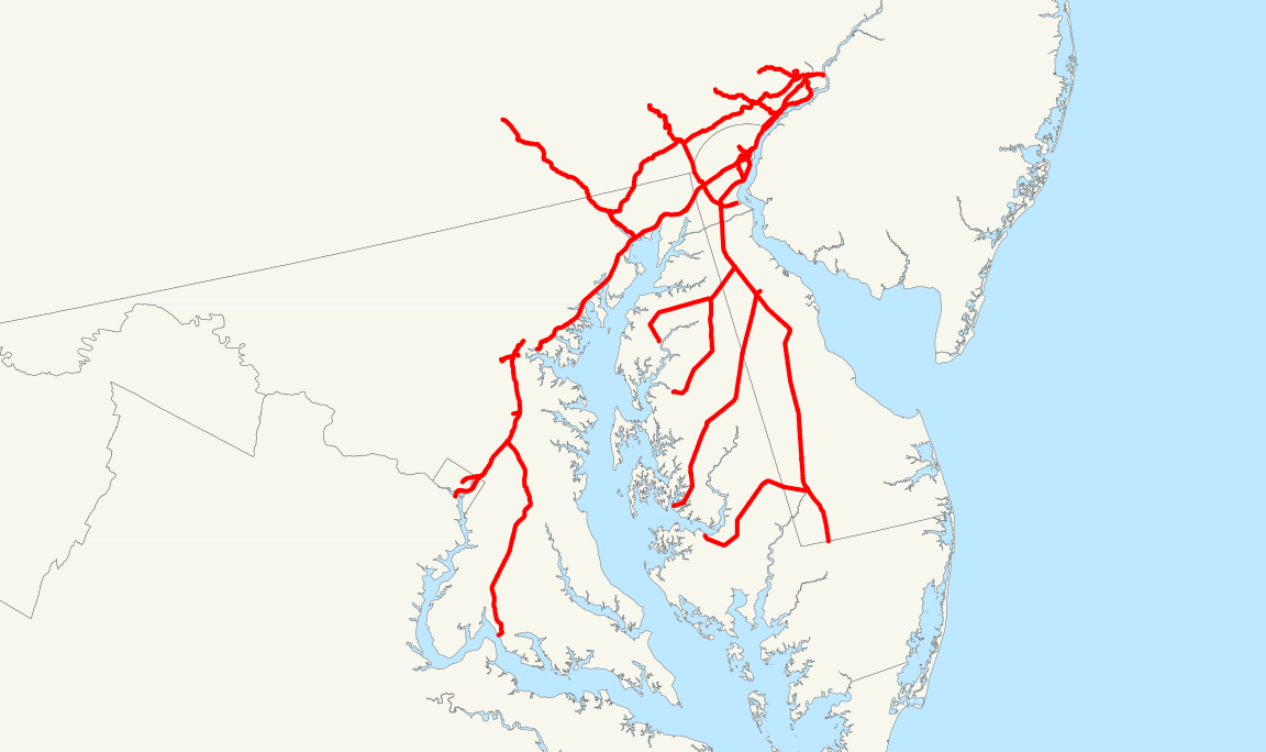
This is a map of the rail network operated by the Philadelphia, Baltimore and Washington Railroad just prior to its 1918 lease by the Pennsylvania Railroad. Trackage rights, like over the Union Railroad of Baltimore, are not shown.
The following GIS data was used:
- NORTAD archive copy at the Wayback Machine for boundaries
- 2006 National Transportation Atlas Database archive copy at the Wayback Machine for U.S. rail lines
A standard North American Lambert conformal conic projection was used.
The PRR Corporate History Archived 2012-12-08 at Archive.today was used for information on where the PB&W operated.
Licensing[edit]
| I, the copyright holder of this work, release this work into the public domain. This applies worldwide. In some countries this may not be legally possible; if so: I grant anyone the right to use this work for any purpose, without any conditions, unless such conditions are required by law. |
File history
Click on a date/time to view the file as it appeared at that time.
| Date/Time | Thumbnail | Dimensions | User | Comment | |
|---|---|---|---|---|---|
| current | 16:57, 1 December 2006 | | 1,152 × 684 (1.71 MB) | NE2 (talk | contribs) | This is a map of the rail network operated by the Philadelphia, Baltimore and Washington Railroad just prior to its 1918 lease by the Pennsylvania Railroad. Trackage rights, like over the Union Railroad of Baltimore, are not shown. The following GIS data |
You cannot overwrite this file.
File usage on Commons
There are no pages that use this file.