File:Palais des Tuileries, Plan de Turgot - David Rumsey.jpg
Jump to navigation
Jump to search

Size of this preview: 800 × 567 pixels. Other resolutions: 320 × 227 pixels | 640 × 454 pixels | 1,024 × 726 pixels | 1,280 × 908 pixels | 2,560 × 1,815 pixels | 5,969 × 4,233 pixels.
Original file (5,969 × 4,233 pixels, file size: 17.48 MB, MIME type: image/jpeg)
Captions
Captions
Building on map.
Summary[edit]
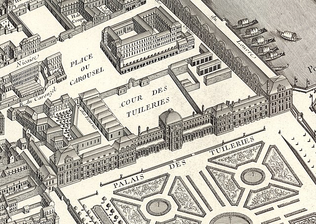
| Description | Palais des Tuileries on the Turgot map of Paris. |
| Date | 1734–1736 |
| Source | Turgot map of Paris, David Rumsey Historical Map Collection |
| Author | Louis Bretez & Claude Lucas |
Licensing[edit]
|
This work is in the public domain in its country of origin and other countries and areas where the copyright term is the author's life plus 100 years or fewer. | |
| This file has been identified as being free of known restrictions under copyright law, including all related and neighboring rights. | |
File history
Click on a date/time to view the file as it appeared at that time.
| Date/Time | Thumbnail | Dimensions | User | Comment | |
|---|---|---|---|---|---|
| current | 13:41, 1 January 2020 | | 5,969 × 4,233 (17.48 MB) | Paris 16 (talk | contribs) | User created page with UploadWizard |
You cannot overwrite this file.
File usage on Commons
The following 2 pages use this file: