File:Pangong-middle-US-Army-map-1954.jpg
Jump to navigation
Jump to search

Size of this preview: 800 × 406 pixels. Other resolutions: 320 × 162 pixels | 640 × 324 pixels | 1,024 × 519 pixels | 1,280 × 649 pixels | 2,795 × 1,417 pixels.
Original file (2,795 × 1,417 pixels, file size: 2.07 MB, MIME type: image/jpeg)
Captions
Captions
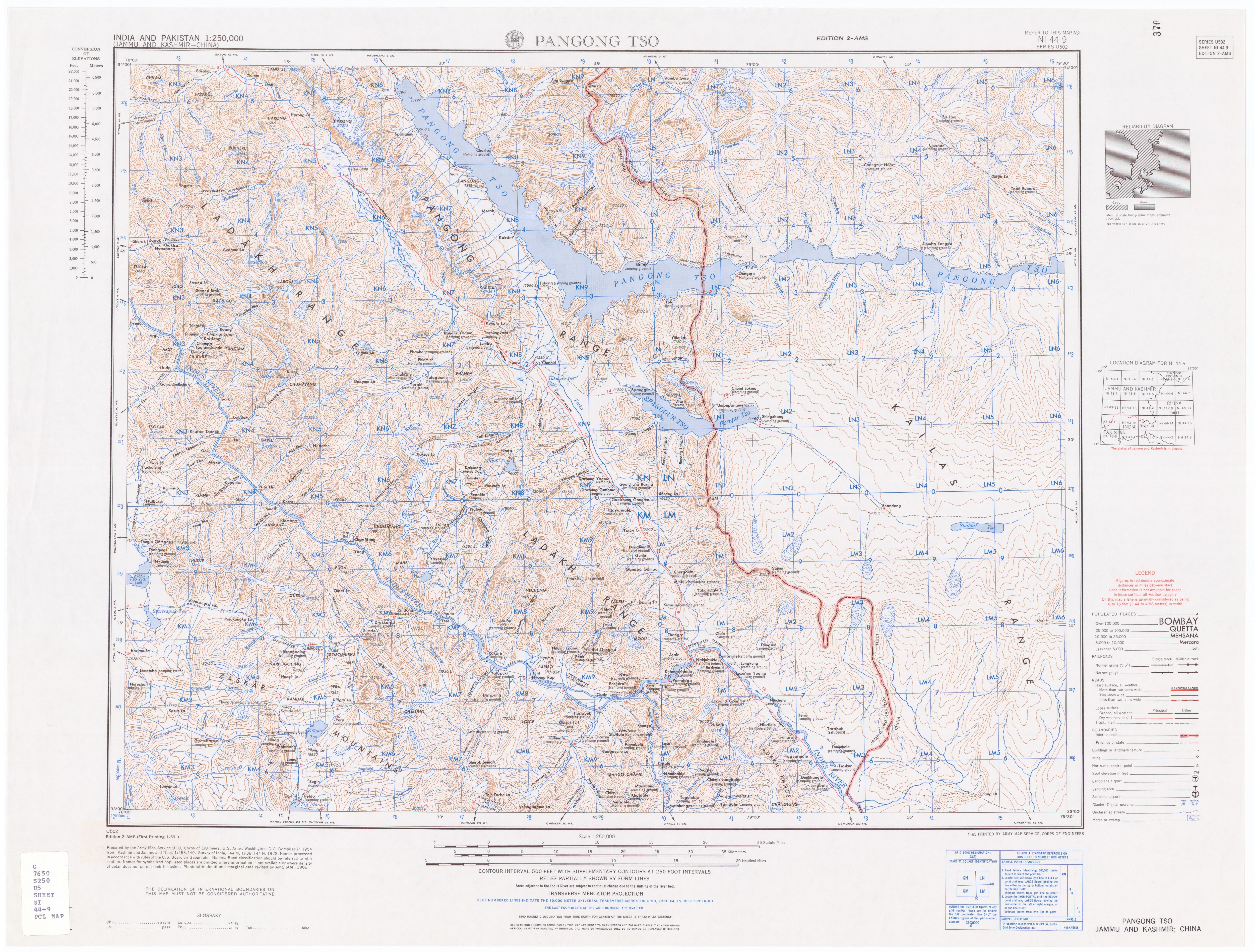
Pangong Lake region (AMS, 1954)
Summary[edit]
| Description |
English: This cropping of the US Army Map Service map NG 44-1 shows both the western and eastern halves of the lake with the Khurnak Plain in the middle. |
| Date | |
| Source | http://www.lib.utexas.edu/maps/ams/india/ni-44-09.jpg |
| Author | US Army Map Service |
| Other versions |

Licensing[edit]
This work is in the public domain in the United States because it is a work prepared by an officer or employee of the United States Government as part of that person’s official duties under the terms of Title 17, Chapter 1, Section 105 of the US Code.
Note: This only applies to original works of the Federal Government and not to the work of any individual U.S. state, territory, commonwealth, county, municipality, or any other subdivision. This template also does not apply to postage stamp designs published by the United States Postal Service since 1978. (See § 313.6(C)(1) of Compendium of U.S. Copyright Office Practices). It also does not apply to certain US coins; see The US Mint Terms of Use.
|
 | |
| This file has been identified as being free of known restrictions under copyright law, including all related and neighboring rights. | ||
File history
Click on a date/time to view the file as it appeared at that time.
| Date/Time | Thumbnail | Dimensions | User | Comment | |
|---|---|---|---|---|---|
| current | 12:51, 22 December 2020 | | 2,795 × 1,417 (2.07 MB) | Kautilya3 (talk | contribs) | Adjusted cropping of the original map |
| 12:20, 22 December 2020 |  | 2,729 × 1,287 (1.85 MB) | Kautilya3 (talk | contribs) | Uploaded a work by US Army Map Service from http://www.lib.utexas.edu/maps/ams/india/ni-44-09.jpg with UploadWizard |
You cannot overwrite this file.
File usage on Commons
There are no pages that use this file.