File:Para-topo.png
Jump to navigation
Jump to search
Size of this preview: 463 × 599 pixels. Other resolutions: 185 × 240 pixels | 371 × 480 pixels | 1,020 × 1,320 pixels.
Original file (1,020 × 1,320 pixels, file size: 386 KB, MIME type: image/png)
Captions
Captions
Add a one-line explanation of what this file represents
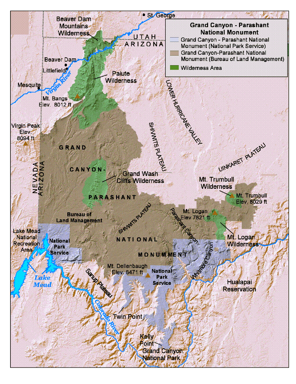
| Description | Map of Grand Canyon-Parashant National Monument — northwestern Arizona. | |||
| Source | http://www.nps.gov/archive/para/locate.html | |||
| Author | NPS Map | |||
| Permission (Reusing this file) |
|
File history
Click on a date/time to view the file as it appeared at that time.
| Date/Time | Thumbnail | Dimensions | User | Comment | |
|---|---|---|---|---|---|
| current | 12:12, 25 February 2007 | | 1,020 × 1,320 (386 KB) | H-stt (talk | contribs) | {{Information |Description= map of Grand Canyon-Parashant National Monument, Arizona |Source= http://www.nps.gov/archive/para/locate.html |Date= |Author= NPS Map |Permission= {{PD-USGov-NPS}} |other_versions= }} [[Category:Grand Canyon-Parashant National |
You cannot overwrite this file.
File usage on Commons
The following page uses this file:
File usage on other wikis
The following other wikis use this file:
- Usage on de.wikipedia.org
- Usage on nl.wikipedia.org
- Usage on www.wikidata.org
Categories:
- Grand Canyon-Parashant National Monument
- Shivwits Plateau
- Uinkaret Plateau
- Lower Granite Gorge
- Beaver Dam Mountains Wilderness
- Paiute Wilderness
- Grand Wash Cliffs Wilderness
- Mount Logan Wilderness
- Mount Logan (Arizona)
- Mount Trumbull Wilderness
- Mount Trumbull
- Virgin Peak
- Virgin Mountains
- Virgin Mountains (northeast section)
- Maps of Lake Mead National Recreation Area
- Maps of national monuments of the United States
- Maps of protected areas in Arizona