File:Peene Flusssystem Relief.png
Jump to navigation
Jump to search
Size of this preview: 659 × 600 pixels. Other resolutions: 264 × 240 pixels | 528 × 480 pixels | 844 × 768 pixels | 1,126 × 1,024 pixels | 2,251 × 2,048 pixels | 4,569 × 4,157 pixels.
Original file (4,569 × 4,157 pixels, file size: 18.6 MB, MIME type: image/png)
Captions
Captions
Add a one-line explanation of what this file represents
- This map in 25% projection – Cette carte en projection de 25% – Diese Karte in 25%-Projektion – 1143 x 1037 px
- This map in 33% projection – Cette carte en projection de 33% – Diese Karte in 33%-Projektion – 1523 x 1386 px
Summary[edit]
| Description |
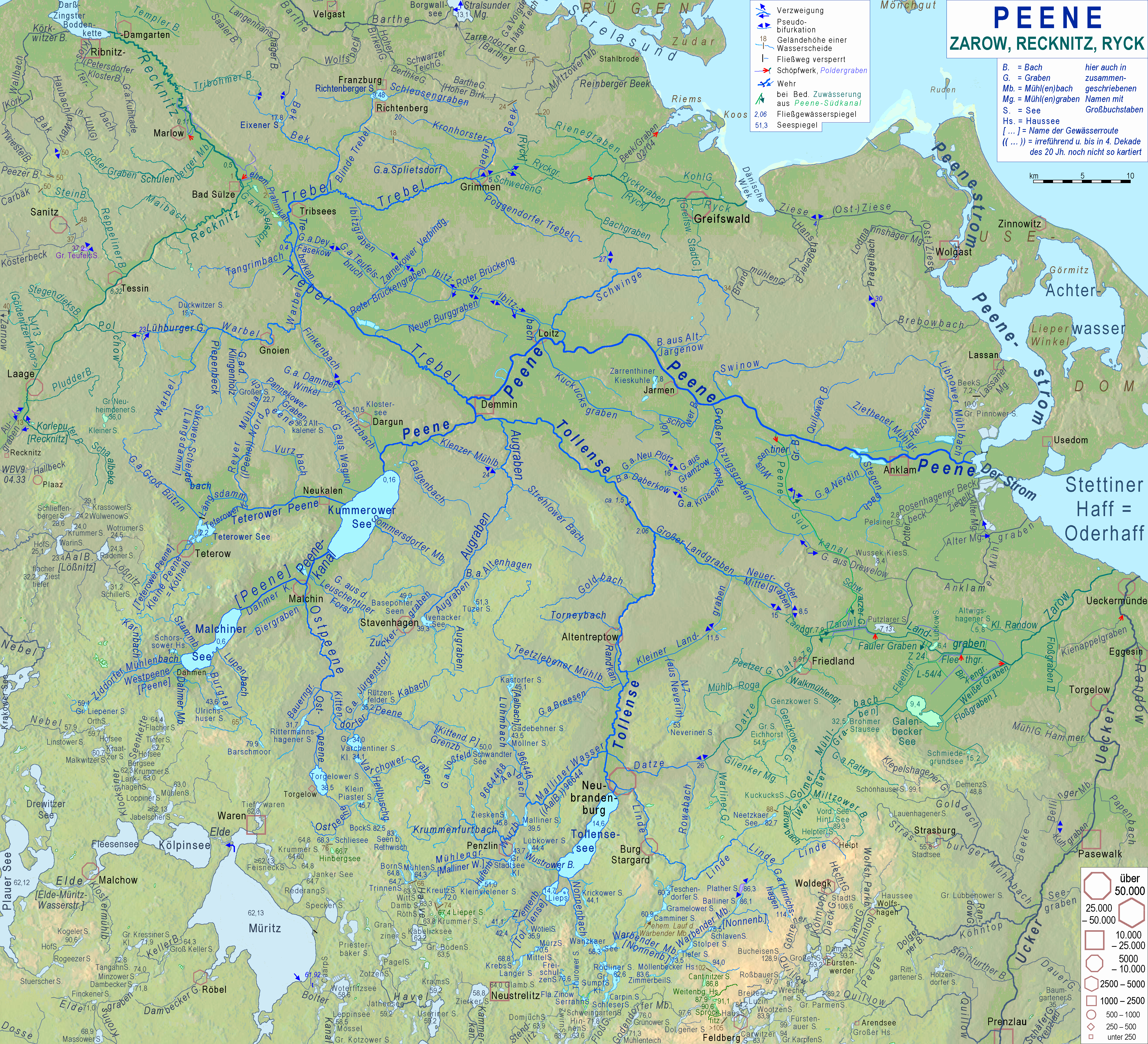
Deutsch: Karte der Flusssysteme von Peene, Zarow, Recknitz und Ryck; ohne Reliefhintergrund. Namen, die von den in den DTK zu findenden abweichen, sind von Gewässerfachleuten der Wasser- und Bodenverbände erfragt. Einige findet man auch in Wasserkörpersteckbriefen. Die meisten erforderlichen Daten und Gewässerdefinitionen entstammen dem Umweltportal des LUNG English: Map of the basins of the rivers Peene, Zarow, Recknitz and Ryck; without relief background. name differring from those written in topographic maps haved been collected from water specialists of the maintaining institutions. |
|||||||||||||||
| Date | ||||||||||||||||
| Source |
& Own work,
|
|||||||||||||||
| Author | Ulamm (talk) | |||||||||||||||
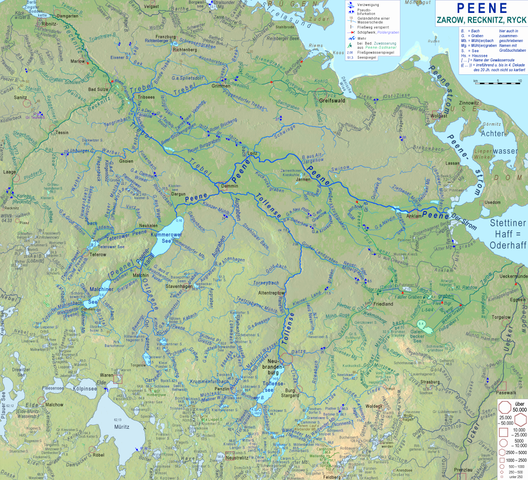
| Other versions | File:Peene Flusssystem plan.png, the same map with white background |
Licensing[edit]
I, the copyright holder of this work, hereby publish it under the following licenses:

|
Permission is granted to copy, distribute and/or modify this document under the terms of the GNU Free Documentation License, Version 1.2 or any later version published by the Free Software Foundation; with no Invariant Sections, no Front-Cover Texts, and no Back-Cover Texts. A copy of the license is included in the section entitled GNU Free Documentation License. |
This file is licensed under the Creative Commons Attribution-Share Alike 4.0 International, 3.0 Unported, 2.5 Generic, 2.0 Generic and 1.0 Generic license.
- You are free:
- to share – to copy, distribute and transmit the work
- to remix – to adapt the work
- Under the following conditions:
- attribution – You must give appropriate credit, provide a link to the license, and indicate if changes were made. You may do so in any reasonable manner, but not in any way that suggests the licensor endorses you or your use.
- share alike – If you remix, transform, or build upon the material, you must distribute your contributions under the same or compatible license as the original.
You may select the license of your choice.
File history
Click on a date/time to view the file as it appeared at that time.
| Date/Time | Thumbnail | Dimensions | User | Comment | |
|---|---|---|---|---|---|
| current | 20:50, 16 May 2019 | | 4,569 × 4,157 (18.6 MB) | Ulamm (talk | contribs) | today's revision completed |
| 12:55, 16 May 2019 |  | 4,569 × 4,157 (18.6 MB) | Ulamm (talk | contribs) | two lakes in the course of Godendorfer Mühlenbach | |
| 14:32, 10 April 2019 |  | 4,569 × 4,157 (18.6 MB) | Ulamm (talk | contribs) | some water levels | |
| 22:12, 5 April 2019 |  | 4,569 × 4,157 (18.6 MB) | Ulamm (talk | contribs) | names of two lakes and some cleaning | |
| 10:44, 5 April 2019 |  | 4,569 × 4,157 (18.65 MB) | Ulamm (talk | contribs) | two names and an explanation | |
| 10:51, 4 April 2019 |  | 4,569 × 4,157 (18.65 MB) | Ulamm (talk | contribs) | two more names | |
| 19:47, 2 April 2019 |  | 4,569 × 4,157 (18.64 MB) | Ulamm (talk | contribs) | improved background: better visibility of elevations of 50 to 100 m above sea level | |
| 10:04, 2 April 2019 |  | 4,570 × 4,157 (18.58 MB) | Ulamm (talk | contribs) | addition to the key | |
| 08:08, 2 April 2019 |  | 4,570 × 4,157 (18.57 MB) | Ulamm (talk | contribs) | Quillowseen | |
| 07:05, 2 April 2019 |  | 4,570 × 4,157 (18.58 MB) | Ulamm (talk | contribs) | Müritz & Elde |
You cannot overwrite this file.
File usage on Commons
The following 3 pages use this file:
File usage on other wikis
The following other wikis use this file:
- Usage on de.wikipedia.org
- Usage on en.wikipedia.org
- Usage on es.wikipedia.org
- Usage on et.wikipedia.org
- Usage on fi.wikipedia.org
- Usage on fr.wikipedia.org
- Usage on nl.wikipedia.org
- Usage on pl.wikipedia.org
- Usage on www.wikidata.org