File:Pierre M. Lapie, Carte de la Palestine ou Terre Sainte (FL35077247 3887370).jpg
Jump to navigation
Jump to search

Size of this preview: 439 × 600 pixels. Other resolutions: 175 × 240 pixels | 351 × 480 pixels | 562 × 768 pixels | 749 × 1,024 pixels | 1,498 × 2,048 pixels | 11,693 × 15,981 pixels.
Original file (11,693 × 15,981 pixels, file size: 242.79 MB, MIME type: image/jpeg)
Captions
Captions
Add a one-line explanation of what this file represents
Summary[edit]
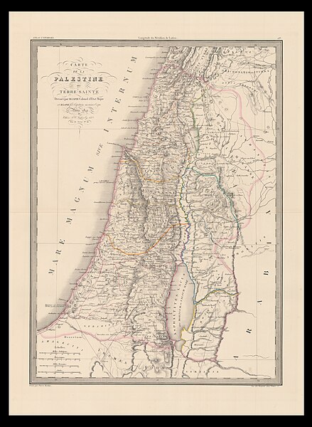
| Pierre M. Lapie: Carte de la Palestine ou Terre Sainte
( |
||||||||||||||||||||||||
|---|---|---|---|---|---|---|---|---|---|---|---|---|---|---|---|---|---|---|---|---|---|---|---|---|
| Artist |
|
|||||||||||||||||||||||
| Title |
Carte de la Palestine ou Terre Sainte |
|||||||||||||||||||||||
| Publisher |
Kaeppelin |
|||||||||||||||||||||||
| Description |
Carte de la Palestine ou Terre Sainte. Dresseé par M. Lapie. |
|||||||||||||||||||||||
| Language | French | |||||||||||||||||||||||
| Publication date | 1842 | |||||||||||||||||||||||
| Collection |
|
|||||||||||||||||||||||
| Current location |
|
|||||||||||||||||||||||
| Place of publication | Paris | |||||||||||||||||||||||
| Notes | Digital image of the original in Amir Cahanovitc Collection, Israel. ACC 424.; From: Atlas de Géographie Universelle Classique et Moderne. | |||||||||||||||||||||||
| IE PID | IE35077245 | |||||||||||||||||||||||
| Rosetta filename | FL35077247 | |||||||||||||||||||||||
| NNL item ID (P3959) | 990038873700205171 | |||||||||||||||||||||||
| search Merhav catalog | French, Pierre M. Lapie, Paris | |||||||||||||||||||||||
| search Merhav catalog | Kaeppelin | |||||||||||||||||||||||
| Source/Photographer |
|
|||||||||||||||||||||||
| Other versions | ||||||||||||||||||||||||
| Jpg / Tif version |
|
|||||||||||||||||||||||

.jpg)

.jpg&action=edit§ion=1)
Licensing[edit]
.jpg&action=edit§ion=2)
The copyright situation of this work is theoretically uncertain, because in the country of origin copyright lasts 70 years after the death of the author, and the date of the author's death is unknown. However, the date of creation of the work was over 120 years ago, and it is thus a reasonable assumption that the copyright has expired (see here for the community discussion). Do not use this template if the date of death of the author is known.
| |
| This file has been identified as being free of known restrictions under copyright law, including all related and neighboring rights. | |
File history
Click on a date/time to view the file as it appeared at that time.
| Date/Time | Thumbnail | Dimensions | User | Comment | |
|---|---|---|---|---|---|
| current | 09:04, 7 August 2023 | | 11,693 × 15,981 (242.79 MB) | Geagea (talk | contribs) | c:User:Rillke/bigChunkedUpload.js: =={{int:filedesc}}== {{Artwork |artist = {{Creator|wikidata=Q16066411}} |author = |title = Carte de la Palestine ou Terre Sainte |description = Carte de la Palestine ou Terre Sainte. Dresseé par M. Lapie. |language = {{Label|1=Q150}} |date = |publication date = 1842 |medium = |dimensions = |institution = {{Institution:Eran Laor Cartographic Collection}} |department = {{Institution:National Library of Israel}} |place of publication = {{La... |
You cannot overwrite this file.
File usage on Commons
The following 2 pages use this file:
.jpg&oldid=790803434)