File:Pieter van der Aa, Terre Sainte (FL200878554 2366851).jpg
Jump to navigation
Jump to search

Size of this preview: 744 × 600 pixels. Other resolutions: 298 × 240 pixels | 595 × 480 pixels | 953 × 768 pixels | 1,270 × 1,024 pixels | 2,540 × 2,048 pixels | 6,808 × 5,489 pixels.
Original file (6,808 × 5,489 pixels, file size: 58.62 MB, MIME type: image/jpeg)
Captions
Captions
Add a one-line explanation of what this file represents
Summary[edit]
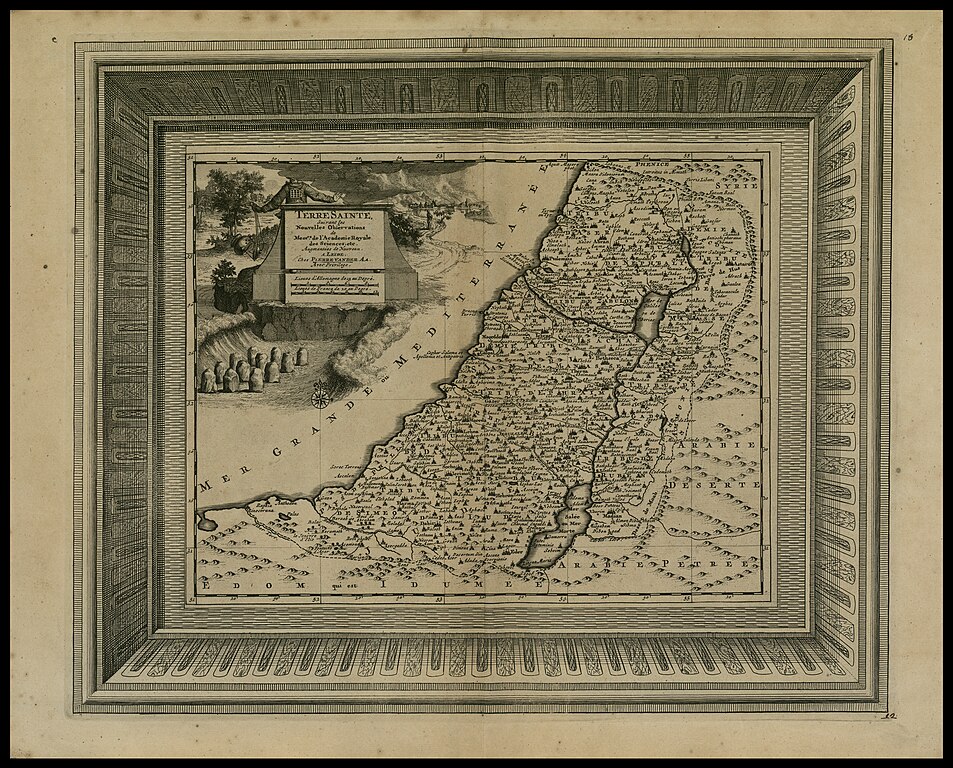
| Pieter van der Aa: Terre Sainte
( |
|||||||||||||||||||||||||||
|---|---|---|---|---|---|---|---|---|---|---|---|---|---|---|---|---|---|---|---|---|---|---|---|---|---|---|---|
| Artist |
| ||||||||||||||||||||||||||
| Contributors | Sanson, Nicolas, 1600-1667 | ||||||||||||||||||||||||||
| Title |
Terre Sainte |
||||||||||||||||||||||||||
| Publisher |
Pierre van der Aa Chez |
||||||||||||||||||||||||||
| Description |
Terre Sainte. Suivant les Nouvelles Observations.. |
||||||||||||||||||||||||||
| Language | French | ||||||||||||||||||||||||||
| Publication date | 1729 | ||||||||||||||||||||||||||
| Dimensions | height: 334 mm (13.14 in); width: 404 mm (15.90 in) | ||||||||||||||||||||||||||
| Collection |
|
||||||||||||||||||||||||||
| Current location |
|
||||||||||||||||||||||||||
| Place of publication | Leiden | ||||||||||||||||||||||||||
| search Merhav catalog | Leiden | ||||||||||||||||||||||||||
| Notes | Copperplate; The map is drawn after Sanson's Palestine.; From: Aa, Pieter van der, La galérie agréable du monde, Leyden, 1729. Tome premiere d'Arabie, Terre Sainte...Map no.12. Atl. D6 - 93 C 6446 Vol. 1.; The Holy Land divided into the 12 Tribes on both sides of the Jordan, the shore line runs from Sidon to Rinocorura (El-Arish). The Carmel Mountain is connected by a river with the Lake of Tiberias.; איורים: מצבת שתים עשרה האבנים ; הכהן הגדול. | ||||||||||||||||||||||||||
| IE PID | IE200878552 | ||||||||||||||||||||||||||
| Rosetta filename | FL200878554 | ||||||||||||||||||||||||||
| NNL item ID (P3959) | 990023668510205171 | ||||||||||||||||||||||||||
| search Merhav catalog | French, Pieter van der Aa | ||||||||||||||||||||||||||
| search Merhav catalog | Twelve tribes of IsraelMapsPierre van der Aa Chez | ||||||||||||||||||||||||||
| Source/Photographer |
|
||||||||||||||||||||||||||
| Other versions | |||||||||||||||||||||||||||
| Jpg / Tif version |
|
||||||||||||||||||||||||||


.jpg)

.jpg&action=edit§ion=1)
Licensing[edit]
.jpg&action=edit§ion=2)
The copyright situation of this work is theoretically uncertain, because in the country of origin copyright lasts 70 years after the death of the author, and the date of the author's death is unknown. However, the date of creation of the work was over 120 years ago, and it is thus a reasonable assumption that the copyright has expired (see here for the community discussion). Do not use this template if the date of death of the author is known.
| |
| This file has been identified as being free of known restrictions under copyright law, including all related and neighboring rights. | |
File history
Click on a date/time to view the file as it appeared at that time.
| Date/Time | Thumbnail | Dimensions | User | Comment | |
|---|---|---|---|---|---|
| current | 07:22, 26 July 2023 | | 6,808 × 5,489 (58.62 MB) | Geagea (talk | contribs) | pattypan 22.03 |
You cannot overwrite this file.
File usage on Commons
The following page uses this file:
.jpg&oldid=801460505)