File:Pont-à-Marcq - Ronde pévéloise, 13 juillet 2014 (A00).jpg
Jump to navigation
Jump to search
Size of this preview: 462 × 599 pixels. Other resolutions: 185 × 240 pixels | 370 × 480 pixels | 592 × 768 pixels | 789 × 1,024 pixels | 1,579 × 2,048 pixels | 3,943 × 5,115 pixels.
Original file (3,943 × 5,115 pixels, file size: 3.87 MB, MIME type: image/jpeg)
Captions
Captions
Add a one-line explanation of what this file represents
| Description |
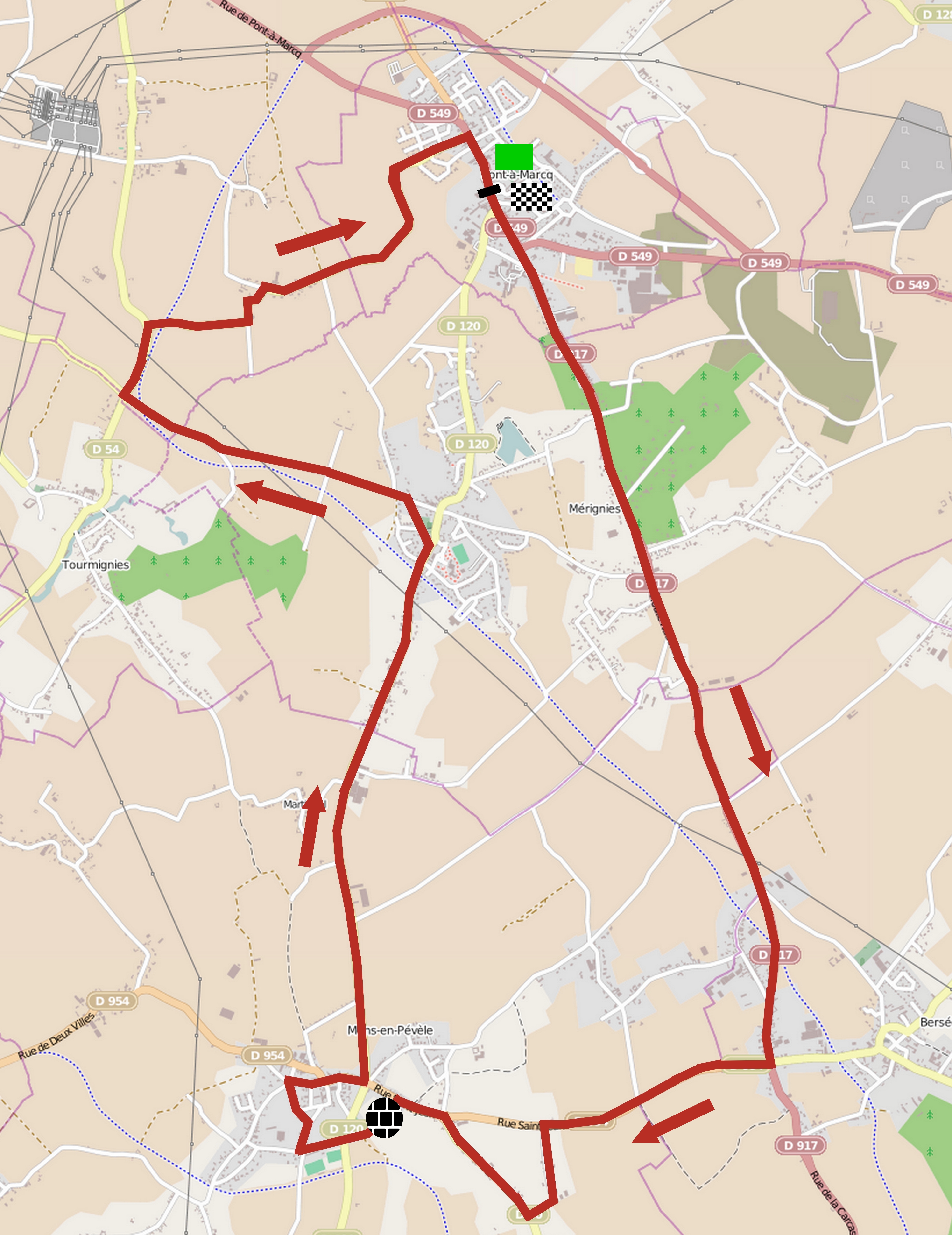
 Français : Reportage photographique réalisé le dimanche 13 juillet à l'occasion du départ et de l'arrivée de la Ronde pévéloise 2014 à Pont-à-Marcq, Nord-Pas-de-Calais, France.
Nederlands: Vertrek en aankomst, zondag 13 juli 2014, Ronde pévéloise 2014, Pont-à-Marcq, Nord-Pas-de-Calais, Frankrijk. |
|||
| Date | ||||
| Source | You may find a page on the OpenStreetMap wiki page for Ronde pévéloise 2014 | |||
| Creator |
OpenStreetMap contributors, JÄNNICK Jérémy. D'après une carte publiée par les organisateurs de la Ronde pévéloise 2014 OpenStreetMap contributors |
|||
| Permission (Reusing this file) |
OpenStreetMap data is available under the Open Database License (details). Map tiles are licensed under the Creative Commons Attribution-ShareAlike 2.0 license (CC-BY-SA 2.0).
This file is licensed under the Creative Commons Attribution-Share Alike 2.0 Generic license.
|
|||
| Georeferencing | If inappropriate please set warp_status = skip to hide. |
File history
Click on a date/time to view the file as it appeared at that time.
| Date/Time | Thumbnail | Dimensions | User | Comment | |
|---|---|---|---|---|---|
| current | 16:41, 14 July 2014 | | 3,943 × 5,115 (3.87 MB) | Jérémy-Günther-Heinz Jähnick (talk | contribs) | {{OpenStreetMap |name = Ronde pévéloise 2014 |location = |description = {{Cyclisme en Nord-Pas-de-Calais et en Belgique|Ronde pévéloise 2014}} |top = |bottom = |left = |right = |date = 2014-07-14 |authors = OpenStreetMap contributors, JÄN... |
You cannot overwrite this file.
File usage on Commons
The following page uses this file:
File usage on other wikis
The following other wikis use this file:
- Usage on fr.wikipedia.org
- Usage on www.wikidata.org
.jpg&oldid=519989316)