File:Popayan-Mapa Rural.svg
Jump to navigation
Jump to search

Size of this PNG preview of this SVG file: 615 × 600 pixels. Other resolutions: 246 × 240 pixels | 492 × 480 pixels | 787 × 768 pixels | 1,050 × 1,024 pixels | 2,100 × 2,048 pixels | 1,013 × 988 pixels.
Original file (SVG file, nominally 1,013 × 988 pixels, file size: 670 KB)
Captions
Captions
Add a one-line explanation of what this file represents
| Description |
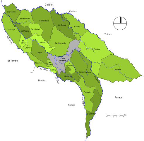
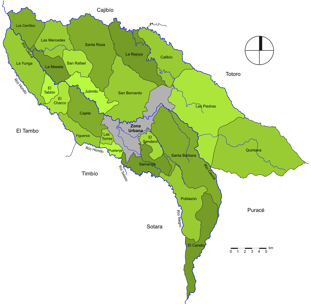
Español: Mapa Rural de la Ciudad de Popayán, Departamento del Cauca. Colombia. El sector rural esta conformado por 23 corregimientos y los 2 resguardos indígenas, (Poblazón y Quintana). |
| Date | |
| Source | Own work |
| Author | SajoR |
| Permission (Reusing this file) |
Trabajo propio, reconocimiento requerido, mantener licencia:(Creative Commons CC-BY-SA-2.5). Citar a Wikipedia ó a Wikimedia como fuente si la imagen es utilizada en otros medios que no sean de los proyectos de la familia Wikipedia. I, SajoR, the copyright holder of this work, hereby publishes it under the following license: This file is licensed under the Creative Commons Attribution-Share Alike 2.5 Generic license. Attribution: I, SajoR
|
File history
Click on a date/time to view the file as it appeared at that time.
| Date/Time | Thumbnail | Dimensions | User | Comment | |
|---|---|---|---|---|---|
| current | 06:23, 29 May 2009 | | 1,013 × 988 (670 KB) | SajoR (talk | contribs) | {{Information |Description={{es|1=Mapa Rural de la Ciudad de Popayán, Departamento del Cauca. Colombia. El sector rural esta conformado por 23 corregimientos y los 2 resguardos indígenas, (Poblazón y Quintana). }} |Source=trabajo propio (own work) |Aut |
You cannot overwrite this file.
File usage on Commons
The following page uses this file:
File usage on other wikis
The following other wikis use this file:
- Usage on avk.wikipedia.org
- Usage on ca.wikipedia.org
- Usage on es.wikipedia.org
- Usage on fr.wikipedia.org
- Usage on it.wikipedia.org
- Usage on no.wikipedia.org