File:Port carlisle map.jpg
Jump to navigation
Jump to search
Size of this preview: 488 × 599 pixels. Other resolutions: 195 × 240 pixels | 391 × 480 pixels | 625 × 768 pixels | 834 × 1,024 pixels | 1,667 × 2,048 pixels | 3,500 × 4,299 pixels.
Original file (3,500 × 4,299 pixels, file size: 1.37 MB, MIME type: image/jpeg)
Captions
Captions
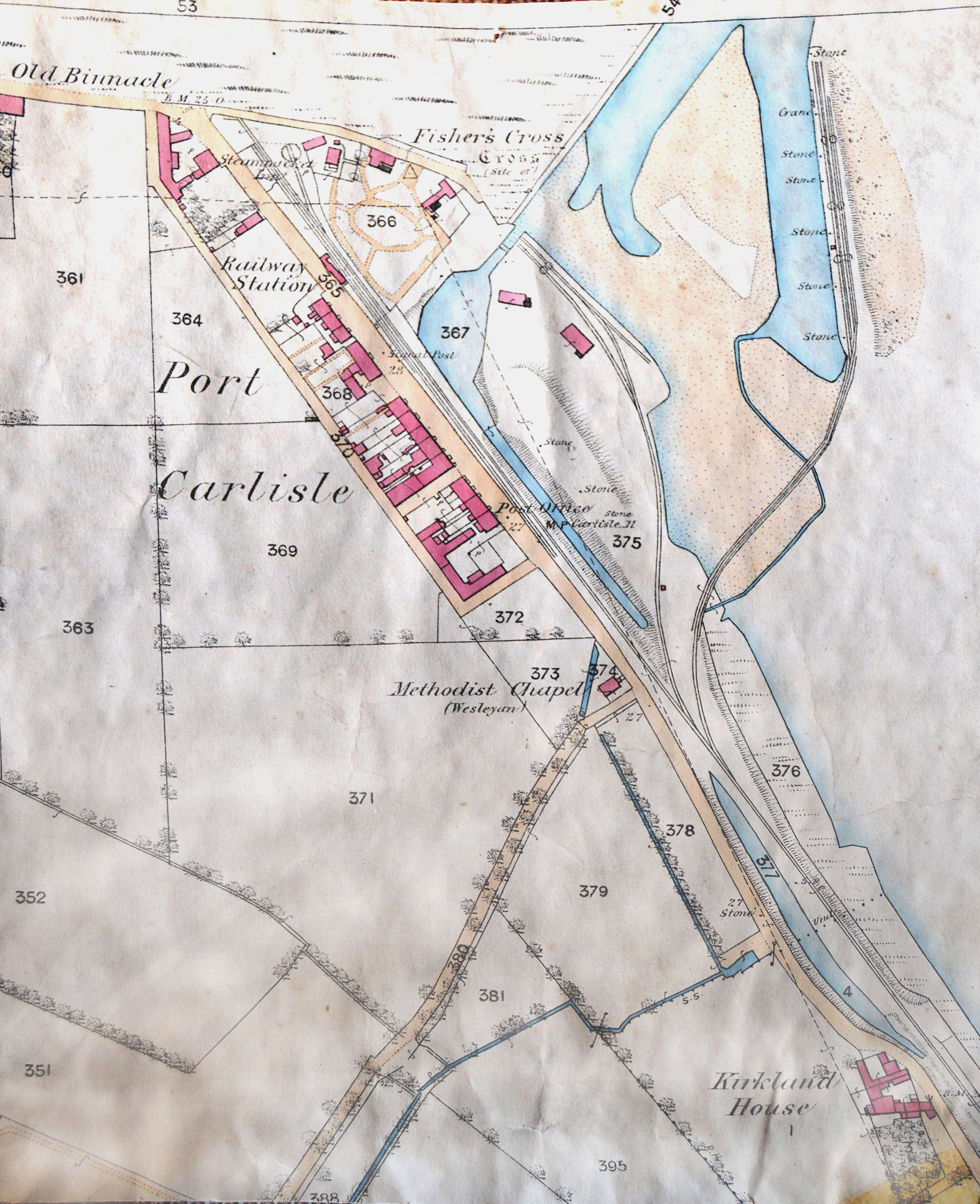
This map of Port Carlisle after 1854 shows the filling in of the Carlisle Canall and the arrival of the railway, which was built along the canal bed. Some port trade was continued using the offshore jetty, but used the railway.
Summary[edit]
| Description |
English: Map of Port Carlisle, Cumbria |
| Date | |
| Source | Own work |
| Author | Dougsim |
Licensing[edit]
I, the copyright holder of this work, hereby publish it under the following license:
This file is licensed under the Creative Commons Attribution-Share Alike 4.0 International license.
- You are free:
- to share – to copy, distribute and transmit the work
- to remix – to adapt the work
- Under the following conditions:
- attribution – You must give appropriate credit, provide a link to the license, and indicate if changes were made. You may do so in any reasonable manner, but not in any way that suggests the licensor endorses you or your use.
- share alike – If you remix, transform, or build upon the material, you must distribute your contributions under the same or compatible license as the original.
File history
Click on a date/time to view the file as it appeared at that time.
| Date/Time | Thumbnail | Dimensions | User | Comment | |
|---|---|---|---|---|---|
| current | 10:24, 28 February 2021 | | 3,500 × 4,299 (1.37 MB) | Dougsim (talk | contribs) | improved contrast and brightness |
| 21:14, 21 April 2017 |  | 4,000 × 4,982 (1.15 MB) | Dougsim (talk | contribs) | User created page with UploadWizard |
You cannot overwrite this file.
File usage on Commons
There are no pages that use this file.
File usage on other wikis
The following other wikis use this file:
- Usage on en.wikipedia.org