File:Powiat sieradzki location map.png
Original file (1,258 × 1,726 pixels, file size: 375 KB, MIME type: image/png)
Captions
Captions
Summary[edit]
| Description |
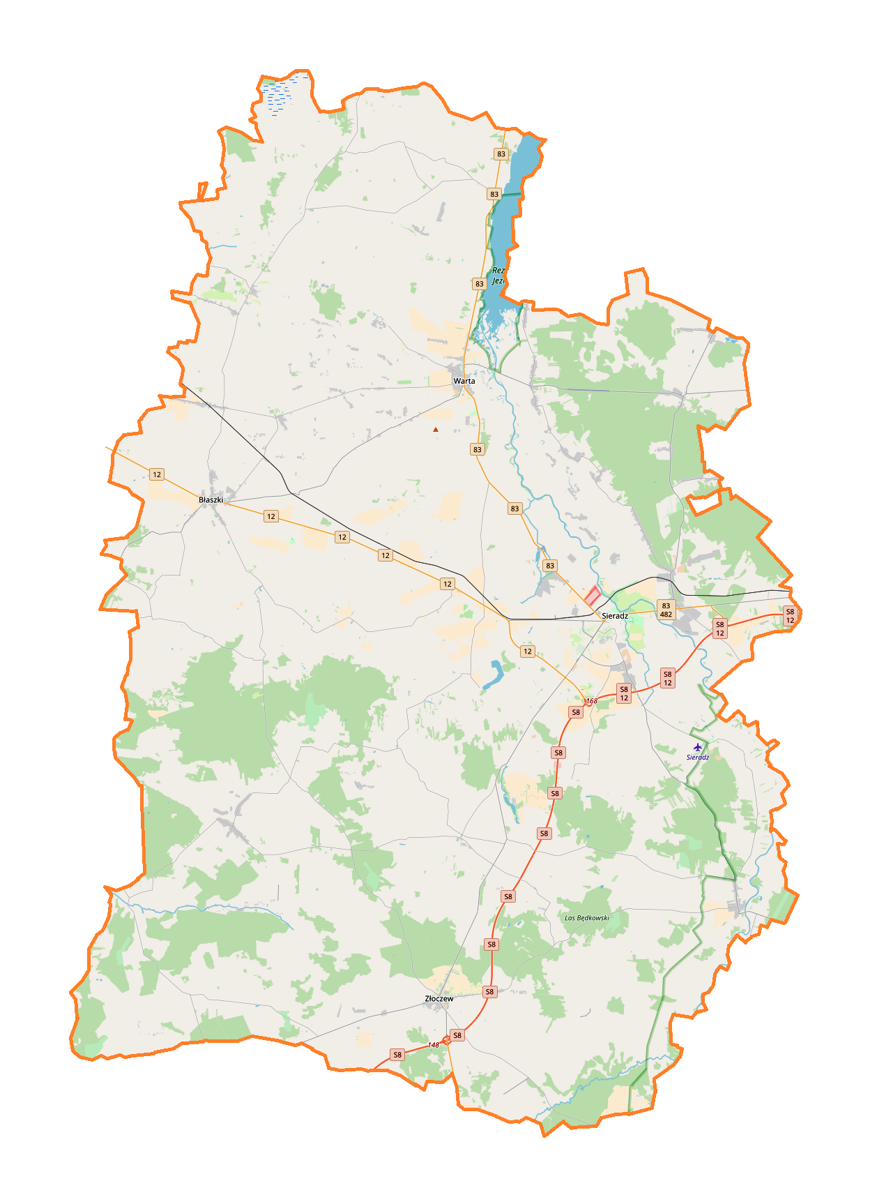
English: Location map |
| Date | |
| Source | Own work |
| Author | Smat |
| Description |
Polski: Mapa powiatu sieradzkiego, Polska
English: Map of powiat sieradzki, Poland |
|||||||||
| Date | ||||||||||
| Source | You may find a page on the OpenStreetMap wiki page for powiat sieradzki | |||||||||
| Creator |
OpenStreetMap contributors OpenStreetMap contributors |
|||||||||
| Permission (Reusing this file) |
OpenStreetMap data is available under the Open Database License (details). Map tiles are licensed under the Creative Commons Attribution-ShareAlike 2.0 license (CC-BY-SA 2.0).
This file is licensed under the Creative Commons Attribution-Share Alike 2.0 Generic license.
|
|||||||||
| Geotemporal data | ||||||||||
| Bounding box |
|
|||||||||
| Georeferencing | If inappropriate please set warp_status = skip to hide. | |||||||||
Licensing[edit]
| This work contains information from OpenStreetMap, which is made available under the Open Database License (ODbL).
The ODbL does not require any particular license for maps produced from ODbL data. Prior to 1 August 2020, map tiles produced by the OpenStreetMap Foundation were licensed under the CC-BY-SA-2.0 license. Maps produced by other people may be subject to other licences. |
File history
Click on a date/time to view the file as it appeared at that time.
| Date/Time | Thumbnail | Dimensions | User | Comment | |
|---|---|---|---|---|---|
| current | 16:34, 9 January 2018 | | 1,258 × 1,726 (375 KB) | Smat (talk | contribs) | User created page with UploadWizard |
You cannot overwrite this file.
File usage on Commons
There are no pages that use this file.
File usage on other wikis
The following other wikis use this file:
- Usage on eo.wikipedia.org
- Usage on pl.wikipedia.org
- Błaszki
- Gruszczyce
- Sieradz
- Kalinowa (powiat sieradzki)
- Warta (miasto)
- Zbiornik Próba
- Tumidaj (powiat sieradzki)
- Złoczew
- Jeziorsko (zbiornik wodny)
- Goszczanów
- Burzenin
- Sulmów
- Biskupice (województwo łódzkie)
- Brąszewice
- Charłupia Mała
- Chojne
- Dąbrowa Wielka (województwo łódzkie)
- Dąbrówka (gmina Sieradz)
- Męcka Wola
- Podłężyce
- Kłocko
- Dziebędów
- Mnichów (województwo łódzkie)
- Jeziory (województwo łódzkie)
- Bartochów
- Borysławice
- Bogumiłów (powiat sieradzki)
- Brzeźnio
- Charłupia Wielka
- Chlewo (województwo łódzkie)
- Cielce
- Glinno (wieś w województwie łódzkim)
- Góra (powiat sieradzki)
- Gzików
- Inczew
- Jasionna (powiat sieradzki)
- Jeziorsko (wieś)
- Kamienna-Wieś
- Kamionacz (wieś)
- Kliczków Mały
- Kliczków Wielki
- Klonowa (województwo łódzkie)
- Kobierzycko
- Kościerzyn
- Krąków
- Małków (województwo łódzkie)
- Mikołajewice (powiat sieradzki)
- Niechmirów
- Biadaczew
View more global usage of this file.