File:Région urbaine de Liège en 2017.png
Jump to navigation
Jump to search
No higher resolution available.
Région_urbaine_de_Liège_en_2017.png (800 × 590 pixels, file size: 79 KB, MIME type: image/png)
Captions
Captions
Add a one-line explanation of what this file represents
Summary[edit]
| Description |
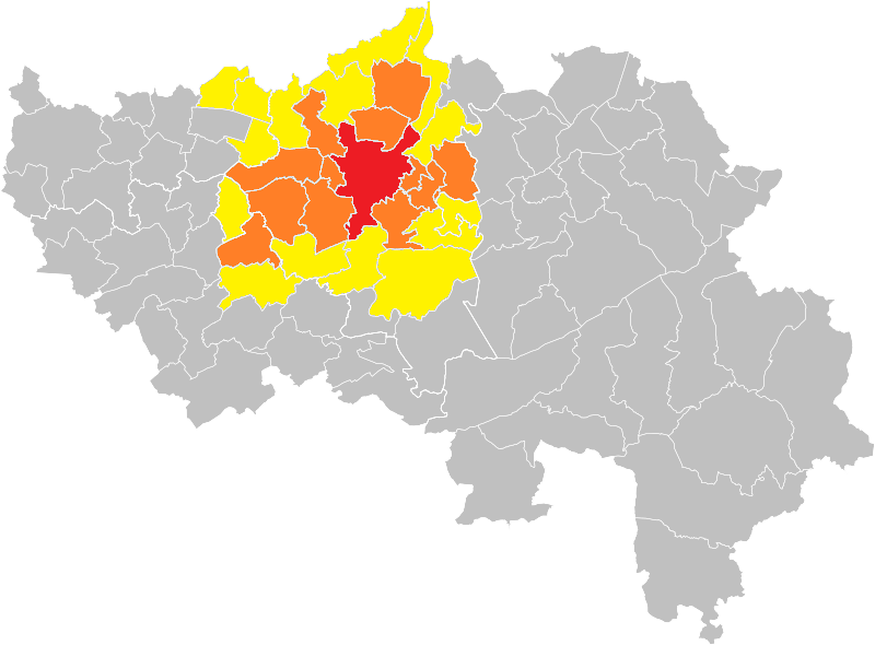
Français : Région urbaine de Liège en 2017.
English: Urban region of Liege in 2017.
Ville-centre
Agglomération opérationnelle
Banlieue |
| Date | |
| Source |
This file was derived from: Municipalities Liège Belgium Map.svg |
| Author | OD02fr |
Licensing[edit]
This file is licensed under the Creative Commons Attribution-Share Alike 4.0 International license.
- You are free:
- to share – to copy, distribute and transmit the work
- to remix – to adapt the work
- Under the following conditions:
- attribution – You must give appropriate credit, provide a link to the license, and indicate if changes were made. You may do so in any reasonable manner, but not in any way that suggests the licensor endorses you or your use.
- share alike – If you remix, transform, or build upon the material, you must distribute your contributions under the same or compatible license as the original.
File history
Click on a date/time to view the file as it appeared at that time.
| Date/Time | Thumbnail | Dimensions | User | Comment | |
|---|---|---|---|---|---|
| current | 21:55, 20 April 2020 | | 800 × 590 (79 KB) | Sigorix (talk | contribs) | Mise en évidence des différentes zones de la région urbaine de Liège. |
| 16:09, 14 April 2020 |  | 800 × 590 (78 KB) | Sigorix (talk | contribs) | Uploaded a work by OD02fr from File:Municipalities Liège Belgium Map.svg with UploadWizard |
You cannot overwrite this file.
File usage on Commons
The following page uses this file:
- File:Région urbaine de Liège en 2019.png (file redirect)
File usage on other wikis
The following other wikis use this file: