File:Railway south of Beverley (geograph 6415795).jpg
Jump to navigation
Jump to search
Size of this preview: 696 × 599 pixels. Other resolutions: 279 × 240 pixels | 557 × 480 pixels | 892 × 768 pixels | 1,024 × 882 pixels.
Original file (1,024 × 882 pixels, file size: 1.24 MB, MIME type: image/jpeg)
Captions
Captions
Add a one-line explanation of what this file represents
Summary[edit]
.jpg&action=edit§ion=1)
| Description |
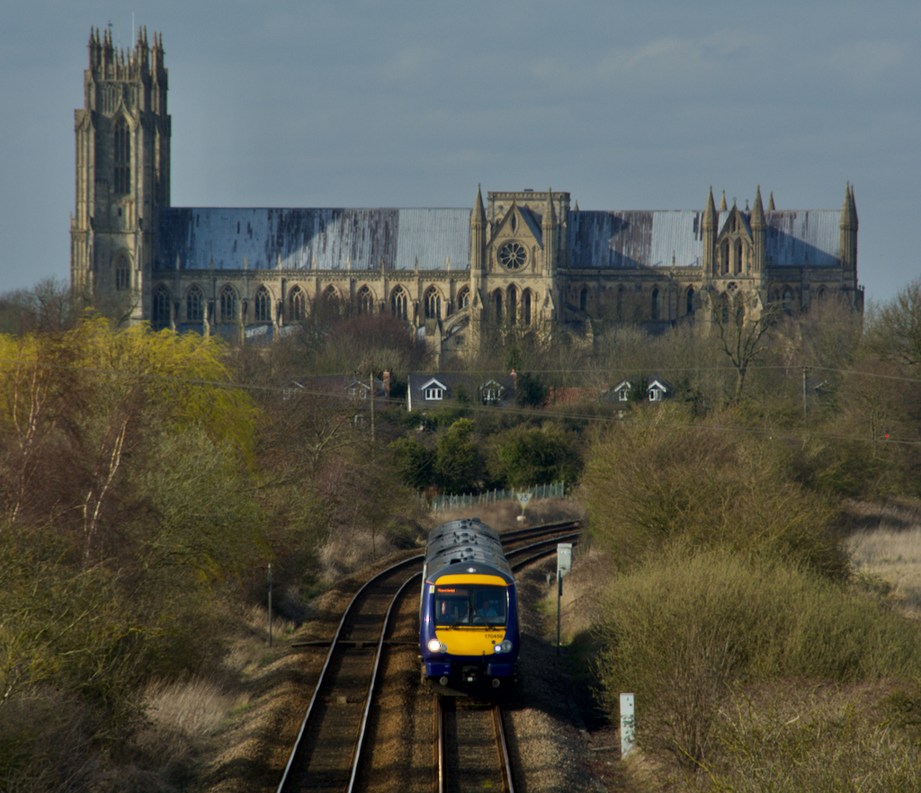
English: Railway south of Beverley, East Riding of Yorkshire, England. A Hull-bound train heads south, with Beverley Minster dominating the background, seen from the bridge carrying Minster Way, the southern relief road. Historically, planning guidance has sought to protect and enhance long-distance views of the Minster, particularly governing the extensive housing developments to the south west of the town. |
| Date | |
| Source | From geograph.org.uk |
| Author | Paul Harrop |
| Permission (Reusing this file) |
Creative Commons Attribution Share-alike license 2.0 |
| Attribution (required by the license) | Paul Harrop / Railway south of Beverley / |
| Camera location | | View this and other nearby images on: OpenStreetMap |
|---|
.jpg¶ms=053.827555_N_-000.418063_E_globe:Earth_type:camera_source:geograph-osgb36(TA04223797)_heading:337.00&language=en)
| Object location | | View this and other nearby images on: OpenStreetMap |
|---|
.jpg¶ms=053.831270_N_-000.420200_E_globe:Earth_class:object_type:object_source:geograph-osgb36(TA04073838)_heading:337.00&language=en)
Licensing[edit]
.jpg&action=edit§ion=2)

|
This image was taken from the Geograph project collection. See this photograph's page on the Geograph website for the photographer's contact details. The copyright on this image is owned by Paul Harrop and is licensed for reuse under the Creative Commons Attribution-ShareAlike 2.0 license.
|
This file is licensed under the Creative Commons Attribution-Share Alike 2.0 Generic license.
Attribution: Paul Harrop
- You are free:
- to share – to copy, distribute and transmit the work
- to remix – to adapt the work
- Under the following conditions:
- attribution – You must give appropriate credit, provide a link to the license, and indicate if changes were made. You may do so in any reasonable manner, but not in any way that suggests the licensor endorses you or your use.
- share alike – If you remix, transform, or build upon the material, you must distribute your contributions under the same or compatible license as the original.
File history
Click on a date/time to view the file as it appeared at that time.
| Date/Time | Thumbnail | Dimensions | User | Comment | |
|---|---|---|---|---|---|
| current | 23:53, 9 November 2020 | | 1,024 × 882 (1.24 MB) | Keith D (talk | contribs) | Transferred from geograph.co.uk using [https://tools.wmflabs.org/geograph2commons/ geograph2commons] |
You cannot overwrite this file.
File usage on Commons
The following page uses this file:
.jpg&oldid=715998432)