File:Red Wall states 1980-2016 map.svg
Jump to navigation
Jump to search

Size of this PNG preview of this SVG file: 800 × 495 pixels. Other resolutions: 320 × 198 pixels | 640 × 396 pixels | 1,024 × 633 pixels | 1,280 × 791 pixels | 2,560 × 1,583 pixels | 959 × 593 pixels.
Original file (SVG file, nominally 959 × 593 pixels, file size: 32 KB)
Captions
Captions
Add a one-line explanation of what this file represents
Summary[edit]
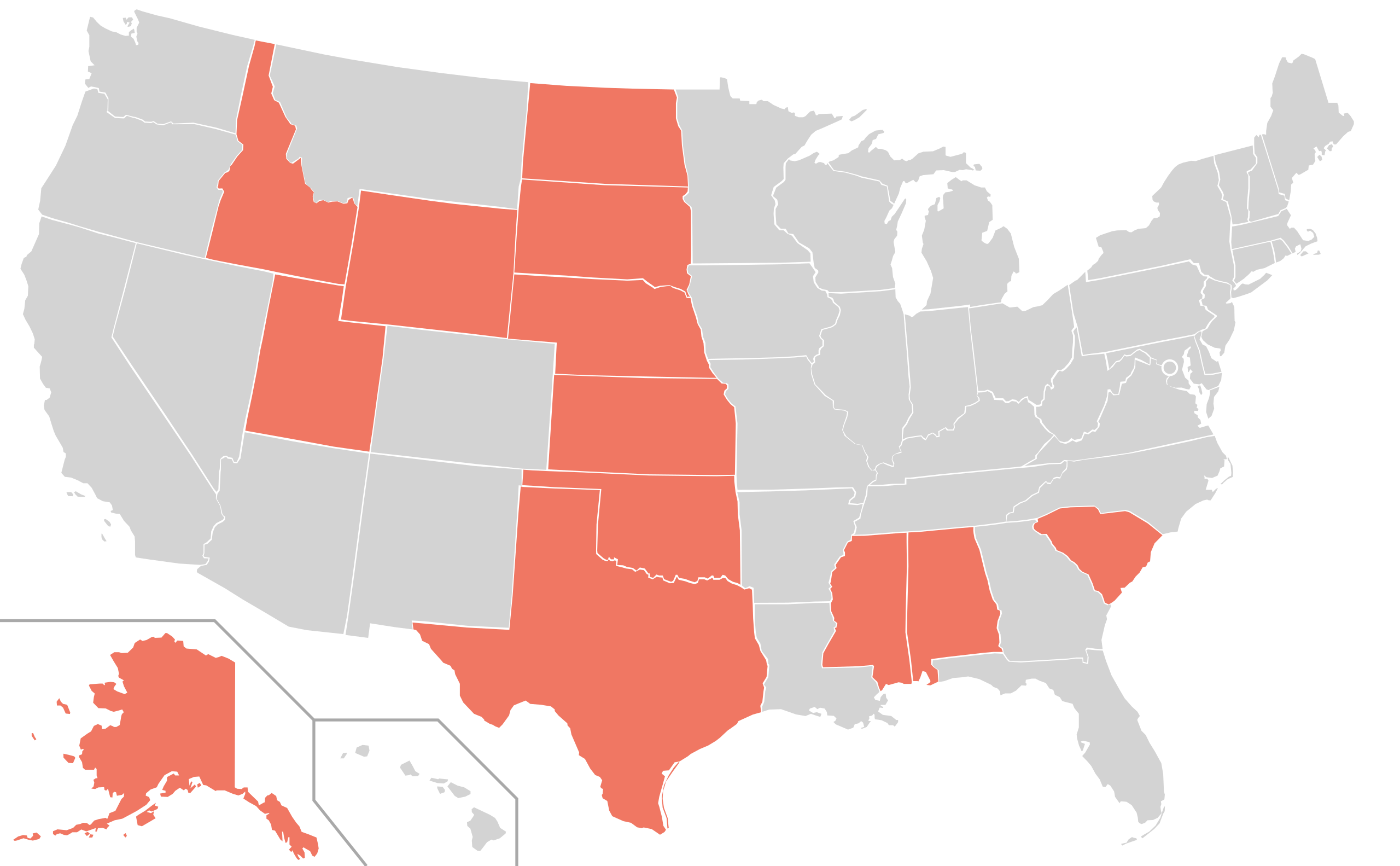
| Description | map of the US states showing the ones where the election was won by the Republican Party between the elections of 1980 and 2016 (the “Red Wall”) |
| Date | |
| Source | made from the file US Map (states only).svg |
| Author | User:MaGioZal |
Licensing[edit]
| I, the copyright holder of this work, release this work into the public domain. This applies worldwide. In some countries this may not be legally possible; if so: I grant anyone the right to use this work for any purpose, without any conditions, unless such conditions are required by law. |
File history
Click on a date/time to view the file as it appeared at that time.
| Date/Time | Thumbnail | Dimensions | User | Comment | |
|---|---|---|---|---|---|
| current | 11:55, 18 January 2017 | | 959 × 593 (32 KB) | MaGioZal (talk | contribs) | {{Information |Description= map of the US states showing the ones where the election was won by the Republican Party between the elections of 1980 and 2016 (the [en:Blue_wall_(politics)#Red_Wall “Red Wall”]) |Source= made from the file [[Blank US M... |
You cannot overwrite this file.
File usage on Commons
There are no pages that use this file.