File:Regions of bhutan labeled-roman script.svg
Jump to navigation
Jump to search

Size of this PNG preview of this SVG file: 800 × 435 pixels. Other resolutions: 320 × 174 pixels | 640 × 348 pixels | 1,024 × 557 pixels | 1,280 × 696 pixels | 2,560 × 1,393 pixels | 875 × 476 pixels.
Original file (SVG file, nominally 875 × 476 pixels, file size: 244 KB)
Captions
Captions
Add a one-line explanation of what this file represents
| Description |
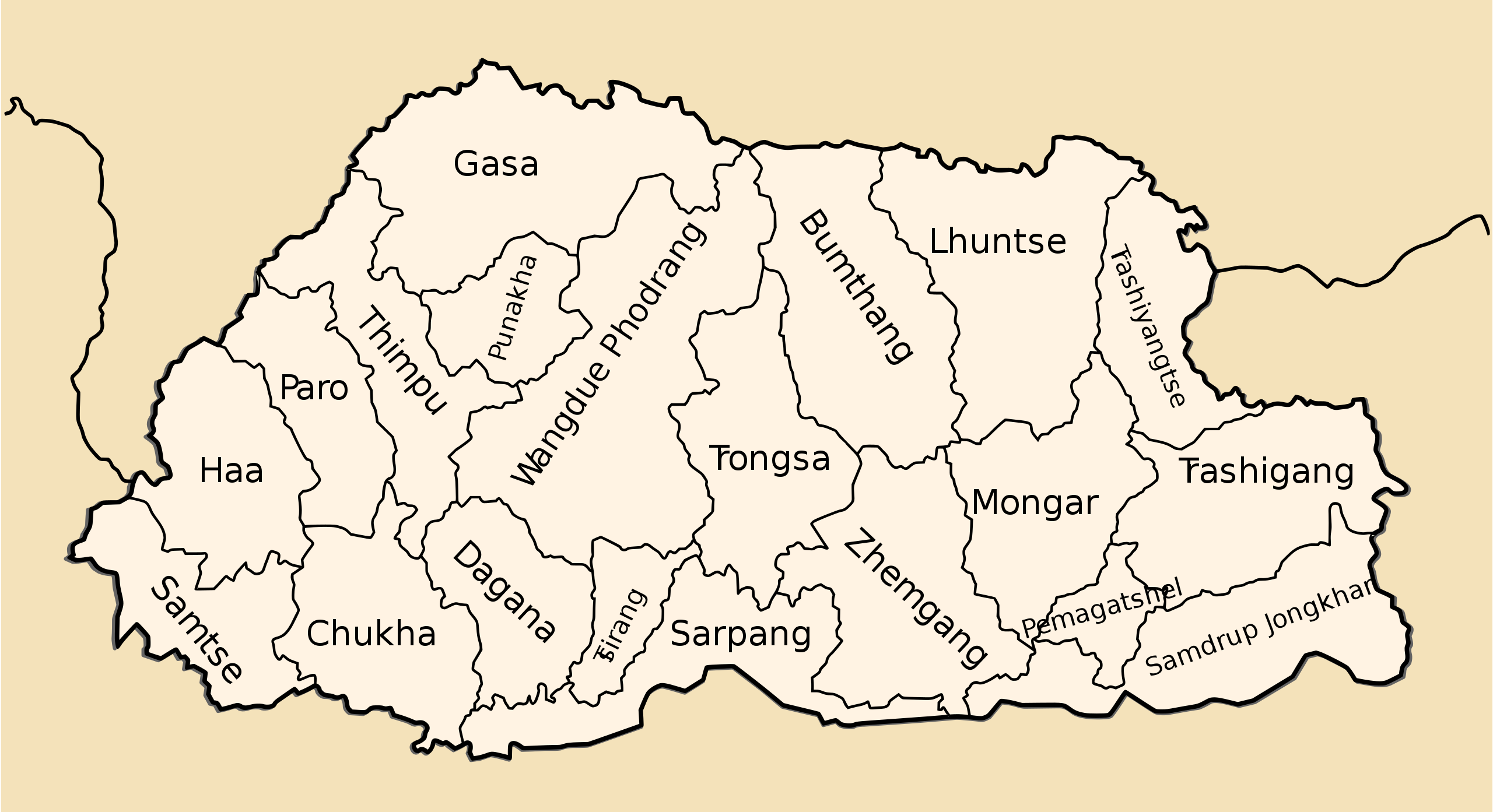
An SVG version of Nichalp map of the regions of Bhutan Bhutan subdivisions numbered Drawn by me, Nichalp |
| Date | (UTC) |
| Source | |
| Author |
|
| Other versions |
Derivative works of this file: |
| This is a retouched picture, which means that it has been digitally altered from its original version. Modifications: Added in-place labels based on Nichalp's original. The original can be viewed here: Bhutan-divisions-numbered.png:
|
This file is licensed under the Creative Commons Attribution-Share Alike 3.0 Unported license.
- You are free:
- to share – to copy, distribute and transmit the work
- to remix – to adapt the work
- Under the following conditions:
- attribution – You must give appropriate credit, provide a link to the license, and indicate if changes were made. You may do so in any reasonable manner, but not in any way that suggests the licensor endorses you or your use.
- share alike – If you remix, transform, or build upon the material, you must distribute your contributions under the same or compatible license as the original.
Original upload log[edit]
This image is a derivative work of the following images:
- File:Bhutan-divisions.svg licensed with Cc-by-3.0
- 2010-10-17T06:25:26Z Babbage 744x405 (53590 Bytes) {{Information |Description=An SVG version of [[User:Nichalp|Nichalp]] map of the regions of Bhutan |Source=*[[:File:Bhutan-divisions-numbered.png|]] |Date=2010-10-17 06:20 (UTC) |Author=*[[:File:Bhutan-divisions.svg|]]: [[Use
- File:Bhutan-divisions-numbered.png licensed with PD-self
Uploaded with derivativeFX
File history
Click on a date/time to view the file as it appeared at that time.
| Date/Time | Thumbnail | Dimensions | User | Comment | |
|---|---|---|---|---|---|
| current | 20:35, 26 October 2010 | | 875 × 476 (244 KB) | Babbage (talk | contribs) | Added layers to svg |
| 20:09, 26 October 2010 |  | 875 × 476 (254 KB) | Babbage (talk | contribs) | More legible color scheme. | |
| 07:36, 18 October 2010 |  | 875 × 476 (254 KB) | Babbage (talk | contribs) | == {{int:filedesc}} == == {{int:filedesc}} == Districts of Bhutan | |
| 07:21, 17 October 2010 |  | 900 × 700 (71 KB) | Babbage (talk | contribs) | {{Information |Description=An SVG version of Nichalp map of the regions of Bhutan Bhutan subdivisions numbered Drawn by me, Nichalp |Source=*File:Bhutan-divisions.svg *File:Bhutan-divisions-numbered.png |Date |
You cannot overwrite this file.
File usage on Commons
The following page uses this file:
File usage on other wikis
The following other wikis use this file:
- Usage on en.wikipedia.org
- Usage on ja.wikipedia.org
- Usage on sco.wikipedia.org