File:Reichsstädte Offenburg - Gengenbach - Zell am Harmersbach, Michal 1725.png
Jump to navigation
Jump to search
Size of this preview: 800 × 425 pixels. Other resolutions: 320 × 170 pixels | 640 × 340 pixels | 1,024 × 543 pixels | 1,920 × 1,019 pixels.
Original file (1,920 × 1,019 pixels, file size: 4.68 MB, MIME type: image/png)
Captions
Captions
Add a one-line explanation of what this file represents
Summary[edit]
| Description |
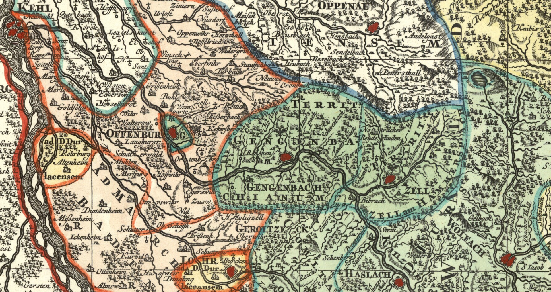
English: Detail cropped out of an 18th century map showing the territories (in the darker green) of the three free imperial cities of Offenburg, Gengenbach and Zell am Harmersbach just east of the Rhine. The last two cities, which were contiguous, ruled over a hinterland, while tiny Offenburg had no hinterland and was entirely surrounded by the Austria-ruled Landvogtei Ortenau. The double-headed eagle next to the name of each cities symbolizes their status as free imperial cities. Cropped out of map four of a nine-map series centered on the Circle of Swabia titled Suevia Universa by Matthäus Seutter and based on information supplied by Jacques de Michal. Published c. 1725-1727. |
| Date | |
| Source | Moll's map collection |
| Author | Matthäus Seutter - Jacques de Michal |
Licensing[edit]
|
This work is in the public domain in its country of origin and other countries and areas where the copyright term is the author's life plus 100 years or fewer. | |
| This file has been identified as being free of known restrictions under copyright law, including all related and neighboring rights. | |
File history
Click on a date/time to view the file as it appeared at that time.
| Date/Time | Thumbnail | Dimensions | User | Comment | |
|---|---|---|---|---|---|
| current | 13:06, 8 September 2018 | | 1,920 × 1,019 (4.68 MB) | Lubiesque (talk | contribs) | User created page with UploadWizard |
You cannot overwrite this file.
File usage on Commons
The following 3 pages use this file:
File usage on other wikis
The following other wikis use this file:
- Usage on de.wikipedia.org
- Usage on hu.wikipedia.org