File:Reichsstadt Schwäbisch Gmünd, 1725.png
Jump to navigation
Jump to search

Size of this preview: 800 × 556 pixels. Other resolutions: 320 × 222 pixels | 640 × 445 pixels | 1,024 × 711 pixels | 1,280 × 889 pixels | 1,920 × 1,334 pixels.
Original file (1,920 × 1,334 pixels, file size: 4.73 MB, MIME type: image/png)
Captions
Captions
Add a one-line explanation of what this file represents
Summary[edit]
| Description |
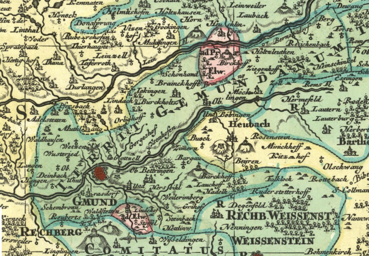
English: Detail cropped from an early 18th century map showing the territory of the Free Imperial City of Schwäbisch Gmünd ("Territ. Gemundanum", in the darker green). Cropped out of map two of a nine-map series centered on the Circle of Swabia titled Suevia Universa by Matthäus Seutter and based on information supplied by Jacques de Michal. Published c 1725-1727. |
| Date | circa 1725 |
| Source | Moll's map collection |
| Author | Matthäus Seutter - Jacques de Michal |
Licensing[edit]
|
This work is in the public domain in its country of origin and other countries and areas where the copyright term is the author's life plus 100 years or fewer. | |
| This file has been identified as being free of known restrictions under copyright law, including all related and neighboring rights. | |
File history
Click on a date/time to view the file as it appeared at that time.
| Date/Time | Thumbnail | Dimensions | User | Comment | |
|---|---|---|---|---|---|
| current | 23:28, 25 August 2018 | | 1,920 × 1,334 (4.73 MB) | Lubiesque (talk | contribs) | User created page with UploadWizard |
You cannot overwrite this file.
File usage on Commons
There are no pages that use this file.