File:Reichsstadt Schwäbisch Hall Territorium - Michal 1725.png
Jump to navigation
Jump to search

Size of this preview: 800 × 450 pixels. Other resolutions: 320 × 180 pixels | 640 × 360 pixels | 1,024 × 575 pixels | 1,280 × 719 pixels | 1,920 × 1,079 pixels.
Original file (1,920 × 1,079 pixels, file size: 4.15 MB, MIME type: image/png)
Captions
Captions
Add a one-line explanation of what this file represents
Summary[edit]
| Description |
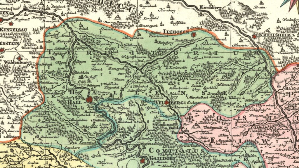
English: Detail cropped out of an 18th century map showing the territory of the Free Imperial City of Schwäbisch Hall (in the darker green only). Cropped out of map two of a nine-map series centered on the Circle of Swabia titled Suevia Universa by Matthäus Seutter and based on information supplied by Jacques de Michal. Published c. 1725-1727. |
| Date | |
| Source | Moll's map collection |
| Author | Matthäus Seutter - Jacques de Michal |
Licensing[edit]
|
This work is in the public domain in its country of origin and other countries and areas where the copyright term is the author's life plus 100 years or fewer. | |
| This file has been identified as being free of known restrictions under copyright law, including all related and neighboring rights. | |
File history
Click on a date/time to view the file as it appeared at that time.
| Date/Time | Thumbnail | Dimensions | User | Comment | |
|---|---|---|---|---|---|
| current | 11:43, 31 August 2018 | | 1,920 × 1,079 (4.15 MB) | Lubiesque (talk | contribs) | User created page with UploadWizard |
You cannot overwrite this file.
File usage on Commons
The following page uses this file: